Finding Blue John

Recently I spent a long weekend in the Peak District – not really long enough to explore properly despite it being Britain’s smallest national park.  However, there was time to explore the small town of Bakewell, home of the famous and very tasty Bakewell Tart as well as a drive through the Chatsworth Estate.  The ancestral home of the Dukes of Devonshire had to be ignored on this occasion but lunch at their farm shop was well worth breaking the journey for. For photographs and a description of these places see my earlier post by clicking on the link The Peak District’s Soft Centre.  Finally reaching the area known as the High Peak (despite the name there are no mountains in the Peak District) a roadside sign pointing in the direction of Blue John led through glorious countryside.
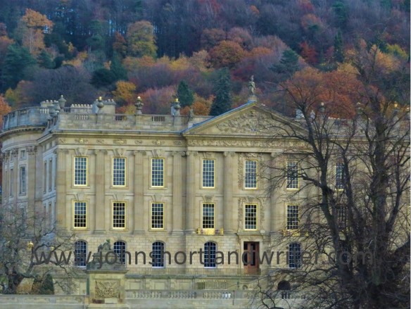
Chatsworth (1) watermark

Chatsworth House

Blue John Mine (2) watermark

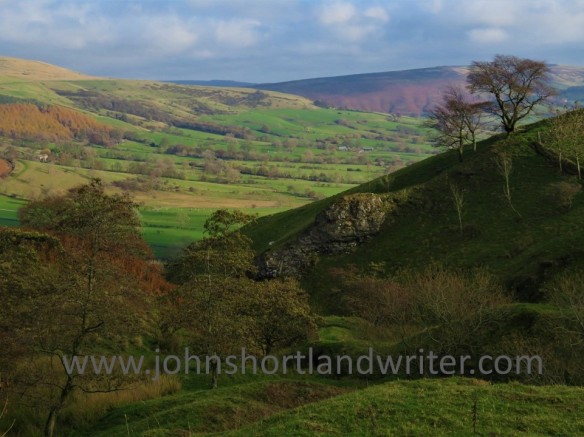
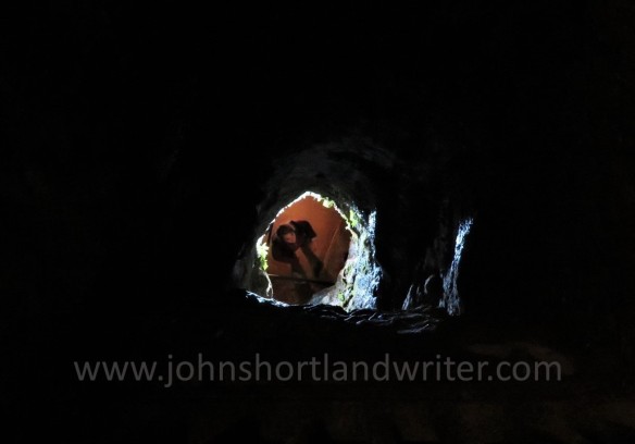
View from the Blue John mine

Blue John is a fluorite semi-precious mineral that in its raw state appears quite dull.  After drying, preparing and polishing it takes on a number of colours ranging from purplish-blue through to yellow.  Despite numerous tests and analyses the origins of the colour has not been discovered.  Blue John is also a rare stone for although similar minerals have been found elsewhere in the world there are only two known places where its unique quality can be found – and those are both in the same hillside in the Peak District.

Blue John Mine (3) watermark

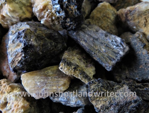
Blue John in its raw state

1280px-Cliff_Blue_Vein_Bowl_-_Castleton_Visitor_Centre

    Blue John after processing – the bowl is in the Castleton (Peak District) Visitor Centre.         Copyright: Pasicles via Wikipedia

Visiting the Blue John mine is not for the faint-hearted or the short-of-breath for that matter: there are two hundred and fifty steps to descend and then, of course, you have to climb back up them to reach the surface once more.  Don’t complain, ‘though, or you may have to descend by rope as the early miners once did.  Fortunately, I only looked down it to see the visitors below.

Blue John Mine (11) watermark

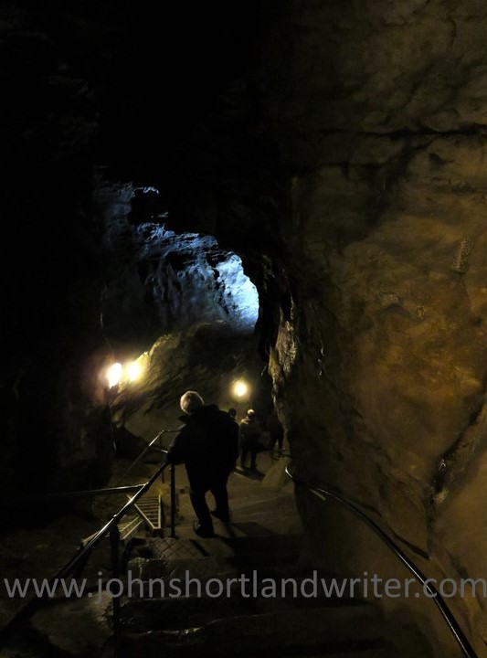
The descent into the mine

Blue John Mine (4) watermark

The alternative way into the mine – being lowered by rope!

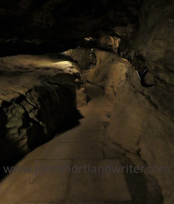
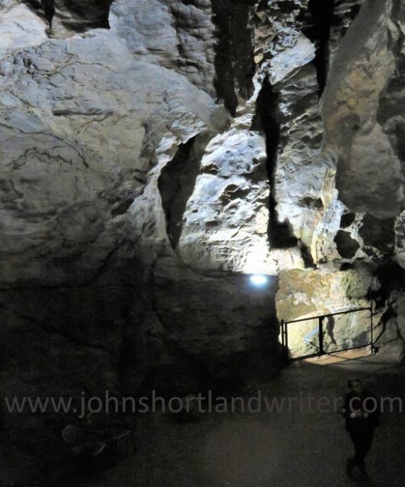
Inside the mine there are low tunnels to pass through contrasting with vast caverns with roof heights of 200 feet or more, either created by ancient rivers or by the miners themselves.  Each cavern has its own unique characteristic although it is difficult to catch it on camera.  The one below is named Lord Mulgrave’s Dining Room, a huge circular space formed by a whirlpool and so named after the dinner Lord M gave his miners there.  The thought of the cooks and food being lowered deep into the mine gives a new angle to the term ‘outdoor catering’!

Blue John Mine (5) watermark

Blue John Mine (14) watermark

Lord Mulgrave’s Dining Room

The Waterfall Cavern is colourful with the stalactite formations along one side appearing to be frozen water.  Elsewhere there are numerous fossils where marine animals have been ‘captured’ for posterity.

Blue John Mine (8) watermark

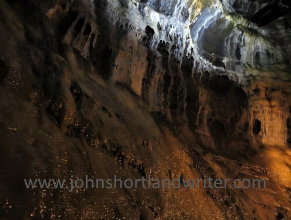
‘The Frozen Waterfall’

Blue John Mine (22) waterfall

Fossils embedded into the mine walls

Throughout the mine the colours and texture of the rock formations are extraordinary and constantly changing.  In one cavern it is easy to ‘see’ the rocky and meandering bed of the prehistoric river that formed it, the difference being that it is way, way above one’s head.  In another, a giant, triangular rock has fallen to balance on its point.

Blue John Mine (16) watermark

The overhead ‘riverbed’

Blue John Mine (12) watermark

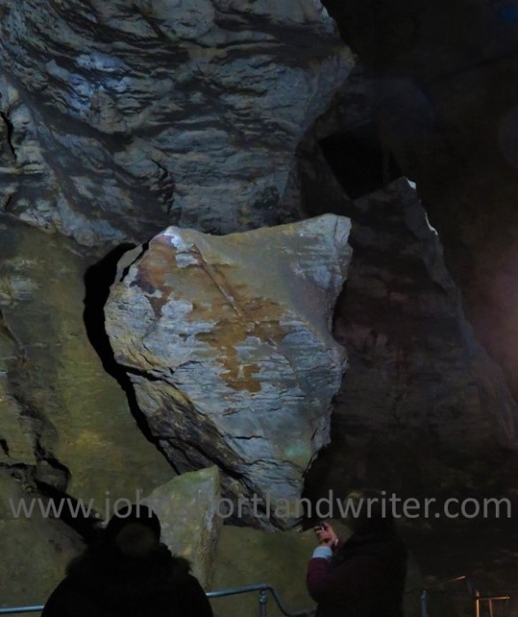
Huge and precariously balanced

The tours, which are led by miners, for Blue John is still mined here during the winter months, last about an hour.  At the end of the tour all there is left is to climb the two hundred and fifty steps back to the surface…

Blue John Mine (19) watermark

The long climb back to the surface


For further details of the history of the Blue John Mine and visiting hours visit their website here.

To give overseas visitors a better idea of its location, the Peak District National Park is approx. 3.5 hours by car, north from London; by public transport allow 6-7 hours.  There are plenty of hotels, traditional pubs and self-catering cottages available for overnight stays.

Advertisement

A Year in Review 2013: the Second Half

July to the end of  December already is a memory and rapidly becoming a distant one at that.  Just five days into January and Christmas seems further back in the mind than it is in reality.  2014 has arrived and I am optimistically looking forward to all that it may bring.  Not that the last one was disappointing or sad in any way; just that with time flying by it is essential to make the most of every moment.  Of course, I’m very fortunate: I have my health, I have a great job, friends and family I can always rely upon and I live in a superb part of the English countryside.  Long may all those things last!

July:  The highlight of my year occurred this month.  An exciting and memorable launch of my first book to be published – a gardening book – Why Can’t My Garden Look Like That? took place in Chipping Norton’s award winning bookshop, Jaffe & Neale.  Would anyone turn up?  As it happened, very many did with people overflowing onto the street, the warm, sunny evening and the wine contributing to a street party feel to the occasion.  If you wish to find out more of the book or would like a signed copy you can find details here.

Many people are attracted to the magnificent looking but dangerous Giant Hogweed, also the subject of a post this month.  I was delighted when photographs from it were used in an educational video by the Hamilton County Soil and Water Conservation District (New York State).  Take heed of the messages if you come across the plant!

August: Travelling around the Cotswold Hills as I do every day in the course of my work you would think I would know most of what goes on there.  Nevertheless, I was surprised when I saw Tibetan flags fluttering in the breeze.  Further investigation found Alain Rouveure’s galleries and tea room.  Of course, I couldn’t leave until I’d tried out their lunch…

September:  Street fairs have been held for hundreds of years throughout England and Chipping Norton has an annual one that dates back to medieval charters.  Originally the time when livestock was sold and labour sought, these days they are purely held for pleasure.  Traffic has to be diverted around the town as the centre is blocked off by the rides and stalls.  Noisy, crowded and well lit they are great fun but I found  myself completely alone in darkness walking around it late one night.  It was an eerie experience, described here.

October:  The appearance of the secret valley was changed dramatically when the willow trees that line the banks of our little winding river were pollarded.  This dramatic ‘haircut’ is carried out only when necessary, the last time about fifteen years ago.  Suddenly, the view in the header of this blog has become wide open as every branch was removed leaving just the trunks standing.  The secret valley looks naked now but ‘new clothes’ will grow rapidly this coming spring.

November:  History isn’t just about learning dates of battles, the most interesting aspects are those that we can so easily relate to.  Yet so much of this is forgotten over time and it takes teams of dedicated people, often volunteers, to literally unearth it.  A now deserted and seemingly empty part of the Exmoor National Park was, one hundred and fifty years ago, teeming with people and was at the very forefront of Victorian technology.  It was quite extraordinary what these engineers achieved and their story featured in two posts which created much interest and comment.  They can be found by clicking here and here.

December:  The blogging year ended on a cuddly note – looking after two adorable but naughty beagle puppies.  If you are a dog lover there is nothing better than to be mauled by puppies.  If you’re not over-keen on dogs then you won’t understand the attraction!  You could try to find out, however, by clicking here.

So what’s going on in 2014?  Lots, hopefully. There is a new racehorse, more gardening, more travel, a lot more writing; it will be a busy year and how it pans out time – and this blog – will tell.

Thank you all so much for following my blog. Over one hundred thousand of you have looked at it since its inception which I find quite extraordinary and very humbling.  Please continue to do so and to tell all your blogging friends to come and pay me a visit, either on here or at my full website www.johnshortlandwriter.com .  I am also on Facebook and Twitter where daily updates can be found.  You are always very welcome to contact me with your comments or queries and I will do my best to answer them all.

Wishing you all a very happy and healthy New Year.

Add to Technorati Favorites

The Hidden History of the Brendon’s

The Brendon Hills, part of the Exmoor National Park, are less well-known than the barren moorland to its west that gives the park its name.  Here the landscape is a patchwork of lush, green fields and of woodlands bordered to the north by the sea.  It is a quiet landscape with only the sounds of birdsong and the occasional farm vehicle to disturb its peace.  It wasn’t always like this, however, for during the nineteenth century it was the centre of a great, albeit relatively short-lived, mining venture.  Today, much of this has been forgotten.

The West Somerset Mineral Railway was built to link iron ore mines with the seaport of Watchet for transportation to the steelyards of south Wales.  Much of its route can be walked and there are several ruins, some of national importance, that have been conserved.  One of the most dramatic is the Incline, where trains hauled truckloads of ore – and passengers – up a 1 in 4 steep hillside, climbing 800 feet in just over half a mile*.  I have written about this feat of Victorian engineering in an earlier post and this can be found by clicking on the link here.

A ruin less impressive than that of the Incline but no less extraordinary in its day is the Langham Hill Engine House built in 1866.  All that remains now is the footprint of the building but a good idea of what it must have looked like and how it worked can be had from the artist’s impression by Anne Leaver shown on the nearby information board.

The engine house was created to draw the iron ore from three separate workings to the surface by sinking a new shaft at Langham Hill.  Powered by steam engines, the ore was pulled up to ground level by trams rising from a depth of up to 650 feet.  The miners who had to descend by ladder were protected from falling by a series of wooden platforms upon which the ladders rested – if they fell they would only drop the length of each ladder, reducing the risk of serious injury.  The steam engines also powered underground pumps to keep the shafts clear of water; this was filtered, stored in reservoirs and reused by the engines – an early example of recycling.  Once the ore was brought to the surface it was tipped into trucks to be carried away by the railway.

Another extraordinary feat of engineering was the aerial tramway that brought iron ore to Langham Hill in buckets from another mine over half a mile away.  A length of the steel cables, which are over four inches in thickness, can be seen coiled by the engine house.  The figures are staggering: the overhead cable was a single, endless 6700 feet length supported on wooden pylons, at times carrying the ore 300 feet above ground level and crossing a 2000 feet wide valley.  No wonder the miners called it ‘the flying machine’.

It is hard to imagine, when visiting the engine house now, the noise, bustle and industry that took place here just 150 years ago.  Two hundred miners and their families, mostly from Wales came to live and work here, yet within fifty years all mining had  ceased.  The engine house only survived for ten years: its engine and even the house itself, dismantled and reused in mines elsewhere.  The aerial tramway lasted an even shorter time being in use for only three years before new transportation technology overtook it.

Today all is silent, the site surrounded by trees and ferns.  For many years the remains of the mines remained hidden until the combined efforts of a number of individuals and groups fought to preserve them.  The West Somerset Mineral Railway Project came into being and has succeeded in doing so; it has also created a permanent exhibition housed in the museum in Watchet.  Its research of the history of the mines is available online – visit their website here.

*Nigel Cavey has through the Exmoor4All website has correctly pointed out that the iron ore would only have descended the Incline.  The trucks carried coal and lime, as well as passengers, up it.

Add to Technorati Favorites

Exmoor’s Forgotten Neighbour

Sandwiched between barren Exmoor to the west and the rugged Quantocks to their east, the Brendon Hills appear remarkably fertile with their neat, small fields testament to a rich farming tradition. Now incorporated into the Exmoor National Park it seems to be as devoid of human life as it’s more visited partner.  It has, however, a surprising past: travel back in time one hundred and fifty years and you would find yourself in a thriving community at the forefront of Industrial Revolution technology.

 A corner of the ruined building

For years, I had been intrigued by a ruined building close to one of the few roads that leads onto Exmoor proper.  Obviously once substantial, what could this building, miles from anywhere, have been and who lived there? There were no clues as I first approached but the  ruins, now stabilised, have had information boards giving its history placed within.  It was the site of an extraordinary Victorian venture that extracted iron ore and then transported it to the coast to ship to Wales for the steel industry.  Although, there was now just this one ruined building, in its heyday over two hundred miners and their families lived close by in houses built especially for them.

 Click on the image to enlarge the poster

The explosion of railway building in the mid 1800’s had created a huge demand for – and, consequently, a shortage of – iron ore.  Mining had taken place in the region on a very small, localised scale for many centuries but the small quantities found had never been a commercial prospect.  With the rapid rise in price and with advances in extraction the Ebbw Vale Company – Welsh steel works – developed the mines. A major problem was how to transport the ore the eleven miles from the furthest mine to the coast from where it could be shipped across the sea to Wales.  The first six miles from the port of Watchet was straightforward enough, the final six miles along the top of the Brendons, although more costly, also did not create a major problem.  It was the mile that included the climb of a 1 in 4 hillside that proved to be a challenge and a costly one at that – over ten times the amount required for the same length elsewhere and over £2 million in today’s prices.  ‘The Incline’ was completed in 1861 and took just four years to build, rising almost 800 feet in just 0.6 of a mile.

The ruins of the winding house as seen from the top of the incline

Trucks of iron ore were lowered or raised down the incline on twin rails, their steam locomotives held in place by steel cables.  The huge drums that were required to do this were housed in the ‘winding house’ with the cables travelling through stone tunnels, now the silent home of bats.  The force of gravity brought empty trucks to the top in twelve minutes as the weight of the full ones descended.   At the top of the incline the trucks passed over the roof of the winding house.  Communications between the men at the top and bottom were by semaphore.

The winding house – the trains passed over its roof

The cable tunnels

The price of iron ore and the methods of extraction continued to change rapidly and the railway never made a profit, with the mines closing just eighteen years later.  Remarkably, the railway continued to carry passengers for a further five years seated on wooden planks bolted to the tops of the iron ore trucks.  It must have been an extraordinary experience to be hauled up the incline and travelling back down couldn’t have been for the faint-hearted!

 The incline today belieing the industry and grit of the men that created it

An even more short-lived attempt to re-open the mine was thwarted by the outbreak of the Great War and in 1916 the sleepers and rails were requisitioned and the drums blown up, demolishing part of the winding house building.  A further attempt  to rebuild the winding house for agricultural use was abandoned during WWII and it was only with the help of a National Lottery grant that the buildings were recently stabilised and the incline cleared of scrub and restored.

Marker stone

For further information including many early photographs and drawings visit the West Somerset Mineral Railway website by clicking here.

Add to Technorati Favorites