A Sudden Escape

Sometimes it is good to plan and sometimes it is good to be spontaneous. I certainly have proved the latter in the past few days by surprising my family when announcing that I thought I would spend a couple of days away in Sidmouth. “When are you thinking of coming down?” my sister had asked. “Now,” was my response, “can you provide a bed?” I arrived a few hours later.

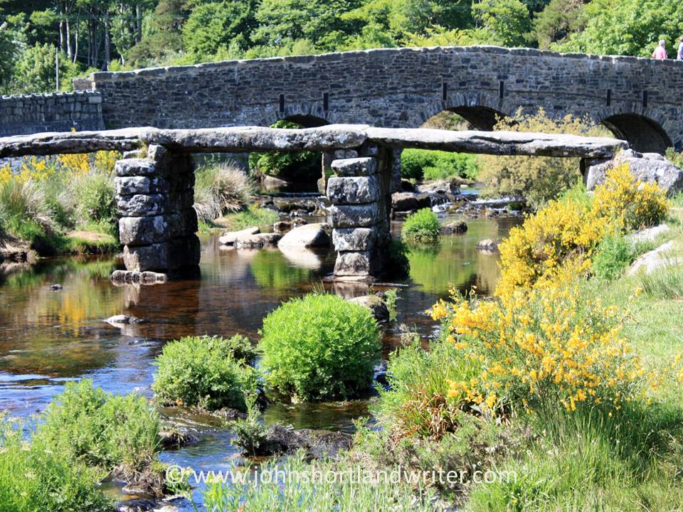
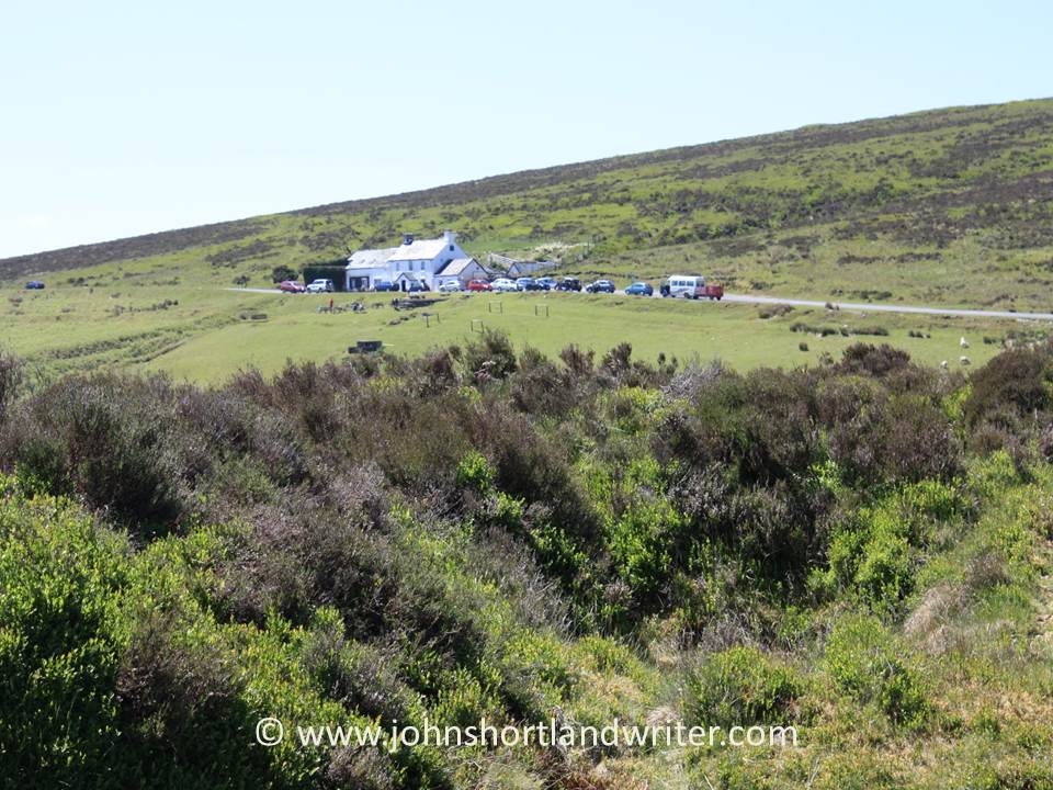
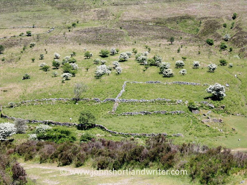
Sidmouth, a small, Regency resort on the south coast of Devon lies about 170 miles to the south-west of the Cotswolds. Devon, along with Somerset and Cornwall, are three English counties collectively known as “The West Country” and a prime tourist destination. A long peninsula reaching out into the Atlantic Ocean, it has many spectacular cliffs and sandy beaches and these, combined with a benign climate, make it the place where many Brits go for their summer holidays. Inland, it is a country of traditional farming, fast-flowing streams and open moorland and remains one of the few areas where it is possible to roam freely without too many restrictions. It is also home to several National Parks and long-distance footpaths.

Sidmouth (4a) copyright

Sidmouth came to prominence during the 1800s when in 1819 the Duke of Kent came to stay with his young child, Victoria. During this stay he died yet despite this inauspicious start the small fishing village became a fashionable place to visit. Later, after Victoria ascended the throne, she gifted to the church a memorial window which in recent times has been restored, partly funded by a further gift by our present Queen. Much of old Sidmouth is now a conservation area and buildings along the Esplanade, the seafront road, are classic examples of those built during this time.
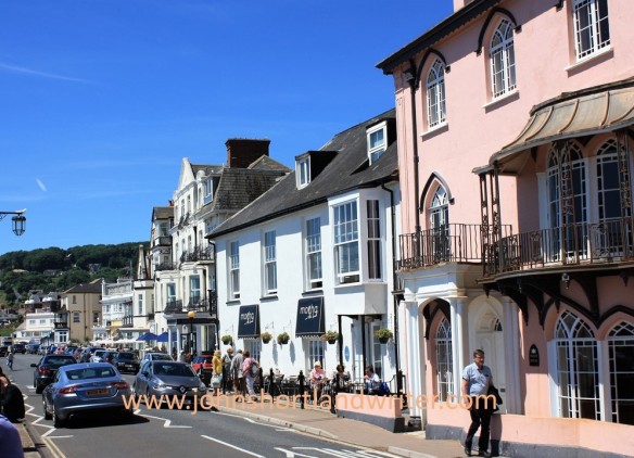
Sidmouth 15 watermark

The Esplanade

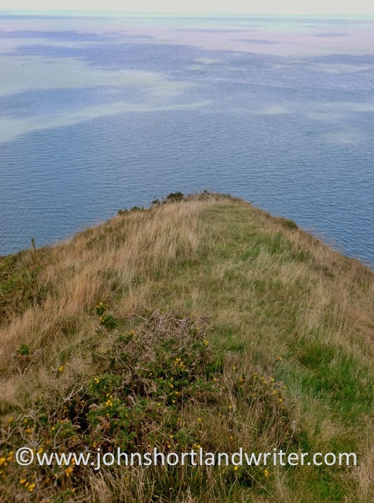
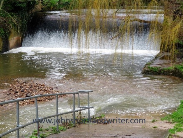
Like many coastal towns, Sidmouth is at the mercy of winter storms and with no natural sheltered harbour to protect it, when the sea batters the town it suffers, although not as badly as might be expected. However, it is the exposed sandstone cliffs that bare the brunt of these storms. Erosion is a real and constant threat and the red cliffs of Salcombe Hill are constantly crumbling. A number of houses are at serious risk of collapse in the forthcoming years. The cliffs form part of the Jurassic Coast, a World Heritage Site, renowned for its rock formations and fossils.

Sidmouth (15) watermark

Not there for much longer…

Sidmouth (9) watermark

Modern fossils!

Away from the crumbling cliff, there are two beaches. The Town Beach is of pebbles, reinstated after a 1990s storm washed it away. It is now protected by manmade rocky outcrops. At the far end of town is Jacob’s Ladder beach, so-named after the series of zig-zag wooden steps that lead down to it from the clifftop. This beach is a combination of sand and shingle. Both beaches are popular in the summer when the water is warmer; now, in February, the sea looks less inviting.

Sidmouth (1) watermark

Jacob’s Ladder Beach in midsummer

Sidmouth - waves (1) watermark

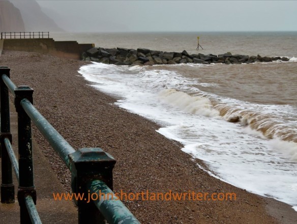
The Town Beach in February

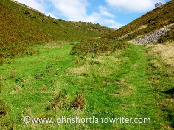
The mild, coastal climate protects many semi-tender plants which further inland would suffer damage from frosts. Connaught Gardens, a public space that date from the 1820s, are a riot of colour during the summer months and each year a number of private gardens also open to the public under the National Gardens Scheme.  Although these can be lovely, for me the jewel in Sidmouth’s crown is the area of natural parkland known as The Byes. A 2km green corridor that follows the course of the Sid river, it has a good path network, some outstanding trees as well as wildflower meadows. It is a good place to spot wild birds such as kingfishers and dippers. Popular with residents, it seems less well-known to visitors.

Sidmouth (12) watermark

The Connaught Gardens in midsummer

Sidmouth (16) watermark

The Byes

During the first week of August, at the height of the tourist season, the Sidmouth Folk Festival takes place. First held in 1955, it attracts some of the top names in the country. Apart from the listed acts, others sit around the seafront playing and busking, greatly adding to the atmosphere. When it all proves too much, there is always the opportunity to sit on a deckchair and take a nap in the summer sun.

Sidmouth Folk Week 2014 (5) copyright

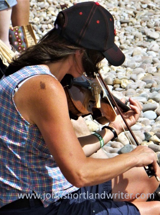
Fiddling on the beach

Sidmouth (6) copyright

The Year in Review: July – December 2016

The second half of 2016 went just as quickly, if not quicker than the first.  No sooner have the nights drawn out than Midsummer Day is upon us and, gradually at first – and then rapidly – the nights close in on us.  In England our really warm summer weather does not arrive before July and with luck extends well into October.  In bad years it never really arrives at all. blewbury-manor-copyright

In July I travelled just about as far west as is possible in the UK for a few days holiday in Cornwall.  Cornwall is a land of contrasts with picturesque, small fishing villages, spectacular cliff walks and golden, sandy beaches.  Inland, the scenery is bleak moorland with granite outcrops and the houses  appear to squat low in the landscape to shelter from the gales that sweep in off the Atlantic.  Luckily, the evening we went to the Minack Theatre was warm with only the lightest of sea breezes.  Lucky because the theatre is carved into the cliff face.  The idea of Rowena Cade, in the 1930s she and her gardener spent a winter moving rocks and to create a stage and seating.  This Herculean effort was more than worthwhile, it was… well, click here to see for yourself.169   copyright172   copyright

August saw me on the other side of Atlantic Ocean in the American State of Arizona visiting another cliff-face achievement, the Canyon de Chelly.  The houses of the Anasazi people were carved out of the sheer rock face hundreds of years ago and can only be reached by precarious toeholds.  Today it is the home of the Navajo.  The canyon is unique amongst the National Parks of America for it is the only one that is… check this link to find out what.Canyon de Chelly (3)   copyrightCanyon de Chelly (5)   copyright

There is nothing like a bit of bragging and September saw me unashamedly showing off about the small lake I created some years back.  These days, it looks as if it has been there forever and is home to numerous wild duck, fish and small mammals.  Originally a rubbish dump click here to see how it has been transformed.pond-build-3-copyrightpond-2-copyright

I am always telling you how beautiful our Cotswold Hills are and how lucky I am to live in the middle of the secret valley, away from traffic and houses.  In October, I took you all on a virtual tour of the valley.  The crab-apple tree lined lane leads to the wonderfully winding river that features on the blog header. After a mile of visual treats the lane narrows even more as it passes our tiny, stone cottage.  Occasionally, there is a traffic jam – but rarely by cars.  To take the tour again click here.secret-valley-2-copyrightcotswold-traffic-jam-copyright

In November we went treasure hunting – looking for fortune in the garden.  We didn’t have to dig it all up, only walk around it for we were searching for plants originating in China and Japan.  The little-known story of how Robert Fortune, a 19th century dour Scotsman travelled to the for side of the world to fight with pirates before smuggling out what has become one of our most popular drinks is told here.dicentra-spectabilis-copyrighttea-plantation-copyright

Travels  and ancient buildings in Sweden and the south of France, hidden Exmoor, and attracting butterflies to your garden all featured in December‘s review.  If that all sounds too exhausting, take a slow, slow canal longboat ride through the stunning scenery that can be found within a few miles of the university city of Oxford (here).133   copyright

2017 is seeing a lot of changes politically and culturally both here in Britain, in the USA and elsewhere in the world.  Some can’t wait for what will happen and others are dreading it.  Whichever ‘side’ you’re on, come and escape to Life in the English Cotswolds and the secret valley which will always be, hopefully, a little haven of peace.dorn-valley-copyright

Best wishes for 2017 and many thanks for your post -and future – support.

Theatre on the (L)edge

Standing on the edge of dramatic cliffs near the tiny Cornish village of Porthcurno, it seems inconceivable that anyone would consider trying to create a theatre there.  Yet Rowena Cade, in 1932, not only thought it, she spent that winter moving rocks and boulders. With the help of her gardener she created a stage and, what is now, the lower tier of seating.  Over the years the theatre developed to its current size.Minak Theatre (3)   copyright169   copyright

The evening of my visit, 11th July, a production of Shakespeare’s A Winter’s Tale was performed by Moving Stories Theatre Company.  The coastal backdrop is constantly changing: light, shadow, sea birds feeding and the sounds of the waves smashing onto the rocks below. On rare occasions porpoise have been known to steal the show.172   copyright177   copyright

The interaction between stage setting and ocean can, at times, be used to advantage by the actors.  When Florizel delivered the lines with a vague flourish of an arm

“And so deliver, I am put to sea
With her whom here I cannot hold on shore;

And most opportune to our need I have
A vessel rides fast by

an ad lib came back “it’s over there, actually” for at that moment, by chance, a boat came into view.Minak Theatre (5)   copyright

The Minack Theatre can be visited throughout the summer months for it is impressive to see even when a performance is not taking place.  The intrepid can scramble down the cliff path to the sandy beach below for a swim, the less adventurous can explore the stage and the gardens that are incorporated into the design.Minak Theatre (4)   copyright

The theatre is situated just four miles from Land’s End, the most westerly point of Britain.  As a consequence, snow and frost are rare and many sub-tropical plants that cannot be grown elsewhere in the UK thrive in the benign climate. Minak Theatre (2)   copyright

To find out more about the Minack Theatre and surrounding area take a look at these website:

The Minack Theatre

Visit Cornwall

South West Coast Path  the 630 mile coastal path doesn’t have to be walked all at once!

In the Footsteps of the Danes

In 858AD Hubba the Dane invaded England to be defeated by the Saxons at the Battle of Arx Cynuit. Recorded in the Anglo-Saxon Chronicles by Asser, biographer of King Alfred the Great, the site of the battle it is thought took place at Countisbury, a tiny clifftop community on Exmoor. Whether true or fanciful, a walk to Wind Hill hillfort* is well worth the effort. It is a place where it is possible to experience all the elements that Exmoor offers in one glorious 360 degree panoramic view.

Countisbury copyright

All the best English country walks should start and end at a pub and there are plenty of options to choose on this one. Mine started from the Blue Ball Inn at Countisbury which is as welcoming now as it was when I first crossed its threshold fifty years earlier.

Blue Ball (2) copyright

Turning left from the pub, walk down the road for a few yards before entering a gate to National Trust land, also on the left and the starting point of several extensive walks. Our destination is a short walk and is the high point close to the road. The path to the fort is well defined and grass covered; it merges with a field access track that leads gently uphill to its entrance. The second photograph below is taken from the fort: the pub is the white building.Wind Hill (9) copyrightWind Hill (5) copyright

The fort is a rare example of a promontory fort where the natural landscape has been adapted to create the defences. The coastal cliffs which form its northern defence are the highest in England rising to over 300 metres, to the west and south the East Lyn River has cut a deep gorge. Where necessary double ramparts were built to defend the weaker areas: at the entrance they still rise, after two thousand years or more, to an impressive thirteen metres.

Wind Hill (10) copyrightWind Hill (2) copyright

Although it is possible to make Wind Hill part of a longer walk I prefer not to do this. It is rare to meet anyone else here and to be able to explore the 85 acre site in splendid isolation gives a real feel of the place. Just spend time enjoying the silence,  lying down with your back propped against the ramparts listening to the wind and sheep calling.  As mentioned earlier, the views from the fort are magnificent: heather moorland, ancient woodland, hills, villages, sea, cliffs, the distant coast of Wales as well as wild creatures, ranging from the iconic red deer to seabirds and butterflies.

Wind Hill (8) copyright


* also known as Countisbury Castle


Links:

Historic England

The Megalithic Portal

Exmoor National Park

The Blue Ball Inn

A Walk Across Dartmoor – part 2

A riverside path heading north from the village of Postbridge, famed for its ancient clapper bridge, leads into the heart of the moor.  The bridge dates back at least to the fourteenth century and some of the slabs weigh over eight tons.  The ‘modern’ bridge in the background was built as recently as 1780.

Postbridge copyrightPostbridge 2   copyright

At the point where the river turns abruptly westwards are the remains of a beehive hut.  These were used mostly for storage and, compared to many of Dartmoor’s archaeological features which date back millennia, are also of more recent origin and date from the 1500’s.  They ‘disappear’ into the moorland  features but are clearly visible once you know where to look.

Beehive Hut (2)   copyrightBeehive Hut   copyright

Walking further onto the moor and leaving the river behind are the low grey shapes of the Grey Wethers double stone circle.  Sitting close to Sittaford Tor, they are so named for their resemblance to sheep, ‘wether’ being the Old English name for a castrated male sheep.  A tale, often repeated, is of a traveller stopping off at the remote Warren House Inn (where this walk started and will end) who complained of the poor quality sheep in the district.  After a drink or two, he was led to the circles and in the mist mistook the stones for sheep and bought them, only to discover later that he had been fooled.

Grey Wethers Stone Circle (4)   copyright

The two circles of Grey Wethers appear to the eye as one shaped as a figure of eight but an aerial view shows them to be quite separate to one another, sitting side by side.  The circles are of similar size and lie on a north-south axis although whether this is of relevance is unknown.  Numerous theories abound: perhaps the meeting place of two separate groups of people, or possibly they represent life and death. When excavations took place in 1909 a thick layer of ash was found to cover their centres but, again, the purpose of this is unknown.

Grey Wethers Stone Circle (2)   copyright

From Grey Wethers the walk back to the Warren House Inn skirted the edge of Fernworthy Forest.  Hidden behind the trees is Fernworthy reservoir, created by damming the South Teign River.  When water levels are low the remains of an old farm can be seen, as can the remains of a small clapper bridge, drowned reminders of life on the moor in times past.

the remote Warren House Inn

the remote Warren House Inn

A Walk Over Dartmoor – part 1

All the best walks start and end at a pub and a popular place to aim for is the Warren House Inn.  Located in the heart of Dartmoor, a national park in the county of Devon in England’s West Country, it has been a stopping point for thirsty travellers since the mid eighteenth century.  The fire, according to tradition, has never been allowed to go out – probably out of necessity for the inn is isolated and exposed on a high windswept plateau.

Warren House Inn copyright

Two miles to the south-west of the inn is the village of Postbridge, famed for its ancient clapper bridge, first mentioned in 1380 and reached by a track opposite the pub.  It passes the remains of habitation for Dartmoor once had a tin mining community and these are just some of the signs of this now vanished industry throughout the moor.  The mining is thought to have predated the Romans, flourished during medieval times and also the nineteenth century before finally ending in the mid-1900s.

IMG_1121 copyrIMG_1124  copyri

Spring comes late to this harsh environment: the few trees grow slowly and stunted.  When the moor flowers many different species of butterflies can be seen.

Stunted and sheep grazed hawthorn

Stunted and sheep grazed hawthorn

Small Pearl-Bordered FritillaryButterfly

Small Pearl-Bordered Fritillary Butterfly

As with many parts of Britain where rock lies close to the surface, drystone walls are a feature.  Unlike the soft limestone walls of the Cotswolds which use small pieces of thin, flat stone, Dartmoor’s are granite and some of the stones massive.  It is hard to conceive how they were built but the huge slabs foreshadow those that are to be found at Postbridge.

Drystone Wall   copyright

Crossing the East Dart River, the clapper bridge at Postbridge is perhaps the best known of all of these bridges in England although there are more than two hundred on Dartmoor alone.  Thought to have been built to allow carts to carry tin off the moor, the bridge is over four metres long and two metres wide.  Some of the stones weigh more than eight tons.  The village consists of a few houses, a pub and a post office and is a favouriteplace to stop  for a traditional Devon cream tea.

The clapper bridge with the 'new' bridge behind built in 1780

The clapper bridge with the ‘new’ bridge behind built in 1780

Postbridge 2   copyrightPostbridge 3   copyright

A riverside path heading north from the village leads into the heart of the moor towards the next stopping point, the prehistoric Grey Wethers stone circle, featured in part two of this blog.

East Dart River   copyright

The Hidden History of the Brendon’s

The Brendon Hills, part of the Exmoor National Park, are less well-known than the barren moorland to its west that gives the park its name.  Here the landscape is a patchwork of lush, green fields and of woodlands bordered to the north by the sea.  It is a quiet landscape with only the sounds of birdsong and the occasional farm vehicle to disturb its peace.  It wasn’t always like this, however, for during the nineteenth century it was the centre of a great, albeit relatively short-lived, mining venture.  Today, much of this has been forgotten.

The West Somerset Mineral Railway was built to link iron ore mines with the seaport of Watchet for transportation to the steelyards of south Wales.  Much of its route can be walked and there are several ruins, some of national importance, that have been conserved.  One of the most dramatic is the Incline, where trains hauled truckloads of ore – and passengers – up a 1 in 4 steep hillside, climbing 800 feet in just over half a mile*.  I have written about this feat of Victorian engineering in an earlier post and this can be found by clicking on the link here.

A ruin less impressive than that of the Incline but no less extraordinary in its day is the Langham Hill Engine House built in 1866.  All that remains now is the footprint of the building but a good idea of what it must have looked like and how it worked can be had from the artist’s impression by Anne Leaver shown on the nearby information board.

The engine house was created to draw the iron ore from three separate workings to the surface by sinking a new shaft at Langham Hill.  Powered by steam engines, the ore was pulled up to ground level by trams rising from a depth of up to 650 feet.  The miners who had to descend by ladder were protected from falling by a series of wooden platforms upon which the ladders rested – if they fell they would only drop the length of each ladder, reducing the risk of serious injury.  The steam engines also powered underground pumps to keep the shafts clear of water; this was filtered, stored in reservoirs and reused by the engines – an early example of recycling.  Once the ore was brought to the surface it was tipped into trucks to be carried away by the railway.

Another extraordinary feat of engineering was the aerial tramway that brought iron ore to Langham Hill in buckets from another mine over half a mile away.  A length of the steel cables, which are over four inches in thickness, can be seen coiled by the engine house.  The figures are staggering: the overhead cable was a single, endless 6700 feet length supported on wooden pylons, at times carrying the ore 300 feet above ground level and crossing a 2000 feet wide valley.  No wonder the miners called it ‘the flying machine’.

It is hard to imagine, when visiting the engine house now, the noise, bustle and industry that took place here just 150 years ago.  Two hundred miners and their families, mostly from Wales came to live and work here, yet within fifty years all mining had  ceased.  The engine house only survived for ten years: its engine and even the house itself, dismantled and reused in mines elsewhere.  The aerial tramway lasted an even shorter time being in use for only three years before new transportation technology overtook it.

Today all is silent, the site surrounded by trees and ferns.  For many years the remains of the mines remained hidden until the combined efforts of a number of individuals and groups fought to preserve them.  The West Somerset Mineral Railway Project came into being and has succeeded in doing so; it has also created a permanent exhibition housed in the museum in Watchet.  Its research of the history of the mines is available online – visit their website here.

*Nigel Cavey has through the Exmoor4All website has correctly pointed out that the iron ore would only have descended the Incline.  The trucks carried coal and lime, as well as passengers, up it.

Add to Technorati Favorites

Exmoor’s Forgotten Neighbour

Sandwiched between barren Exmoor to the west and the rugged Quantocks to their east, the Brendon Hills appear remarkably fertile with their neat, small fields testament to a rich farming tradition. Now incorporated into the Exmoor National Park it seems to be as devoid of human life as it’s more visited partner.  It has, however, a surprising past: travel back in time one hundred and fifty years and you would find yourself in a thriving community at the forefront of Industrial Revolution technology.

 A corner of the ruined building

For years, I had been intrigued by a ruined building close to one of the few roads that leads onto Exmoor proper.  Obviously once substantial, what could this building, miles from anywhere, have been and who lived there? There were no clues as I first approached but the  ruins, now stabilised, have had information boards giving its history placed within.  It was the site of an extraordinary Victorian venture that extracted iron ore and then transported it to the coast to ship to Wales for the steel industry.  Although, there was now just this one ruined building, in its heyday over two hundred miners and their families lived close by in houses built especially for them.

 Click on the image to enlarge the poster

The explosion of railway building in the mid 1800’s had created a huge demand for – and, consequently, a shortage of – iron ore.  Mining had taken place in the region on a very small, localised scale for many centuries but the small quantities found had never been a commercial prospect.  With the rapid rise in price and with advances in extraction the Ebbw Vale Company – Welsh steel works – developed the mines. A major problem was how to transport the ore the eleven miles from the furthest mine to the coast from where it could be shipped across the sea to Wales.  The first six miles from the port of Watchet was straightforward enough, the final six miles along the top of the Brendons, although more costly, also did not create a major problem.  It was the mile that included the climb of a 1 in 4 hillside that proved to be a challenge and a costly one at that – over ten times the amount required for the same length elsewhere and over £2 million in today’s prices.  ‘The Incline’ was completed in 1861 and took just four years to build, rising almost 800 feet in just 0.6 of a mile.

The ruins of the winding house as seen from the top of the incline

Trucks of iron ore were lowered or raised down the incline on twin rails, their steam locomotives held in place by steel cables.  The huge drums that were required to do this were housed in the ‘winding house’ with the cables travelling through stone tunnels, now the silent home of bats.  The force of gravity brought empty trucks to the top in twelve minutes as the weight of the full ones descended.   At the top of the incline the trucks passed over the roof of the winding house.  Communications between the men at the top and bottom were by semaphore.

The winding house – the trains passed over its roof

The cable tunnels

The price of iron ore and the methods of extraction continued to change rapidly and the railway never made a profit, with the mines closing just eighteen years later.  Remarkably, the railway continued to carry passengers for a further five years seated on wooden planks bolted to the tops of the iron ore trucks.  It must have been an extraordinary experience to be hauled up the incline and travelling back down couldn’t have been for the faint-hearted!

 The incline today belieing the industry and grit of the men that created it

An even more short-lived attempt to re-open the mine was thwarted by the outbreak of the Great War and in 1916 the sleepers and rails were requisitioned and the drums blown up, demolishing part of the winding house building.  A further attempt  to rebuild the winding house for agricultural use was abandoned during WWII and it was only with the help of a National Lottery grant that the buildings were recently stabilised and the incline cleared of scrub and restored.

Marker stone

For further information including many early photographs and drawings visit the West Somerset Mineral Railway website by clicking here.

Add to Technorati Favorites

Babies Everywhere

Everywhere I  look at the moment there are babies – it’s that time of year.  I’m not talking human babies although quite a lot of my friends seem to be having new grandchildren, yet another sign of our ageing.  In the secret valley animals outnumber humans by dozens to one so it isn’t surprising that all around us there are signs of new life.

Lambing starts later here than in many places, for the spring grass is also later, so it is with impatience that we wait to see them skipping in the fields and chasing one another up and down the  river banks.  Of course, that was some weeks ago – now they are grown quite large and, as I write this, very noisy as they call for their mothers who have been separated for shearing. It will be a few hours before they have all found one another and normality returns again; the sound of contented and playful bleating telling us that all is well.

Calves can be born in spring or autumn.  Beyond the secret valley is a beautiful herd of Red Devon cattle and they make good mothers.  I first came across this gentle breed when I worked on a farm as a teenager on Exmoor and they have been a firm favourite ever since.  Bred for beef, we used to hand milk a few for the farm’s own use and the milk was very rich and creamy.   Large enamel basins of it would be placed on top of the Rayburn stove (fired by the peat turves I have recently written about, click here)  and I would watch fascinated as the cream would rise in large clots to be skimmed off  to be eaten with afternoon tea, that most traditional of West Country meals.

The bantams – Lavender Pekins (Cochins) – are all rapidly going broody.  I find that they are only good layers in spring, the rest of the year they lay fewer eggs.  We always set some of these under them so that we have a new supply of youngsters: if we get too many there is always a ready home for them but mostly they are there as ready-made meals for Mr Fox who is a far too regular visitor.  I’d rather see the bantams having a short but very lovely time wandering about the place than cooped up in a pen somewhere.  When left to free range it is amazing just how far they travel up and down the field which does make them rather vulnerable.  As the fox usually visits in the early hours of the morning I try to always remember to shut them away safely for the night.  In the cold weather earlier in the year a fox visited the garden regularly during the day – at one time actually peering through the glass garden door at us.

 
We don’t keep duck but that doesn’t stop us from seeing them in the garden.  Usually one raises a brood of ducklings somewhere secluded: often under a large clump of oat grass or, before it rotted away completely, a few feet up on top of a rotten tree stump at the foot of a hedge. As soon as they hatch, she leads them away down the field to the river below the house.

Every year, there are many pheasants that survive the shooting season.  Last spring we had one nest in a planting trough beside our kitchen door.  Despite the constant activity, she sat tight and none of the dogs, visiting or resident, discovered her.  I have read that, when sitting on eggs, the hen pheasant can supress any scent so as to avoid predators.  No sooner had the chicks hatched than every dog in the neighbourhood was investigating the planter but by then, of course, she had led them all to safety.

Partridge also visit the garden but are much more wary.  When their eggs hatch the chicks are not much bigger than bumble bees and swarm about their mother.  They are so tiny they appear to have no legs moving as if somehow they are fitted with wheels instead!

I almost certainly won’t find it necessary to blog about the next ‘hatching’ for an eagerly waited event is the royal birth.  When Kate has her baby it will make world news – you won’t need to see a photo of it here!

Add to Technorati Favorites

Turf Cutting on Exmoor

A few weeks ago I blogged about cutting peat – or ‘turf’ as it is known on Exmoor – for burning.  It is an ancient tradition, now past.  You can read that post by clicking on the link here.

When I first visited Exmoor forty-five years ago one of the first tasks I was given was to ‘turn’ the turf, literally just turning it over and over so that the wind dried it.  In many ways it was a boring and monotonous job but it had to be done for it was the provider of heat for the farm, both water and cooking.  Being alone, high up on the moors, was never lonely for the isolation, even for a lad, was awe-inspiring.  I loved it.

Recently, I was flicking through the pages of a book that has been in our possession for as long as I can remember and came across a photograph of an Exmoor turf cutter.  I’d never noticed it before.  The book is called ‘People of all Nations’ and was written about 1920.  The photographs are wonderful and show a way of life long gone.  

click on the photo to enlarge

With the benefit of hindsight, it is a pity that I took so few photos of my early days on Exmoor.  At the time, it seemed that the unchanged life of the moors would go on for ever.  Little did I realise that I was witnessing its passing and  I feel very privileged to have been a (very tiny) part of it.  What has endured has been its influence: my arrival quite by chance on Exmoor and being taken into its heart has been a subject of discussion recently with Phil Gayle on BBC Oxford.

The caption below the photograph reads:

Cutting Turf on the Rolling Heights of Exmoor. With his primitive cutter this Devon labourer is procuring long strips of turf at the opening of the shearing season.  The turf is stacked into barns in which the sheep are herded on the eve of shearing.  They rub against it and lie on it, thus ridding their wool of much dirt and grease which would detract from the value of their fleece were it present when shearing began.

Add to Technorati Favorites