A Hidden Exmoor Walk

I have misgivings about sharing this walk for it is a favourite of mine: in the 48 years that I have known it I have rarely met anyone other than those that work the land here. Do I want to encourage others to discover its beauty? I’m not sure.

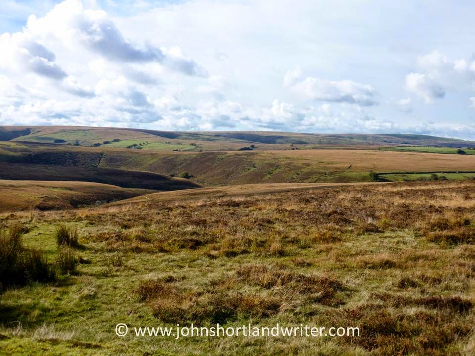
This circular walk begins with the open expanses of Brendon Common but follows more sheltered winding lanes before descending through beech woodland to Rockford and the East Lyn River. A steep climb past Brendon church returns you to the moor. How long does it take? There’s no easy answer to this – allow two hours although experience tells me there are so many distractions along the way, including the Rockford Inn, that it can take much, much longer. Whether you want a quick sprint or a leisurely amble good supportive footwear is essential as is the ability to climb hefty hills.
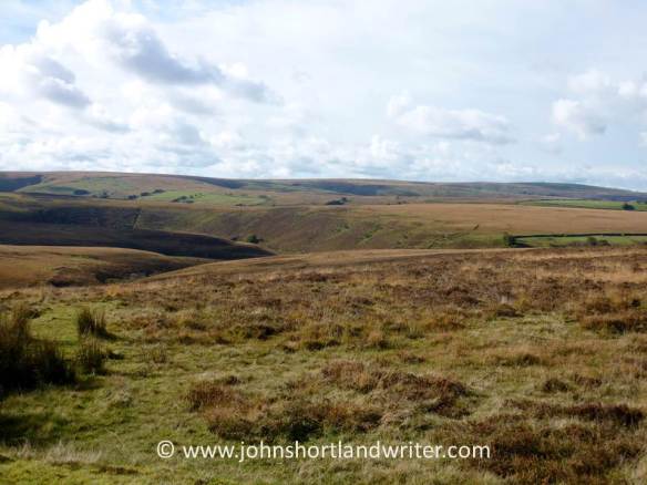
Brendon Common (14)   copyright

Brendon Common


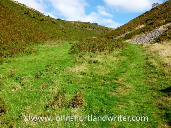
There is plentiful parking at Scobhill Gate, the cattle grid on the B3223 that denotes the westernmost boundary of Brendon Common. From here walks radiate across the 2000 acres of heather moorland but our route takes us over the cattle grid into farmed country and turns right by the hairpin bends at Brendon Manor Stables.

Scob Hill Gate   copyright.jpg

Scobhill Gate


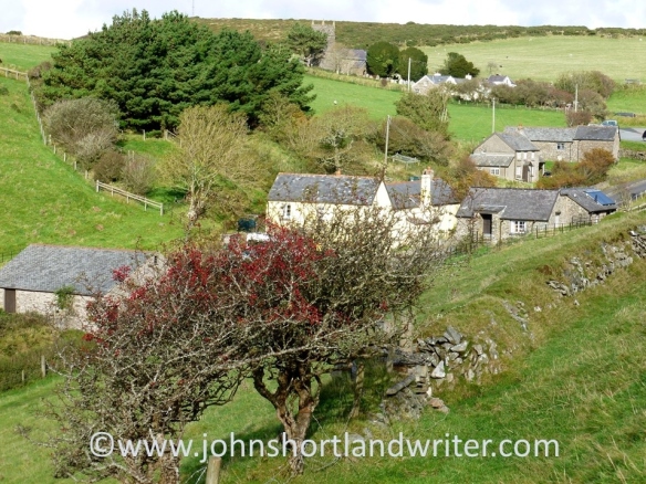
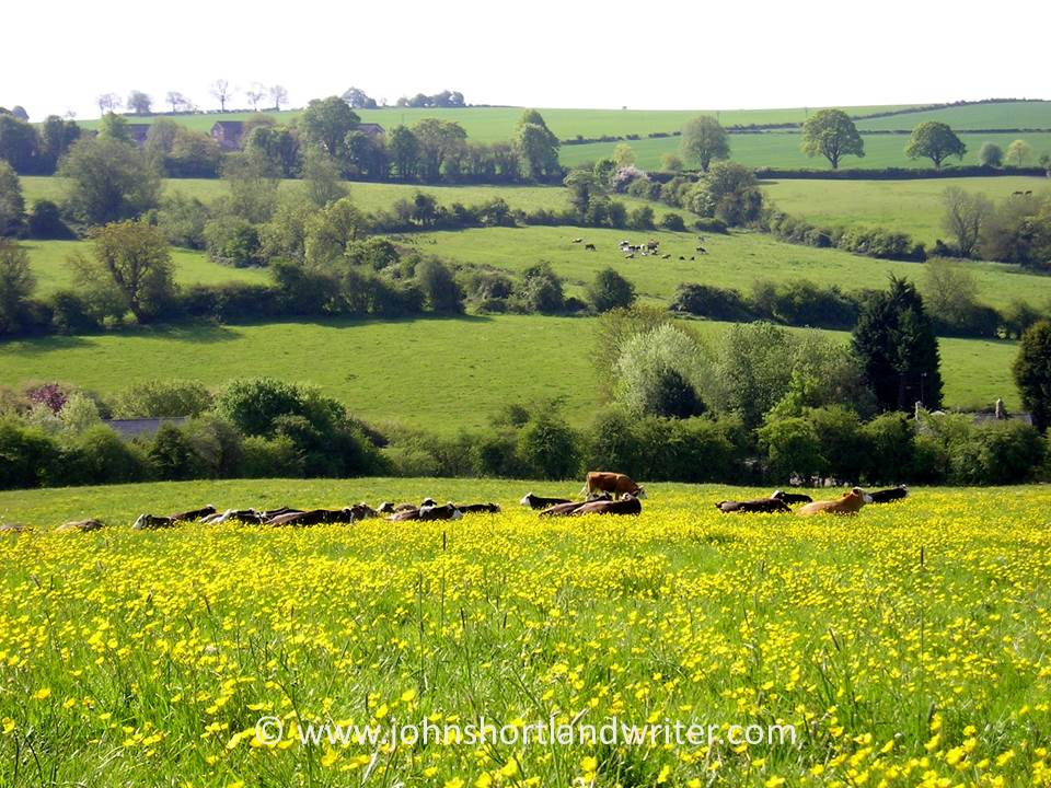
After a few hundred yards the road, which is flanked by hedges of hazel, ash, furze, bramble and bilberry (known locally as wurts), meets Gratton Lane. This is very much ‘home’ territory for me, for it is here at Brendon Barton that I arrived as a lad to work and play in 1968. Opposite the farm there are fine views of Brendon church and in the far distance Countisbury Common and the sea.
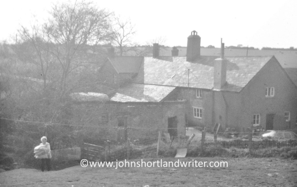
Lil @ Brendon Barton 1968   copyright

Brendon Barton 1968

Brendon Church 1968 (2)   copyright.jpg


Walking along Gratton Lane is lovely at any time of the year but is at its best in spring when the beech hedges are bursting into leaf and primroses and bluebells nestle at their feet. These banks are an ancient method of providing shelter, as well as a barrier to livestock, from the fierce gales and snowstorms that sweep in from the Atlantic. The banks stand about five feet in height, lined with stone with the beech planted above.
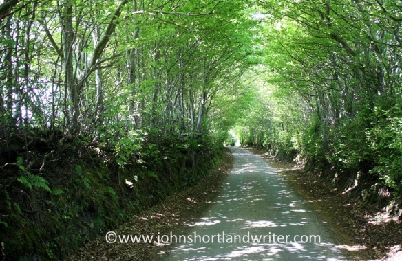
Above Brendon Barton (2)   copyright.jpg

Gratton Lane


Just as the lane starts to descend it enters woodland and it is here – just past the warning sign denoting the ford that crosses the road – that a footpath is taken to the left. The path follows a pretty stream as it tumbles over rocks down to join the East Lyn River. It is here that the unwary walker can also take a tumble as the path crosses outcrops of rock that become quite slippery when damp. This stream has everything a larger one would have – cascades, waterslides, ferns growing from niches – but all in miniature. Despite its diminutive size it once powered a sawmill.Waterfalls (2)   copyright.jpg

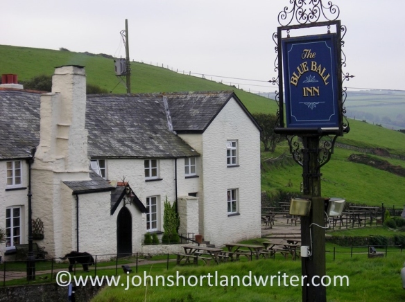
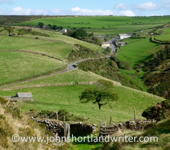
The mill has long been a ruin and is now fenced for safety but the rusting ironwork is still visible. Just beyond the old building the path joins the road. Turn left and follow the lane to the hamlet of Rockford. You are now walking in the Brendon valley with its beechwoods clinging to the steep hills high above, home to a number of rare rowan trees (Sorbus) unique to the area.  The East Lyn River is a major river; when water levels are low it is difficult to imagine its ferocity when in spate. In 1952 it destroyed bridges, houses and lives as it passed through the valley culminating in the flood disaster at Lynmouth where thirty-four people lost their lives and over one hundred houses were destroyed. The Rockford Inn is a good place to stop for a beer; they also serve cream teas. Just make sure that you put the cream on the scone before the jam in the Exmoor tradition! It is possible to extend the walk to Watersmeet (where there is a National Trust tearoom) by crossing the river.

ROCKFORD MILL   copyright.jpg

The Old Mill nr Rockford


East Lyn River (2)  copyright.jpg

East Lyn River


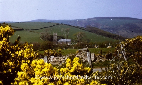
Once past Rockford the road starts to climb until it reaches Brendon church. The hill is a killer – it’s not called Church Steep for nothing! The church which nestles into the hill and looks out across the combes looks as if it has been there for centuries. In reality, it was moved stone by stone from nearby Cheriton in 1738. It is simply decorated inside but has some attractive stained glass. Brendon Barton, passed earlier, can be seen from the steps of the church. Follow the lane back to the farm; from there retrace the original route back to Scobhill Gate.

Brendon Church (5)   copyright.jpg

Brendon Barton (2)   copyright.jpg

Brendon Barton, view from the church


Happy walking!


Exmoor is a National Park in the southwest of England and straddles the counties of Devon and Somerset. Apart from miles of wonderful moorland walks, it also has the highest sea cliffs in England, pretty villages and spectacular wildlife including the majestic Red Deer. Native Exmoor ponies roam the open moor. Now a rare breed they remain virtually unchanged from pre-history.


Advertisement

In the Footsteps of the Danes

In 858AD Hubba the Dane invaded England to be defeated by the Saxons at the Battle of Arx Cynuit. Recorded in the Anglo-Saxon Chronicles by Asser, biographer of King Alfred the Great, the site of the battle it is thought took place at Countisbury, a tiny clifftop community on Exmoor. Whether true or fanciful, a walk to Wind Hill hillfort* is well worth the effort. It is a place where it is possible to experience all the elements that Exmoor offers in one glorious 360 degree panoramic view.

Countisbury copyright

All the best English country walks should start and end at a pub and there are plenty of options to choose on this one. Mine started from the Blue Ball Inn at Countisbury which is as welcoming now as it was when I first crossed its threshold fifty years earlier.

Blue Ball (2) copyright

Turning left from the pub, walk down the road for a few yards before entering a gate to National Trust land, also on the left and the starting point of several extensive walks. Our destination is a short walk and is the high point close to the road. The path to the fort is well defined and grass covered; it merges with a field access track that leads gently uphill to its entrance. The second photograph below is taken from the fort: the pub is the white building.Wind Hill (9) copyrightWind Hill (5) copyright

The fort is a rare example of a promontory fort where the natural landscape has been adapted to create the defences. The coastal cliffs which form its northern defence are the highest in England rising to over 300 metres, to the west and south the East Lyn River has cut a deep gorge. Where necessary double ramparts were built to defend the weaker areas: at the entrance they still rise, after two thousand years or more, to an impressive thirteen metres.

Wind Hill (10) copyrightWind Hill (2) copyright

Although it is possible to make Wind Hill part of a longer walk I prefer not to do this. It is rare to meet anyone else here and to be able to explore the 85 acre site in splendid isolation gives a real feel of the place. Just spend time enjoying the silence,  lying down with your back propped against the ramparts listening to the wind and sheep calling.  As mentioned earlier, the views from the fort are magnificent: heather moorland, ancient woodland, hills, villages, sea, cliffs, the distant coast of Wales as well as wild creatures, ranging from the iconic red deer to seabirds and butterflies.

Wind Hill (8) copyright


* also known as Countisbury Castle


Links:

Historic England

The Megalithic Portal

Exmoor National Park

The Blue Ball Inn

2014 in Review: the first six months

So another year is almost over and it certainly has been a busy one for me.  Living and working in the spectacular Cotswold countryside, a classified area of Outstanding Natural Beauty (AONB) is a great treat and one of which I never tire.  It’s also nice to go off exploring other places so 2014 found me in other parts of the UK and  Ireland too.  One of the first places I visited, however, was only twenty miles down the road but light years apart in reality!

a typical Cotswold scene   copyright

typical Cotswold countryside

Like many people that live close to tourist attractions I don’t often visit the ones on my doorstep but last January found me walking the streets of Oxford.  I hadn’t come to explore the colleges but the covered market which dates back more than two hundred years.   The history of the market and the building is fascinating and is well worth making the time to visit – especially if you like a bargain.  To read more about it and to see other photos click here.

0bab1-copyrightjjj

One of the fathers of ecological writing died tragically young and in February I matched quotations from his work to images I had taken (to see them, click here).  My favourite was noticed by the Society that bears his name and reprinted in their journal.  I felt very honoured!

7d91b-hmecopyright

Wild and rugged scenery is often best appreciated over cake and coffee and at Watersmeet in Exmoor National Park you can do just that.  Two rivers collide spectacularly besides the Victorian fishing lodge that is now owned by the National Trust and run as a café. March found me walking through beautiful scenery as well as indulging myself and the link to this remote but very accessible place is here.

c6c63-watersmeet5copyright

Dublin, the capital city of Ireland is a favourite place of mine and in April I visited the Casino Marino, one of the most impressive and perfect neo-classical buildings in Europe.  Everything about it was designed to deceive so although you only see one window on each side you actually have – well, click here to find out what plus all the other deceptions the Georgian architect managed to fit in.

Casino Marino

Planting trees is a long term project for they rarely mature during the life of the planter.  Of all the hundreds I have done in my professional life none has given me as much pleasure as this particular one.  I have waited for years for it to flower and in May it did so for the first time.  I felt quite emotional – it was a case of finding a handkerchief.  Take a look by clicking the link here.

Davidia involucrata   copyright (2)

The Cotswolds are world renowned for their ‘chocolate box’ village scenes and Lower Slaughter must be one of the contenders.  Despite its name it is a beautiful and tranquil place to visit for it has everything from crystal clear trout streams to olde-world stone cottages to a mill complete with working water wheel. If you choose the right time to explore you can have the place to yourself.  To learn more click the June link here.

2d910-lowerslaughter3copyright

The Story of Lorna Doone – just a myth?

 Lorna Doone is the tale of a young boy, John Ridd, whose father is killed by Scottish outlaws – the Doones.   Exiled to a remote part of Exmoor (which is in England’s West Country and now a National Park), they rob travellers and local farms.  Living amongst them is the pretty Lorna Doone, kidnapped by them as an infant.  John enters the forbidden Doone Valley by climbing a steep and difficult waterfall, the ‘waterslide’, and meets Lorna for the first time.  Some years later he rescues her and as they marry Lorna is shot through the window of Oare church by the wicked Carver Doone.  John pursues him and after a struggle Carver perishes in a bog.  Lorna recovers from her wounds and so the story has a happy ending.

Oare Church

But is it true?  The simple answer to the question is that the answer isn’t simple.  When Richard Dodderidge Blackmore wrote his historic novel in the late 1800’s he mixed fact with fiction and local legend with the names of local people.

Blackmore placed the Doone stronghold beside Badgworthy (pronounced ‘Badgery’) Water.  There is a deserted medieval village beside a tributary in Hoccombe Combe and it is very probable that this is the site for the ruins were still visible in Blackmore’s day.  However the Waterslide is not found there but in another side valley, Lank Combe. Nowhere as sheer as described it is, however, an impressive sight with its three smooth slabs of rock especially when the river is in spate.  I like to think that he also had in mind the waterslide at Watersmeet a few miles further downstream which would be much more of a challenging climb.
The waterslide at Watersmeet
 

Because the precise location of the Doone Valley is uncertain it is no longer described as such on maps, the Ordnance Survey now describing the area more accurately as Doone Country.  A rewarding walk can be taken along the whole length of Badgworthy Water starting from Brendon Common by parking the car at Brendon Two Gates.  Here there are wide views of both the open heather moorland and also the grass moor of the Royal Forest ‘improved’ in the nineteenth century.  Badgworthy Water changes in character along its length from fast running rapids to smoother, deeper pools.

Badgworthy Water

The above walk is rugged and long but a more gentle approach is from Malmsmead with its much photographed packhorse bridge and ford that also denotes the county border between Devon and Somerset.

Malmsmead where Badgworthy Water crosses the road
 

Further along the lane nestles the village of Oare and the church where Lorna and John wed.  Inside is a memorial to Blackmore, a smaller copy of the one in Exeter cathedral.  A memorial can also be seen to the Snow family who lived at Oare manor and also feature in Lorna Doone. It is recorded that as Blackmore didn’t write kindly of the Snows he was afterwards much disliked by them.  Other local characters also existed: Tom Faggus, the highwayman was – in real life – from nearby North Molton and Ridd is still a local surname. 

Oare village and church nestle in a deep combe

Is Lorna Doone a story based on truth?  That is for the reader to decide, perhaps after visiting Mother Meldrum’s cave in the Valley of Rocks, for both are mentioned in Blackmore’s book.

The Valley of Rocks

Add to Technorati Favorites