Conceived on Exmoor?

There used to be a standing joke between my mother and I that I must have been conceived on Exmoor as it has such a magnetic hold on me.  My parents had honeymooned there, staying at Ye Olde Cottage Inne at Barbrook in the mid-1940s – the fact that I was born in the early 50s and had an older sibling we conveniently overlooked.

Mum & H wedding photo watermark

Wedding Day

When I first came across Exmoor, in the summer of ‘68, I thought I had stumbled into a paradise, if not unknown to others, certainly unknown to members of my family.   “Stumbled” is an accurate description. My intention had been to cycle further west into Cornwall before returning south to Exeter for the train journey home.  Poor map reading skills took me instead to the North Devon Coast at Westward Ho!.   During my final term at school we had studied the novel Lorna Doone and now seeing Doone Valley, Exmoor marked on the map it seemed logical to visit despite it being way off to the east.

Badgworthy Water watermark

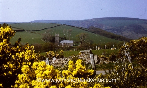
Badgworthy Water, Doone Valley

Brought up in the Chiltern Hills, I was used to a hidden landscape of narrow lanes, high beech hedges and dense and extensive beech woodlands.  Rarely, was there an unbroken view of far-distant places and, almost as rarely, large expanses of sky and cloud.  Cycling across Exmoor with its open, rolling landscape ablaze with heather and gorse and views across the sea to the Welsh coast was unlike anything I’d ever experienced.  Sometimes the lanes would pass between high banked hedgerows or descend into well-wooded coombes reminding me of home.  I came across a farm where I pitched my tent intending to stay two days before leaving for Exeter.

Nr Fingest 2 watermark

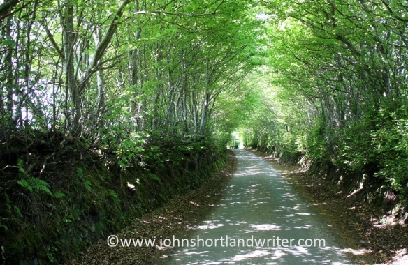
A Chiltern lane winds its way through dense woodland


River Barle watermark

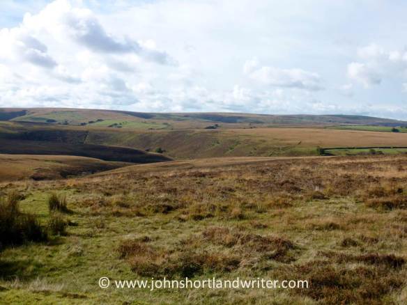
The open views of Exmoor

Helping on the farm, two days turned into weeks and then into months by which time I had moved into the farmhouse and embraced Exmoor life.  I occasionally telephoned my parents, or sent a postcard, always being evasive about where I was staying and only telling them I was working on a farm and being well cared for.  With the benefit of maturity, I sometimes wonder how they coped with their sixteen-year old son, on his first lone holiday, disappearing for so long in an era of no mobile phones or credit cards for them to track my progress.  They only succeeded in finding me after I foolishly reversed the telephone call charge and soon after arrived on the doorstep to drag me away, kicking and screaming.  It was time to get “a proper job” but Exmoor and the farm had completely changed my outlook on life as well as the direction it would ultimately take.  After twenty years of “a proper job” I finally escaped to agricultural college and a life of outdoor work.
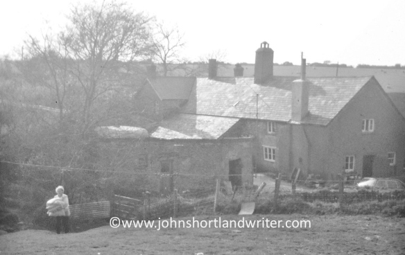
Brendon Barton 1968 (4a) watermark

Brendon Barton 1968

Pruning watermark

At agricultural college 1994

I had been surprised and a little disappointed when I first discovered my parents also knew Exmoor.  Despite not having been conceived there, my attachment to Exmoor has never waivered and more than fifty years later I regularly return.  Upon entering the moor the same emotion of discovery, as if seeing it for the first time, remains.  Many of the old friends that I made in those early years and their unique way of life that I was privileged to be part of, albeit in a small way, have gone but the landscape remains remarkably unchanged.  The heather and gorse are still a carpet of purple and gold, the sea (at least, on a fine, sunny day) still blue.

Countisbury (15) watermark

Countisbury Common, where the moor falls into the sea

Very recently, through researching my family history, I have found that an earlier cousin, at a similar age to myself, had also discovered Exmoor.  He too had never settled in school and life on Exmoor changed him.  He also chose to write about his time on the moor, something else we have in common. Although I was surprised to learn of his life and his book, this time I am delighted!

002

PostscriptJust a few years before she died at the age of 93, I spent a few days on Exmoor with my mother and took her to revisit the honeymoon hotel.  Long widowed, the day must have been a mix of emotions.

Honeymoon Hotel watermark

At Ye Olde Cottage Inne, renamed The Bridge Inn


A Hidden Exmoor Walk

I have misgivings about sharing this walk for it is a favourite of mine: in the 48 years that I have known it I have rarely met anyone other than those that work the land here. Do I want to encourage others to discover its beauty? I’m not sure.

This circular walk begins with the open expanses of Brendon Common but follows more sheltered winding lanes before descending through beech woodland to Rockford and the East Lyn River. A steep climb past Brendon church returns you to the moor. How long does it take? There’s no easy answer to this – allow two hours although experience tells me there are so many distractions along the way, including the Rockford Inn, that it can take much, much longer. Whether you want a quick sprint or a leisurely amble good supportive footwear is essential as is the ability to climb hefty hills.

Brendon Common (14)   copyright

Brendon Common


There is plentiful parking at Scobhill Gate, the cattle grid on the B3223 that denotes the westernmost boundary of Brendon Common. From here walks radiate across the 2000 acres of heather moorland but our route takes us over the cattle grid into farmed country and turns right by the hairpin bends at Brendon Manor Stables.

Scob Hill Gate   copyright.jpg

Scobhill Gate


After a few hundred yards the road, which is flanked by hedges of hazel, ash, furze, bramble and bilberry (known locally as wurts), meets Gratton Lane. This is very much ‘home’ territory for me, for it is here at Brendon Barton that I arrived as a lad to work and play in 1968. Opposite the farm there are fine views of Brendon church and in the far distance Countisbury Common and the sea.

Lil @ Brendon Barton 1968   copyright

Brendon Barton 1968

Brendon Church 1968 (2)   copyright.jpg


Walking along Gratton Lane is lovely at any time of the year but is at its best in spring when the beech hedges are bursting into leaf and primroses and bluebells nestle at their feet. These banks are an ancient method of providing shelter, as well as a barrier to livestock, from the fierce gales and snowstorms that sweep in from the Atlantic. The banks stand about five feet in height, lined with stone with the beech planted above.

Above Brendon Barton (2)   copyright.jpg

Gratton Lane


Just as the lane starts to descend it enters woodland and it is here – just past the warning sign denoting the ford that crosses the road – that a footpath is taken to the left. The path follows a pretty stream as it tumbles over rocks down to join the East Lyn River. It is here that the unwary walker can also take a tumble as the path crosses outcrops of rock that become quite slippery when damp. This stream has everything a larger one would have – cascades, waterslides, ferns growing from niches – but all in miniature. Despite its diminutive size it once powered a sawmill.Waterfalls (2)   copyright.jpg

The mill has long been a ruin and is now fenced for safety but the rusting ironwork is still visible. Just beyond the old building the path joins the road. Turn left and follow the lane to the hamlet of Rockford. You are now walking in the Brendon valley with its beechwoods clinging to the steep hills high above, home to a number of rare rowan trees (Sorbus) unique to the area.  The East Lyn River is a major river; when water levels are low it is difficult to imagine its ferocity when in spate. In 1952 it destroyed bridges, houses and lives as it passed through the valley culminating in the flood disaster at Lynmouth where thirty-four people lost their lives and over one hundred houses were destroyed. The Rockford Inn is a good place to stop for a beer; they also serve cream teas. Just make sure that you put the cream on the scone before the jam in the Exmoor tradition! It is possible to extend the walk to Watersmeet (where there is a National Trust tearoom) by crossing the river.

ROCKFORD MILL   copyright.jpg

The Old Mill nr Rockford


East Lyn River (2)  copyright.jpg

East Lyn River


Once past Rockford the road starts to climb until it reaches Brendon church. The hill is a killer – it’s not called Church Steep for nothing! The church which nestles into the hill and looks out across the combes looks as if it has been there for centuries. In reality, it was moved stone by stone from nearby Cheriton in 1738. It is simply decorated inside but has some attractive stained glass. Brendon Barton, passed earlier, can be seen from the steps of the church. Follow the lane back to the farm; from there retrace the original route back to Scobhill Gate.

Brendon Church (5)   copyright.jpg

Brendon Barton (2)   copyright.jpg

Brendon Barton, view from the church


Happy walking!


Exmoor is a National Park in the southwest of England and straddles the counties of Devon and Somerset. Apart from miles of wonderful moorland walks, it also has the highest sea cliffs in England, pretty villages and spectacular wildlife including the majestic Red Deer. Native Exmoor ponies roam the open moor. Now a rare breed they remain virtually unchanged from pre-history.