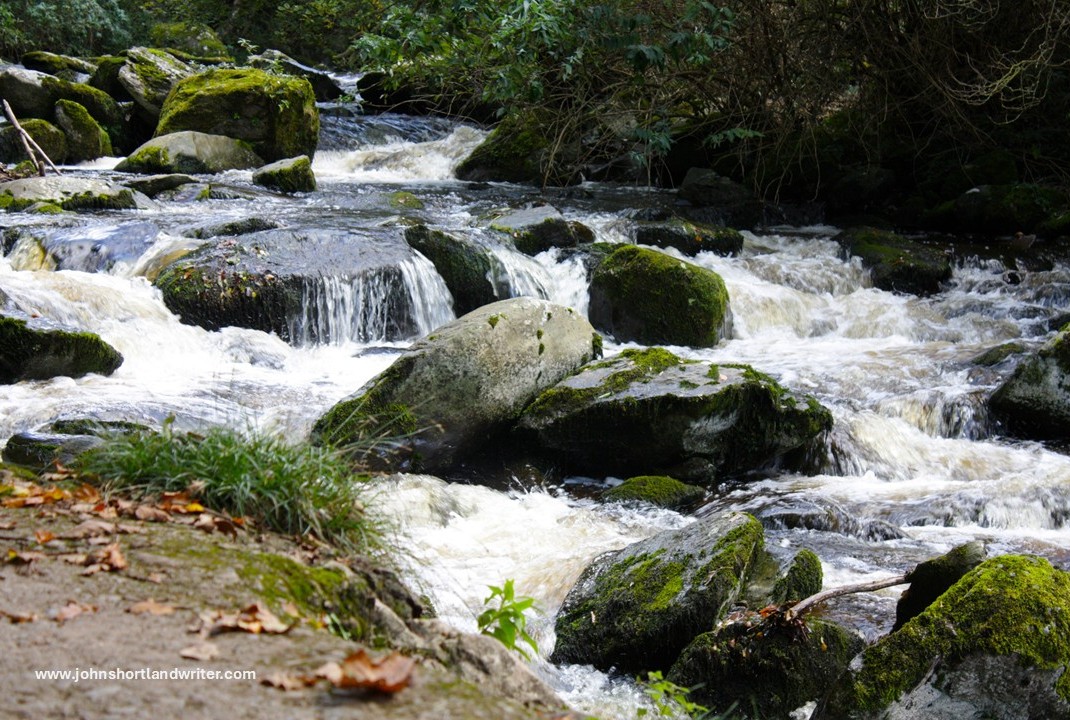
I think this title may be a little misleading, for the river that runs past our little stone-built cottage is neither deep nor that still. However, it isn’t like the raging rapids that surge through my other secret valley, the one in my beloved Exmoor. I guess it falls somewhere between the two – perhaps the title should be Still Glides the Stream after the poem by Wordsworth for the water, for much of its course through the valley, does seem to glide rather than flow.
The river seems to glide past our little stone house rather than flowThe river in my other secret valley in the Exmoor National Park is more like a raging torrent
‘Our’ Cotswold river, the Glyme, starts its course in the hills above the town of Chipping Norton. There is no big fanfare to announce its rising from the ground, instead there is a marshy bit of land and a trickle of water. How surprising it is to think that this is the source of our drinking water and mill wheel power, as well as two beautiful, landscaped lakes created in the 18th century by Lancelot ‘Capability’ Brown. One of these lakes is at Kiddington Hall where, when I first moved to live in this area, I was employed as Head Gardener. Another of the lakes is at Blenheim Palace in Woodstock, a UNESCO World Heritage Site and one of relatively few Grade 1 listed gardens in the UK. By the time the water has reached these it has flown past our little stone cottage and threaded its way around the series of meanders, the photo of which I use as my blog header.
There is no big fanfare to tell you that this is the start of a most beautiful riverThe Italianate gardens at Kiddington Hall at the time I was Head Gardener. They overlook the river
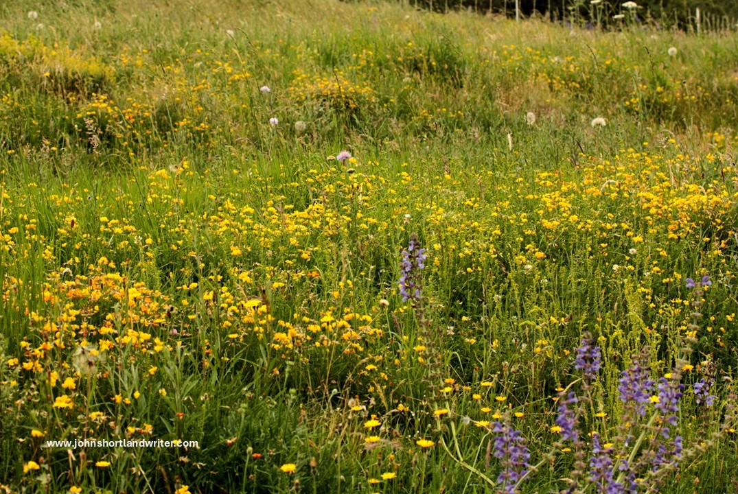
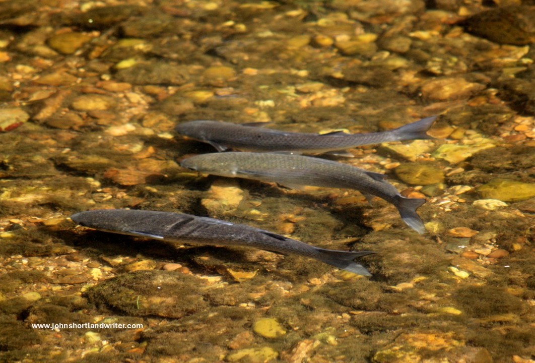
Nature abounds along the whole length of the river. At its headwaters on a series of natural terraces an abundance of wildflowers grow including the rare native Salvia pratense, more usually thought of as a deservedly popular garden plant. On the banks around our house and elsewhere, orchids can be found as can, on dryer spots, diminutive wild thyme (see my earlier blog, I Know a Bank Where the Wild Thyme Grows). In the river both native White-clawed Crayfish and their larger, hungrier cousins American Crayfish thrive, the latter crowding out the former which are now restricted to the higher reaches. Trout and pike can be caught (although the private fishing rights are jealously guarded) and the much smaller minnows – ‘tiddlers’ to us as children, stickleback and Miller’s Thumb fish are also present.
Purple spikes of the rare Salvia pratense growing amongst a myriad of other wild flowers by the headwaters of the River GlymeA trio of wild river trout
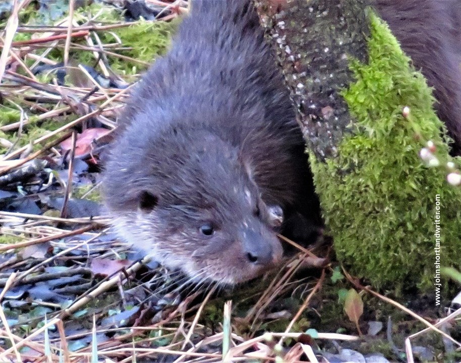
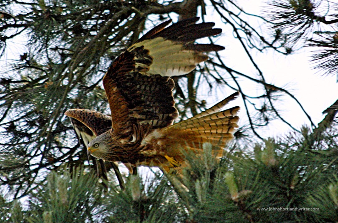
It isn’t just flowers and fish that frequent the river for many of the larger mammals live by or near it – four of the six species of wild deer in England roam here: Fallow, Roe, Muntjac and Chinese Water Deer. Roe are native, whereas Fallow were reputedly introduced by the Romans two thousand years ago; the Muntjac and Water Deer are more recent introductions. Badger, Fox and Otter are shy, mostly nocturnal and so are rarely seen other than by the lucky few. Fortunately, I have been one of them! Birdsong, especially at this time of the year, announce the many different species that visit or breed here: Red Kite, Spotted Flycatcher, Kingfisher, Little Egret being just a few of my favourites.
Otters frequent the river but are shy and rarely seenRed Kite, once hunted to near extinction are now a common sight along the course of the river
After Kiddington Hall, the river continues to wind its way through the villages of Glympton and Wootton where it is joined by the even smaller River Dorn. A mile upstream of that river is where we stabled our horses and like our own valley, it is secluded and not much frequented despite being very pretty. The Glyme next enters Blenheim Park, and as mentioned earlier, the river has been dammed and landscaped to create the palace’s Queen Pool and Lake. From there it cascades into the larger River Evenlode which in turn flows into the Thames a few miles from Oxford.
The River Dorn, a tributary of the Glyme, snakes its way through the hilsThe lake at Blenheim Palace created by the waters of the Glyme
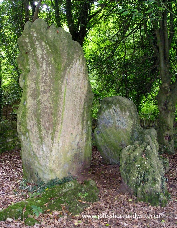
Human settlement around the banks of the Glyme didn’t just start with the Romans. Evidence of much earlier Britons can be found all along its length. Perhaps one of the most prominent, yet weirdly more often overlooked, is the hoar stone in the village of Enstone. Perhaps the reason for this is that by tradition the Old Soldier, as it is known, takes himself off to the river when thirsty to have a drink (see my blog post on the Old Soldier here). This may well be true for, despite the stones’ huge size, I have often gone past it only later to realise that I hadn’t actually noticed it being there! Further downstream there are earthworks known as Grim’s Ditch, a series of banks and ditches that probably served as boundary markers. When the ditch was being created some 3000 years ago, the Old Soldier was already 2000 years old. I rather like the thought that living and working on the land I and am part of an unbroken chain that dates back five millennia or more.
The Old Soldier, now 5000 years oldThis insignificant looking little bridge marks the place where Akeman Street, a road built by the Romans, crosses the River Glyme
Footnote: i) Still Glides the Stream is from William Wordsworth sonnet, written in the early 1800s – “….Still glides the stream, and shall forever glide….” ii) Still Waters Run Deep: a proverb dating from the early 1400s or even earlier. Modern use refers to great passion hiding behind quietness. Originally it suggested that silence often hid danger and Shakespeare (who else!) picks up on this theme in Henry IV – “…smooth runs the water where the brook is deep….show he harbours treason….”
Mentor. There are dozens of words to choose from when looking for an alternative description of someone who takes on this role: life coach, guide, adviser, confidante, counsellor, influencer to name just a few. One thing that is certain is that the four people who played such an important role in shaping my life would not recognise any of these terms, not even the word mentor. And to be honest, it is only with the benefit of hindsight that I recognise them as being mentors at all.
If I had to choose just one word, I think it would beguide for that seems to describe what they were during their lifetimes. It is only since they’ve been gone – for sadly, they have all been dead for more than twenty years – that I actually think of them even as that for their influence was subtle. They would almost certainly find the description laughable for there was never any conscious effort to take on that role. It was one that had come about by chance meetings leading to friendship, respect and love.
Despite the angelic appearance I wasn’t an easy child!
I was not an easy child – I know that statement is hard to believe now (laughs). A streak of rebellion has run through our family for generations and although I wasn’t outwardly rebellious, I sometimes made life difficult for those around me. From the age of fourteen I found school a waste of my time for I had wanted to study sciences and school insisted I did languages instead. I’m sure they were probably right for studying French and English had come easily to me whereas I’d struggled with even General Science. To me that was irrelevant for I had desperately wanted to learn botany and biology. Instead, I now found myself sitting in German classes seething inwardly and resenting every moment of having to learn the difference between der, das and dem or liebe and Lieber. I began playing truant and found that if I left school after the lunchtime register had been taken nobody seemed to notice and I could walk the three hours back home through the woods and fields where I could practice my botanising. I finally stormed out of school halfway through my ‘O-level’ exams before sitting the dreaded German but not before I’d sat French and English. I passed both with flying colours but my parents were furious.
Me in my element!
More out of desperation, my parents agreed that I could take my bicycle and tent on the train to Exeter and cycle and camp across Dartmoor for two weeks. It would be my first solo holiday and, I imagine, they agreed in the hope that it would make me appreciate just how fortunate I was to have been given the chance of a good and expensive private education. I arrived in Exeter in blazing sunshine and armed with maps and far too much self-confidence started my journey westwards. In those days, with no mobile phones or credit cards to monitor my progress, my parents provided me with stamps and cash so that I could send them a postcard at the end of each day. I reached Okehampton, a small market town on the fringe of the Dartmoor National Park in a sweat and seeing from my map that I wasn’t that far from the sea instead decided to cycle northwards to Westward Ho, a beach resort on the North Devon coast.
I had reached the sea
Refreshed from an early morning swim in the sea (I’d arrived there at 2.00 in the morning) I looked again at the map and now decided to travel eastwards to a different national park, Exmoor. I’d read the novel Lorna Doone at school and had loved it and the thought of exploring the rugged and isolated places where she had met and married John Ridd, only then to be shot at the altar of Oare church, filled my imagination. Little did I know then that soon I would be meeting a real-life Lorna Ridd who with her farmer husband would welcome me into their lives.
Oare Church – where Lorna Doone was shot at the altar on her wedding day
Three days later, having cycled over some tough and exhausting hilly roads I ended up at Brendon Barton, a remote farm perched high on the edge of the open moorland. It was coming towards the end of my fortnight away and so I knew that I could only stay there for one or two days before the long bike ride back south to Exeter and home. Venturing into the farmyard I could hear sounds coming from inside the barn where Dick French, the farmer, was working with sheep. I asked if I could camp in one of his fields but he didn’t look up and instead replied, “be a good lad and bring those last two sheep in here.” I had never been near a sheep before and so spent the next half an hour running around the yard in circles before finally managing to herd them inside. I was out of breath, sweating and covered in sheep shit but I found a contentment in my success that I’d not experienced before. Years later, Dick and I would laugh about that first encounter. I used to say that I should have just got back on my bike and cycled away to which he would respond with, “when I saw you wouldn’t give up, I knew that you’d do!”
I cycled over Exmoor’s remote, hilly roadsPreparing for a good night’s sleep, Brendon Barton 1968
By my second day on the farm I had helped bring in the cows and Dick had taught me how to hand milk them. Hearing I could ride, he suggested that I took Star, one of their horses up onto the moor to have a look around The heather was in flower and its deep purple carpet continued to the sea. Beyond, the coastline of Wales could be seen in the hazy far-distance. I ventured into a deep combe before crossing a stream and climbing up a ridge. There I spotted a deserted farm cottage* half-hidden by beech trees. I stood entranced by the beauty of my surroundings and its all-encompassing silence. I felt I had found my true home and with no consideration for my parent’s concern, I decided never to leave. I sent them a postcard saying that I’d missed my train home. I remained purposely vague as to my whereabouts, just saying that I’d kept back enough money to buy a new railway ticket.
The heather clad hills of Exmoor reach to the seaHalf-hidden amongst the trees stood a deserted farm cottage
A week later I was having my meals in the farmhouse enjoying the banter amongst the farm lads and hearing the discussions about the tasks that needed to be done around the farm. By the time harvest came round, my tent had been ditched and I was sleeping in the house in a comfortable bed, receiving a small wage and spending evenings in the village pub with new-found friends. Dick had said that it would be his wife Lorna (Ridd had been her maiden name) who would decide whether I could stay or not. She was such a hard-working woman and one more person to care for might be one too many. Her approach had been that one more would make no difference and so she looked after me while I spent long days working at Dick’s side, listening to his tales and learning about their way of life. Asked about my parents, they seemed content enough with my explanation that I was spending extended time away having just left school (the term gap year hadn’t been invented then!).
Brendon Barton 1968 – I soon moved into the farmhouse and a comfortable bedHarvest was still carried out the old-fashioned way
Months passed and the harder I worked the more I knew an Exmoor outdoor life was for me. However, it came to an abrupt end when one day I walked into the kitchen to find my parents sitting there telling me it was time to return home. I was devastated and asked Dick why he hadn’t told me they were coming. “I knew you’d hide up on the moor,” he’d replied – and he was right! Although I was pleased to see my parents I pleaded with them to let me stay. Dick, in the first of his subtle acts of persuasion that I can recall, asked me to help him look at a horse in the barn. There was no horse, instead we sat and talked about our time together before he reminded me that my home was with my parents and, in time, running our family business. Don’t forget, he’d said, there’s a room here always available so why not come down for lambing next spring. To ensure that I did he added, “You’d be doing me a great favour, I could do with your help.”
The barn in 1968 where I had my first taste of farmingI returned for lambing in 1969
Lorna, too, had her subtle ways of persuasion. “Your parents have said that you can come here for Christmas if you’d like to. We’ll be on our own and some young company would be good. It’ll be just the three of us.” She’d also boxed up the bantam chicks that I’d been caring for so that “you can carry on farming at home.” After that first Christmas I visited them both for many years, helping on the farm whenever I could, and exchanging letters and phone calls. They were always my first port of call when I was having difficulties, feeling down or just wanting to celebrate with them. Life hill-farming is hard, the weather often unmerciful and the hours long but there are also the pleasures of being part of a small tight-knit community that will help one another whatever the reason. Leading by example, they instilled in me a love of farming and hard work, a sense of duty, generosity of spirit and kindness. I will leave it to others to decide whether they succeeded or not! From them, I also acquired an even deeper love for being outdoors regardless of the weather and especially in remote, wild landscapes. Little did I know then that these skills would be put to the test when, aged forty, I began my career change to follow my outdoor dream, or that Exmoor would still play such an important part of my life today.
The bantam chicks that Lorna sent back home with me, 1968
Dick and Lorna French died just before the Millenium and the farm was sold to another local farming family, some of whom I’ve now known for almost sixty years. Because of that, I still on occasion visit Brendon Barton and sit in the kitchen drinking tea to discuss farming and, of course, putting the world to rights. A bonus is that Maria, the new ‘Lorna’ has been creating an extensive garden around the farmhouse, so we have gardening in common too, as well as a lifetime of shared memories. It would be another fifteen years and then as a man, before I would meet my other mentor couple. Cyril Heber Percy and his wife Pamela’s lives were worlds apart from Dick and Lorna’s but there were some similarities too. Part 2 tells their story.
Lorna & Dick French
Have you had a mentor or mentored someone? What does it take for someone to become a mentor? Our parents have probably the greatest influence on our lives so why does a mentor s role take on such importance? Let’s hear your story either in the comments below or, if you prefer, by using the Get in Touch tab at the top of this page. Thanks to Diane Highton for posing the question that triggered this blog!
* The deserted cottage still stands in splendid isolation hidden away behind the trees, albeit now as a ruin. It has a fascinating history and has been the subject of much research in recent years. Take a look at the website devoted to the story of Hoar Oak Cottage
It’s Halloween so when can be a better time to consider what scares us and what doesn’t? To be honest, I don’t really ‘get’ Halloween. I don’t find any excitement in all those ghoulish faces cut into pumpkins or in the buying of fake cobwebs and skeletons. Perhaps it’s because I don’t care for fancy dress of any kind: for me there is only a feeling of mild embarrassment on other people’s behalf as they don face paint and hideous costumes. Quite why I should feel the need to apologise for other people’s silliness when they are obviously enjoying themselves enormously, as are those around them, goodness knows. After all, it’s just a bit of harmless fun, isn’t it? Possibly, but then again, possibly not.
Beneath Huntington Castle
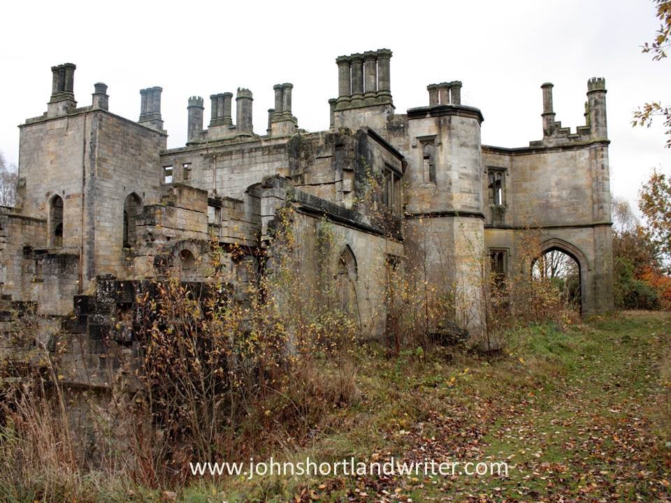
Like many teenagers, I messed around with Ouija boards without any lasting harm, but they can be a great source of trauma and anxiety for others. It isn’t pumpkins and fancy dress that are scary, or for that matter, it isn’t the dead either, it’s the living. And the one that’s likely to scare us the most is our living self for who knows what our minds are capable of conjuring up. Despite my indifference to Halloween, I do like a good scary moment as much as (or perhaps even more than) the next person. There is nothing like exploring a derelict building – especially if you can visit at dusk as I did, the old mansion in the photos below – to get the mind working overtime.
The abandoned and derelict Dunmore Park
My feeling of unease only increased when, following a maze of passageways, I found myself in the cellars. I had forgotten my mobile phone and the only source of light I had was to trigger the flash on my camera. Of course, that only gave the briefest moment of vision before plunging me into even greater darkness. Extracting myself from the cellars, I made my way through derelict gardens only to find an equally ruined tower. Pushing open the door I chose not to explore further when I realised that I was entering an empty crypt – were the coffins scattered nearby, I wondered. It was definitely time to get back home and to the land of the living.
I just couldn’t resist entering the far door…I found myself in total darkness…The empty crypt in the tower was just a little too creepy for me!
A few years ago I received an invitation to a house party and stay overnight in a remote, medieval manor house. Arriving, again at dusk, and expecting to find a throng of people, instead I entered an empty and dark house. Fortunately, the electric lights worked but as I explored the building with its stone staircases and grotesque carvings I half-wondered if I was about to star in a real-life crime drama, tricked by someone with a long-held grudge. My imagination went into overdrive when leaning against a wall of oak panelling, it opened to reveal a secret room. I was glad when my fellow partygoers arrived and the house became a lively and wonderful place to stay.
Just one of several staircases at medieval Wortham ManorThe grotesque carvings with eyes that seemed to follow you…The panel opened unexpectedly to reveal a secret room
Of the various creepy experiences that I have sought out or endured (depending on the circumstance) perhaps, rather surprisingly, the ones that have unsettled me most of all have been places that are normally associated with crowds, bustle and noise. The ferry to Ireland is a case in point and an unlikely candidate for spooky. Somehow, I became the first person to board and as I walked along empty decks and through deserted lounges, it felt rather as if I had just discovered the Marie Celeste. Of course, it was only a very short while before other passengers arrived but not before I’d begun to think that others must have known something that I didn’t and had decided to stay away.
The deserted ferry to Ireland was surprisingly spookyWhat had happened to all the other passengers???
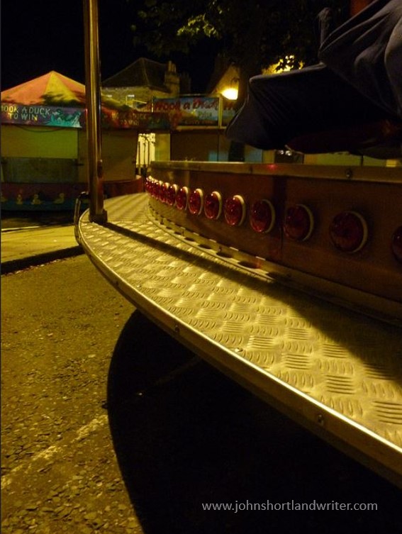
Perhaps the very creepiest place I’ve experienced was also the one I would have least expected it to be. Walking home late one night I decided to take a short cut through the fairground which had closed a couple of hours earlier. Associated with noise, excitement, music and flashing lights, the area was silent and deserted. There was no danger but around each corner I expected to find someone lurking in the shadows, not helped by the ghoul I came across hanging from a scaffold behind the blacked-out House of Horrors. Arriving back home in the darkness and silence of the secret valley I was met by the reflection of a hundred eyes watching me. Fortunately, they were real-life sheep and thankfully, not the ghosts of countless Sunday roasts coming back to haunt me.
The deserted fairground: shadows and surprises around every corner…That made me jump!Being watched as I walk home late at night
So, what do you like/dislike about Halloween? What scares you the most? I will be intrigued to know!
The second half of 2016 went just as quickly, if not quicker than the first. No sooner have the nights drawn out than Midsummer Day is upon us and, gradually at first – and then rapidly – the nights close in on us. In England our really warm summer weather does not arrive before July and with luck extends well into October. In bad years it never really arrives at all.
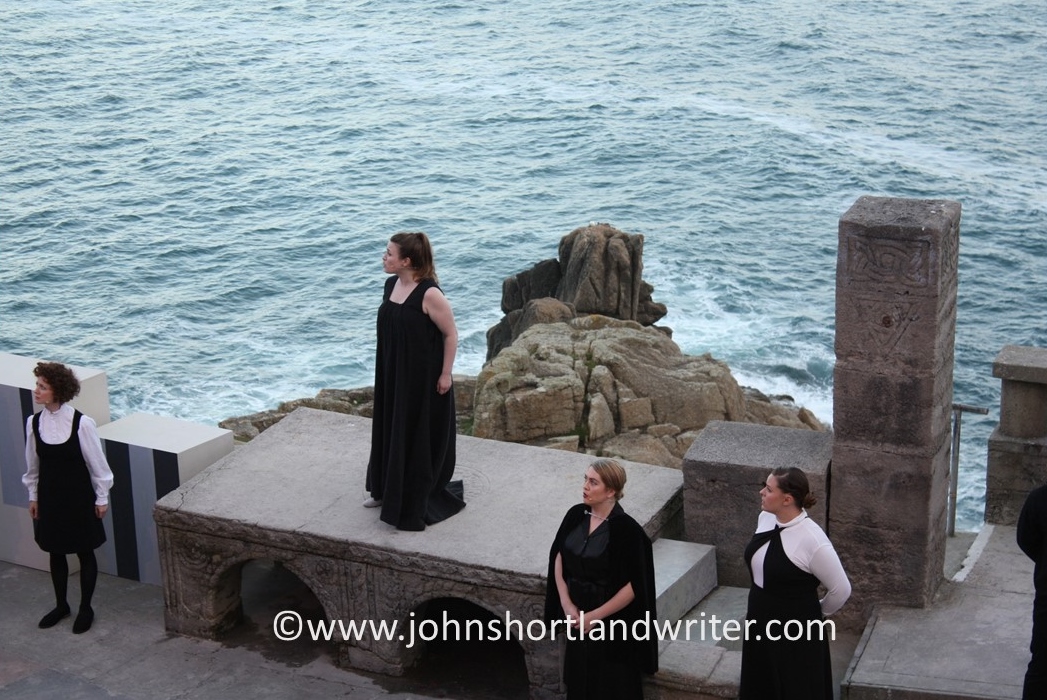
In July I travelled just about as far west as is possible in the UK for a few days holiday in Cornwall. Cornwall is a land of contrasts with picturesque, small fishing villages, spectacular cliff walks and golden, sandy beaches. Inland, the scenery is bleak moorland with granite outcrops and the houses appear to squat low in the landscape to shelter from the gales that sweep in off the Atlantic. Luckily, the evening we went to the Minack Theatre was warm with only the lightest of sea breezes. Lucky because the theatre is carved into the cliff face. The idea of Rowena Cade, in the 1930s she and her gardener spent a winter moving rocks and to create a stage and seating. This Herculean effort was more than worthwhile, it was… well, click here to see for yourself.
August saw me on the other side of Atlantic Ocean in the American State of Arizona visiting another cliff-face achievement, the Canyon de Chelly. The houses of the Anasazi people were carved out of the sheer rock face hundreds of years ago and can only be reached by precarious toeholds. Today it is the home of the Navajo. The canyon is unique amongst the National Parks of America for it is the only one that is… check this link to find out what.
There is nothing like a bit of bragging and September saw me unashamedly showing off about the small lake I created some years back. These days, it looks as if it has been there forever and is home to numerous wild duck, fish and small mammals. Originally a rubbish dump click here to see how it has been transformed.
I am always telling you how beautiful our Cotswold Hills are and how lucky I am to live in the middle of the secret valley, away from traffic and houses. In October, I took you all on a virtual tour of the valley. The crab-apple tree lined lane leads to the wonderfully winding river that features on the blog header. After a mile of visual treats the lane narrows even more as it passes our tiny, stone cottage. Occasionally, there is a traffic jam – but rarely by cars. To take the tour again click here.
In November we went treasure hunting – looking for fortune in the garden. We didn’t have to dig it all up, only walk around it for we were searching for plants originating in China and Japan. The little-known story of how Robert Fortune, a 19th century dour Scotsman travelled to the for side of the world to fight with pirates before smuggling out what has become one of our most popular drinks is told here.
Travels and ancient buildings in Sweden and the south of France, hidden Exmoor, and attracting butterflies to your garden all featured in December‘s review. If that all sounds too exhausting, take a slow, slow canal longboat ride through the stunning scenery that can be found within a few miles of the university city of Oxford (here).
2017 is seeing a lot of changes politically and culturally both here in Britain, in the USA and elsewhere in the world. Some can’t wait for what will happen and others are dreading it. Whichever ‘side’ you’re on, come and escape to Life in the English Cotswolds and the secret valley which will always be, hopefully, a little haven of peace.
Best wishes for 2017 and many thanks for your post -and future – support.
Ask people – both here at home or abroad – how they imagine Great Britain to be, the answer is often the same: an overcrowded island. We do, of course, have our fair share of big cities, motorways and densely populated housing estates but it often comes as a surprise just how much unspoilt, open countryside remains. A few of us are lucky enough to live in it.
The M40 motorway where it enters Oxfordshire
Less than two hours drive from the centre of London, thesecret valley, seems more like a million miles away rather than just the eighty odd miles that, in reality, it is. Tucked down an unclassified side road and not shown on a number of maps, only those ‘in the know’ tend to visit it. Time for a quick tour.
The Secret Valley
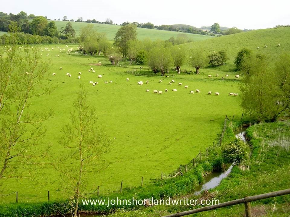
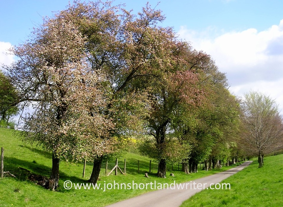
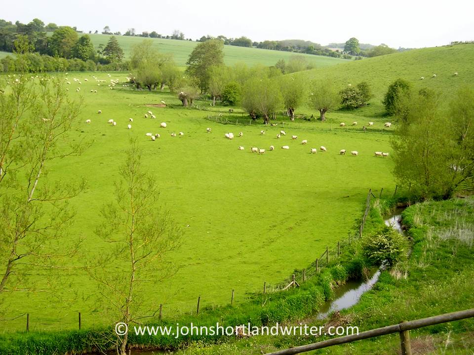
The approach to the secret valley gives little hint of what’s to come. Lined with crab apple trees, the lane gently descends between a fold in the hills where, on the steepest banks, wild thyme, orchids and other wild flowers grow.
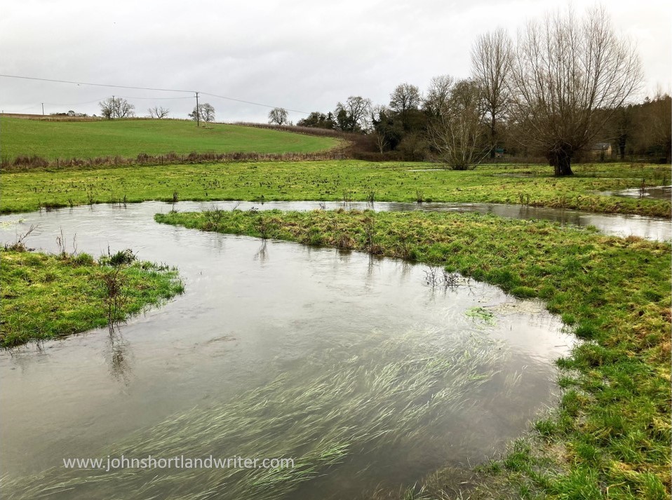
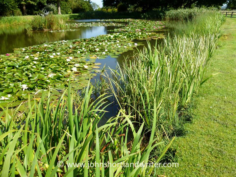
A bend in the road conceals the valley’s crowning glory: the most perfect, easily jumpable river (as can be seen in the header image of this blog page). Twisting and turning as it passes through meadows, in its shallows watercress grows where both trout and crayfish hide. By its banks willow pollards, now elderly and bent, wear garlands of wild roses; they grow from the tree crowns courtesy of seed dropped by birds generations ago.
The lane, crossing the river, passes our tiny stone cottage and climbs towards the village – a cluster of nine houses, a farm and little else. Our home sits alone, down by the river bank, with just one other as companion. Here, the lane – barely wide enough for a combine harvester to pass – once was busy with drovers taking their cattle and sheep to the markets in Oxford.
These days the drove road enters and leaves thesecret valley by a different route, only its mid-section by our house is still in use. The ‘old road’, as it is known, can still be walked – its path clearly defined by the wild flowers and hedgerows that line it.
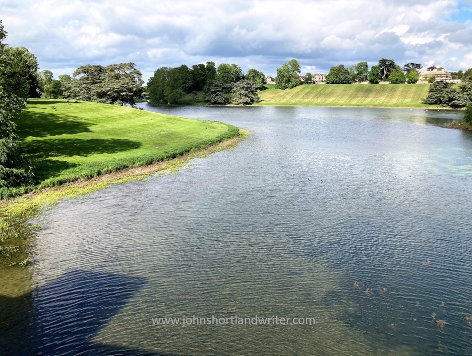
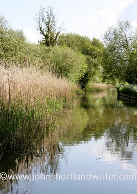
The river, too, has chosen a different route according to the earliest maps. Downstream from our house, it flows past wooded banks to widen into a small lake before passing through fields, these days marshy where the watermill’s sluice gates have decayed with age.
Further downstream still, where the sheep cannot graze, swathes of scented, moisture loving plants such as wild valerian – looking very different from the one grown in our gardens – provide nectar for insets and a hiding place for deer.
a forest of Valerian & Meadowsweet
On the higher ground of the secret valley, the fields are cultivated with wheat, barley and oilseed rape. Even here, in the favoured places, wild flowers and birds of many types can be found: the diminutive hay rattle, a relic from the old farming days to ravens, buzzards and red kites, all now common again after centuries of persecution.
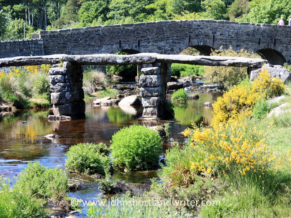
A riverside path heading north from the village of Postbridge, famed for its ancient clapper bridge, leads into the heart of the moor. The bridge dates back at least to the fourteenth century and some of the slabs weigh over eight tons. The ‘modern’ bridge in the background was built as recently as 1780.
At the point where the river turns abruptly westwards are the remains of a beehive hut. These were used mostly for storage and, compared to many of Dartmoor’s archaeological features which date back millennia, are also of more recent origin and date from the 1500’s. They ‘disappear’ into the moorland features but are clearly visible once you know where to look.
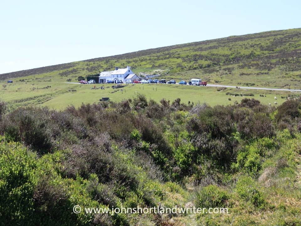
Walking further onto the moor and leaving the river behind are the low grey shapes of the Grey Wethers double stone circle. Sitting close to Sittaford Tor, they are so named for their resemblance to sheep, ‘wether’ being the Old English name for a castrated male sheep. A tale, often repeated, is of a traveller stopping off at the remote Warren House Inn (where this walk started and will end) who complained of the poor quality sheep in the district. After a drink or two, he was led to the circles and in the mist mistook the stones for sheep and bought them, only to discover later that he had been fooled.
The two circles of Grey Wethers appear to the eye as one shaped as a figure of eight but an aerial view shows them to be quite separate to one another, sitting side by side. The circles are of similar size and lie on a north-south axis although whether this is of relevance is unknown. Numerous theories abound: perhaps the meeting place of two separate groups of people, or possibly they represent life and death. When excavations took place in 1909 a thick layer of ash was found to cover their centres but, again, the purpose of this is unknown.
From Grey Wethers the walk back to the Warren House Inn skirted the edge of Fernworthy Forest. Hidden behind the trees is Fernworthy reservoir, created by damming the South Teign River. When water levels are low the remains of an old farm can be seen, as can the remains of a small clapper bridge, drowned reminders of life on the moor in times past.