Discovering the Five Senses in Lockdown

It sometimes takes a crisis to make us re-evaluate what is of importance in our lives and the present one of Coronavirus/Corvid-19 surely has to be the greatest that we will collectively face. Now, several weeks into lockdown we have all been developing new patterns to our daily regime, one of which may well be taking more exercise. Never before have we placed so much value on fresh air and being able to walk freely whether it be in our parks, gardens or open countryside.

Marlow watermark

                           Riverside path, Higginson Park, Marlow (before social distancing).                                 The river is the River Thames in Buckinghamshire

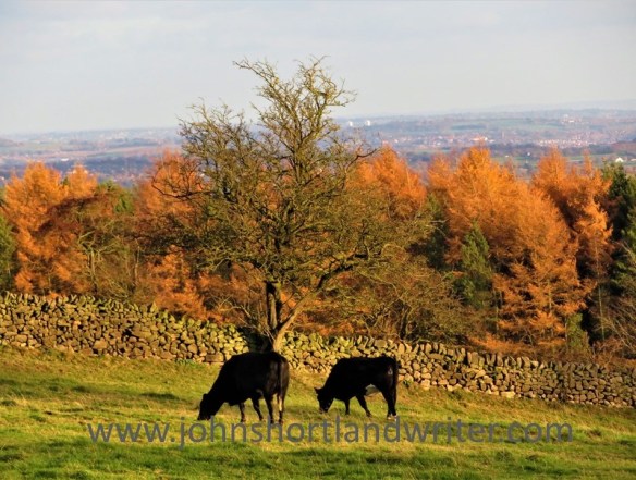
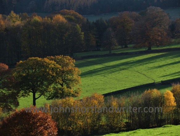
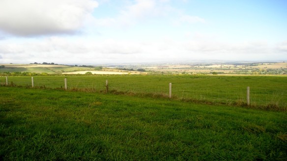
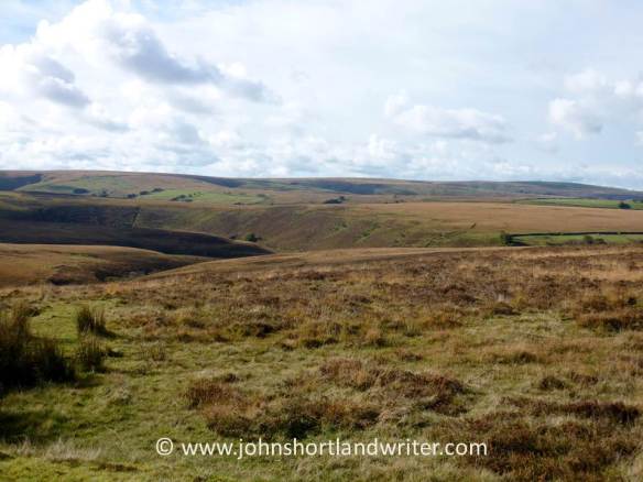
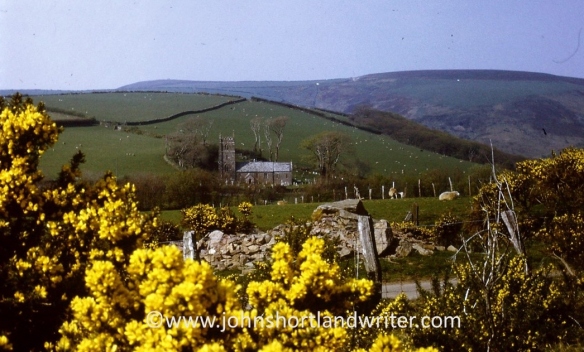
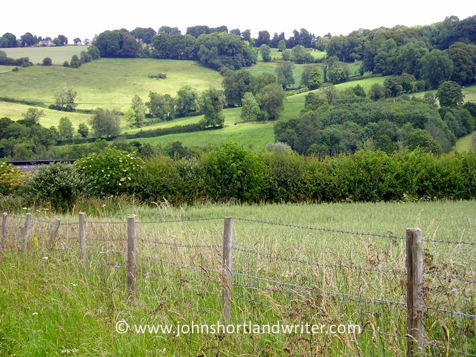
Living where I do in the Cotswolds surrounded by fields and with woodlands and the river close by it is relatively easy for me to enjoy the open space. For others able to take advantage of their enforced free time, it may involve a longer walk and I have certainly noticed an increase in the numbers of walkers and cyclists here in the valley. I have also noticed that for many of them one aspect of their lives hasn’t changed: as they walk their eyes are glued to the screen of their mobiles and headphones are clamped to their ears, seemingly unaware of their surroundings. It has made me think all the more of our five senses and how we use (or should use) each one of them when out exercising.

Nr Fingest copyright

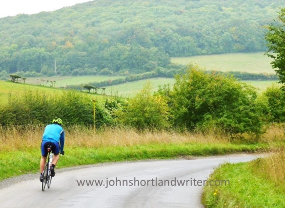
Cycling in the Chiltern Hills

SIGHT For those of us blessed with the gift of vision, perhaps sight is the most important sense we use and perhaps the one we most take for granted.  Without it, it is still possible to enjoy one’s surroundings for the other senses become heightened but I doubt if anyone would deny the pleasure of seeing the beauty that surrounds us on our daily walks. Even within cities there is much nature to be enjoyed although I admit that sometimes it has to be sought with more vigour and awareness.

Viola watermark

Look everywhere – self-sown violas peep out from overhead guttering!

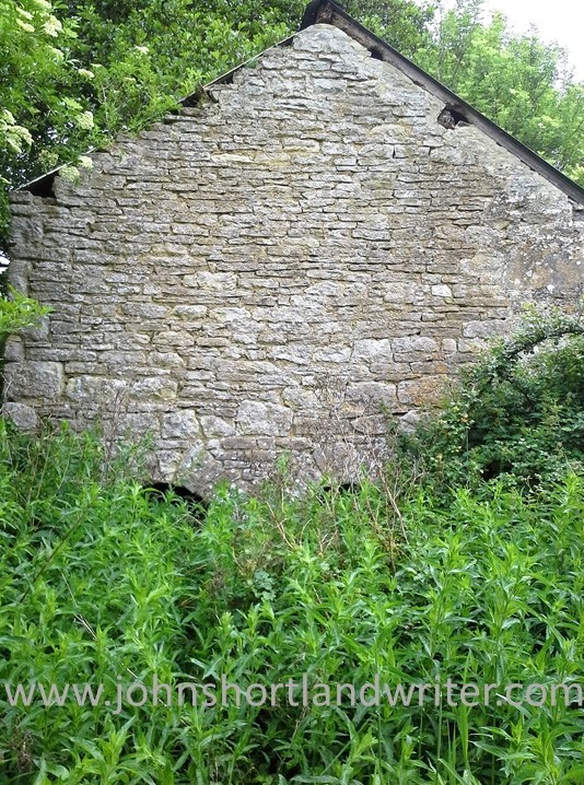
At this time of year, more than any other season, there is much to see. Tight leaf buds unfurl into an explosion of vivid green foliage, iridescent wherever sunlight filters through; young ducklings tumbling into the park pond to take their first swim. But it isn’t just the natural world to be seen anew, there are other things too. Although it had been there for more than a hundred and forty years (and I’d walked past it very day for twenty) the date scratched into the stone on this wall had gone unnoticed.

Date stone watermark

Who scratched this date into the old stone wall and why?

HEARING Along with sight the second most important sense we use on our daily amble. Apart from the glory of birdsong there are other sounds that bombard us when out walking. The wind flurry that makes the catkins tremble and shed their pollen, the stronger breeze that make the twigs and branches clatter gently against one another. Then there’s the rustle in the undergrowth. Stop and wait silently and with patience you may be rewarded by the sight of a little field mouse going about its daily chores or a rabbit venturing out to feed.

Field Mouse watermark

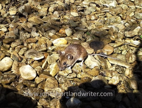
patience was rewarded when this little field mouse ventured into the open

Altamont Gardens (8) watermark

… and also this rabbit

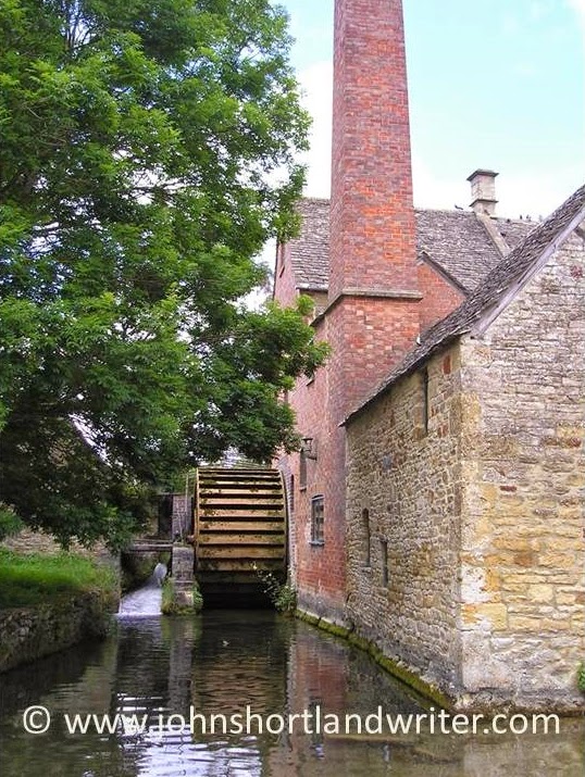
The sound of the river alters constantly. The smooth, barely audible glide of the water changes to a tinkling of soft musical sounds, its flow interrupted by a fallen branch. A few yards further downstream they rise to a crescendo as they crash and tumble over the old millrace before returning to silence as the flow stills in the calm of the millpond.

Radford Mill (1) watermark

The old millrace 

Radford Mill watermark

the calm of the millpond

TOUCH   In the present crisis we are sensibly being discouraged from touching things unnecessarily. Out on walks perhaps care may be advisable when opening gates or climbing stiles but, if you do, take a moment to think about what you feel. Heed the cold steel of the metal five-bar gate and the way it slowly warms beneath your hand; feel the rough timbers of a stile worn smooth from much use over the years. Of less concern health-wise – and all the more pleasurable for that – become aware of the softness of new horse chestnut leaves; later in the year they will become as harsh as sandpaper. Run your fingers across the twisted, grooved bark of the sweet chestnut tree and stroke the furry softness of the aptly named ‘Lamb’s Ears’, the favourite garden herbaceous plant Stachys byzantina.

Sweet Chestnut 4 watermark

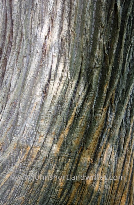
The deeply grooved bark of the Sweet Chestnut tree

Stachys byzantina  Lamb’s Ears

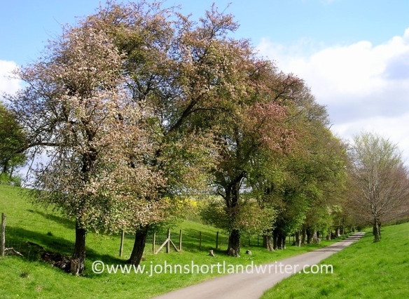
SMELL   The scent of spring is everywhere at the moment and to be delighted in. However, the sense of smell is also a powerful trigger of long-forgotten memories. In a few weeks’ time the sweet scent of drying hay in the meadows may recall childhood farm holidays but for now there is the unique smell of new-mown lawns. Both start off as freshly cut grass yet their scent is so surprisingly different. Likewise, compare the subtly differing fragrance of apple and cherry blossom, both in their full-blown glory right now.

Drying hay before baling

The smell of freshly-mown grass…

Without even leaving home, squeeze the leaves of the herbs on the kitchen sill and notice their variation in scent, their colours and textures too. Early morn in the woodland, especially after warm rain, the delicate perfume of bluebells quickly disappears as the sun becomes stronger. Half-close your eyes and glory in their colour, in the silence and in their perfume and leave all cares behind you – if only for a while.

discover the different textures & scents of herbs

The vivid greens & blues of an English beechwood in spring

In town, the scents are also there just waiting to be noticed. Rain falling on roads and pavements or scorched by hot sun both produce delightfully tarry smells, one mild, the other strong. In the formal beds of the local park flowering bulbs stand in regimental rows; each have a unique scent which rises in the air to mingle with the vanilla fragrance of wallflowers. The wallflowers, their dull green foliage barely noticeable throughout the winter, now shout out the arrival of spring through the colours of their flowers of brick red, orange and yellow.

Tulips & wallflowers – a favourite park bedding combination

TASTE   In shaded places where the soil stays moist you may be greeted – even before you arrive – by the pungent scent of wild garlic. A prolific carpeter of the woodland floor its leaves and flowers make a useful ingredient to spring salads. Wild garlic or Ramsons to give it it’s country name, is fickle where it will grow. In some places that would seem suitable, not a single plant can be found. A less common member of the onion family to be found in the wild are the chives of our gardens, they grow along road edges and field boundaries locally. It is thought that they were spread by the old drovers of centuries ago so that they could harvest them along the way to liven up a bland meal. There is no doubting its identification, disturb the tubular green leaves and the familiar scent is immediately released.

Ramsons grow in damp, shaded places

It is not only the onion family that can be nibbled en route. Richard Mabey in his book Food for Free, published many years before foraging became a ‘craze’, suggests nibbling on the half-open buds of hawthorn. Many a country child has done so over countless generations and perhaps that is how they got their old name of Bread and Cheese. To me, they only have a slightly nutty taste and texture.

Hawthorn leaf buds are not really worth eating!

As a boy, brought up close to the River Thames, the hollow stems of the common reed were a regular source of pleasure for the soft pithy centre could be drawn out by pulling the stems through clenched teeth. Close to my present home there is also a small reedbed. These tall reeds have something to offer every one of the other senses too: sight – the pleasure of watching petrol-blue damsel-flies sunbathing on the stems; hearing – as they sway and rustle with the slightest breeze; touch – the coarseness of the leaves, a contrast to their smooth stems; smell – those of the river as it seeps around the roots, a heady mix of wet mud and wet greenery.

Only the male of the Beautiful Demoiselle damsel-fly has petrol-blue wings & body

So, within the bounds and restraints of the Covid-19 advice when out on your daily exercise, remove the earphones, place the phone in your pocket and use, really use, every one of your senses. Not only will you notice more, you will wonder how you never managed to notice them before. Stay safe, stay alert and take this unique opportunity to discover a new world on your doorstep.

Finally, one word of warning. Only try tasting wild plants if you are confident they have been identified correctly. If you decide to forage, do so responsibly and only pick a few leaves at a time. Make sure that all plants for consumption are free of pesticides and other contaminants, especially those growing in or near water.


The Peak District’s Soft Centre

Ask people what they associate with the Peak District and you will receive many different answers: Chatsworth House and the Devonshire’s, Bakewell Tart, grouse moors, rock climbing and caving.  The UK’s first designated national park is all of these things and more.

Chatsworth (1) watermark

Chatsworth House

A whistle-stop tour last weekend of the Peak District didn’t allow a thorough exploration of all its diverse scenery.  A drive through Chatsworth’s historic parkland and a visit to their farm shop gave a glimpse of the famous cascade in the gardens but that and the house interior will have to wait for another occasion.  If ‘farm shop’ conjures up a vision of a limited choice of vegetables covered in mud at a wayside shack, think again.  Chatsworth’s huge selection is impeccably presented along with breads, cheeses and meat in the former Shire Horse stallion stable block, now beautifully converted.

Chatsworth (2) watermark

Quality is key at Chatsworth Farm Shop

The town of Bakewell is renowned for Bakewell Tart or to be more accurate, as I now know it should be called, Bakewell Pudding.  Forget the oversweet, thickly iced versions available nationwide, the traditional version is packed full of almonds, the shortest of sweet pastry and not much else.  The queues of people waiting to purchase them stands testament to their quality and flavour.

Bakewell (6) watermark

Prepare to join a queue!

Only moments away from the busy town centre is the River Wye (one of several in the UK with that name), a place of calm and surrounded by historic, stone buildings.  On Sunday morning, Remembrance Day and the 100-year anniversary of the end of the Great War, brought silence to the town.  As elsewhere throughout the country, the focus at 11 o’clock was the war memorial with the traditional wreath laying ceremonies of scarlet poppies.

Bakewell (1) watermark

The old mill at Bakewell is available for holiday lets

Bakewell (9) watermark

WW1 memorial to the fallen men of Bakewell

As already hinted, the Peak District has broad expanses of heather moorland as well as limestone crags and outcrops.  This weekend’s exploration of the Peaks revealed the softer side of the national park; its gentler views were bathed in unseasonably warm sunshine highlighting the last of the autumn colours.

Bent Chapel (3) watermark

Peaceful grazing with a view!

Chatsworth (6) watermark

Lengthening shadows as the autumn sun sets

Another visit to the Peaks is planned, next time exploring on foot the passes of the High Peaks, the Chatsworth estate and the village of Eyam, where in 1665 the villagers chose to isolate themselves during an outbreak of bubonic plague.   Of the three hundred villagers, only eighty survived but their self-sacrifice prevented the disease spreading to the neighbouring population.

nr Bakewell (2) watermark

Isolated cottages are scattered throughout the national park

Although time was short, a visit to the Blue John Mines couldn’t be ignored.  The story of this rare semi-precious stone and the descent into the caves via two hundred and fifty steps will come next.  If you suffer from claustrophobia or struggle with steps this isn’t the place for you – it’s a long (and sometimes low and narrow), old climb back to the top!

Blue John Mine (11) watermark

The descent into the mine

A Forgotten Building in a Deserted Village

Tucked away in the fold of the wildflower banks where our horses graze is a small building that rarely gets a second glance if it is noticed at all. Semi-derelict and difficult to reach, its appearance offers no clues of its historic importance – important only to the history of the farm upon whose land it was built. Further up the valley the landscape offers some hints of its past use: a dried-up watercourse that only shows up after heavy rain; an old, crumbling pack-bridge that seems to lead nowhere.  It is only when the building is explored does its purpose become realised.Dornford Old Pump House watermarkDornford Old Pump House (21) watermark

The farm and its associated barns today seem isolated and remote by south of England standards, set high on the hill and away from roads. However, during the early medieval period it was a thriving community which had disappeared by late medieval times possibly due to the Black Death. By 1700 only a farm was left standing. In 1800 this was replaced by the present buildings although the 350+ year old dovecote and stable block both remain from those early days. All are now protected and their architectural features recorded. I can find no such protection or detail of the little pump house – for that is what this is – out of sight in the valley below. Yet it is a little gem!

Dornford 5 watermark

The seventeenth century stable block lies empty

Dornford Old Pump House (20) watermark

Arched entrance to the old pump house

Probably built at the same time as the new farmhouse, the pump house would most likely have provided power for the barns as well as pumping water. What is fascinating about the building is that it still has its paddle wheel and much of its mechanism in place.

Dornford Old Pump House (9) watermark

The wheel – made from iron – is still in place

Dornford Old Pump House (16) watermark

Some parts of the building look as if they were deserted yesterday

Visiting the site isn’t for the faint-hearted. At this time of year, it is necessary to fight a way through chest height stinging nettles and to crawl through narrow and low passageways. Once inside, however, the architectural detail is delightful with its chamfered chambers and arched entrance and exit. Like all deserted places it is important to be vigilant at all times and not just in case of falling masonry. It’s just as important to keep an eye on what’s happening at ground level – this old well shaft, its cover rotten, waits to trap the unwary.

Dornford Old Pump House (5) watermark

Tall weeds almost totally hide the entrance to the building

Dornford Old Pump House (2) watermark

The well shaft with its rotten cover

A Tour of the Secret Valley

Ask people – both here at home or abroad – how they imagine Great Britain to be, the answer is often the same: an overcrowded island. We do, of course, have our fair share of big cities, motorways and densely populated housing estates but it often comes as a surprise just how much unspoilt, open countryside remains. A few of us are lucky enough to live in it.

m40-stokenchurch-copyright

The M40 motorway where it enters Oxfordshire

rollright-stones-9-copyright

Less than two hours drive from the centre of London, the secret valley, seems more like a million miles away rather than just the eighty odd miles that, in reality, it is. Tucked down an unclassified side road and not shown on a number of maps, only those ‘in the know’ tend to visit it. Time for a quick tour.

secret-valley-3-copyright

The Secret Valley

The approach to the secret valley gives little hint of what’s to come. Lined with crab apple trees, the lane gently descends between a fold in the hills where, on the steepest banks, wild thyme, orchids and other wild flowers grow.

secret-valley-2-copyright

A bend in the road conceals the valley’s crowning glory: the most perfect, easily jumpable river (as can be seen in the header image of this blog page). Twisting and turning as it passes through meadows, in its shallows watercress grows where both trout and crayfish hide. By its banks willow pollards, now elderly and bent, wear garlands of wild roses; they grow from the tree crowns courtesy of seed dropped by birds generations ago.

willow-and-wild-rose-copyright

The lane, crossing the river, passes our tiny stone cottage and climbs towards the village – a cluster of nine houses, a farm and little else. Our home sits alone, down by the river bank, with just one other as companion. Here, the lane – barely wide enough for a combine harvester to pass – once was busy with drovers taking their cattle and sheep to the markets in Oxford.

combine-harvester-copyrightcotswold-traffic-jam-copyright

These days the drove road enters and leaves the secret valley by a different route, only its mid-section by our house is still in use. The ‘old road’, as it is known, can still be walked – its path clearly defined by the wild flowers and hedgerows that line it.

old-road-2-copyright

The river, too, has chosen a different route according to the earliest maps. Downstream from our house, it flows past wooded banks to widen into a small lake before passing through fields, these days marshy where the watermill’s sluice gates have decayed with age.

old-sluice-copyright

Further downstream still, where the sheep cannot graze, swathes of scented, moisture loving plants such as wild valerian – looking very different from the one grown in our gardens – provide nectar for insets and a hiding place for deer.

meadowsweet-valerian-copyright

a forest of Valerian & Meadowsweet

On the higher ground of the secret valley, the fields are cultivated with wheat, barley and oilseed rape. Even here, in the favoured places, wild flowers and birds of many types can be found: the diminutive hay rattle, a relic from the old farming days to ravens, buzzards and red kites, all now common again after centuries of persecution.

yellow-rattle-copyright

red-kite-6-copyright

Red Kite

Sounds idyllic? You’re quite right – it is!

rainbow-2-copyright

A Hidden Exmoor Walk

I have misgivings about sharing this walk for it is a favourite of mine: in the 48 years that I have known it I have rarely met anyone other than those that work the land here. Do I want to encourage others to discover its beauty? I’m not sure.

This circular walk begins with the open expanses of Brendon Common but follows more sheltered winding lanes before descending through beech woodland to Rockford and the East Lyn River. A steep climb past Brendon church returns you to the moor. How long does it take? There’s no easy answer to this – allow two hours although experience tells me there are so many distractions along the way, including the Rockford Inn, that it can take much, much longer. Whether you want a quick sprint or a leisurely amble good supportive footwear is essential as is the ability to climb hefty hills.

Brendon Common (14)   copyright

Brendon Common


There is plentiful parking at Scobhill Gate, the cattle grid on the B3223 that denotes the westernmost boundary of Brendon Common. From here walks radiate across the 2000 acres of heather moorland but our route takes us over the cattle grid into farmed country and turns right by the hairpin bends at Brendon Manor Stables.

Scob Hill Gate   copyright.jpg

Scobhill Gate


After a few hundred yards the road, which is flanked by hedges of hazel, ash, furze, bramble and bilberry (known locally as wurts), meets Gratton Lane. This is very much ‘home’ territory for me, for it is here at Brendon Barton that I arrived as a lad to work and play in 1968. Opposite the farm there are fine views of Brendon church and in the far distance Countisbury Common and the sea.

Lil @ Brendon Barton 1968   copyright

Brendon Barton 1968

Brendon Church 1968 (2)   copyright.jpg


Walking along Gratton Lane is lovely at any time of the year but is at its best in spring when the beech hedges are bursting into leaf and primroses and bluebells nestle at their feet. These banks are an ancient method of providing shelter, as well as a barrier to livestock, from the fierce gales and snowstorms that sweep in from the Atlantic. The banks stand about five feet in height, lined with stone with the beech planted above.

Above Brendon Barton (2)   copyright.jpg

Gratton Lane


Just as the lane starts to descend it enters woodland and it is here – just past the warning sign denoting the ford that crosses the road – that a footpath is taken to the left. The path follows a pretty stream as it tumbles over rocks down to join the East Lyn River. It is here that the unwary walker can also take a tumble as the path crosses outcrops of rock that become quite slippery when damp. This stream has everything a larger one would have – cascades, waterslides, ferns growing from niches – but all in miniature. Despite its diminutive size it once powered a sawmill.Waterfalls (2)   copyright.jpg

The mill has long been a ruin and is now fenced for safety but the rusting ironwork is still visible. Just beyond the old building the path joins the road. Turn left and follow the lane to the hamlet of Rockford. You are now walking in the Brendon valley with its beechwoods clinging to the steep hills high above, home to a number of rare rowan trees (Sorbus) unique to the area.  The East Lyn River is a major river; when water levels are low it is difficult to imagine its ferocity when in spate. In 1952 it destroyed bridges, houses and lives as it passed through the valley culminating in the flood disaster at Lynmouth where thirty-four people lost their lives and over one hundred houses were destroyed. The Rockford Inn is a good place to stop for a beer; they also serve cream teas. Just make sure that you put the cream on the scone before the jam in the Exmoor tradition! It is possible to extend the walk to Watersmeet (where there is a National Trust tearoom) by crossing the river.

ROCKFORD MILL   copyright.jpg

The Old Mill nr Rockford


East Lyn River (2)  copyright.jpg

East Lyn River


Once past Rockford the road starts to climb until it reaches Brendon church. The hill is a killer – it’s not called Church Steep for nothing! The church which nestles into the hill and looks out across the combes looks as if it has been there for centuries. In reality, it was moved stone by stone from nearby Cheriton in 1738. It is simply decorated inside but has some attractive stained glass. Brendon Barton, passed earlier, can be seen from the steps of the church. Follow the lane back to the farm; from there retrace the original route back to Scobhill Gate.

Brendon Church (5)   copyright.jpg

Brendon Barton (2)   copyright.jpg

Brendon Barton, view from the church


Happy walking!


Exmoor is a National Park in the southwest of England and straddles the counties of Devon and Somerset. Apart from miles of wonderful moorland walks, it also has the highest sea cliffs in England, pretty villages and spectacular wildlife including the majestic Red Deer. Native Exmoor ponies roam the open moor. Now a rare breed they remain virtually unchanged from pre-history.


Don’t Be Put Off By Its Name…

Slaughter may not sound the most promising of names but Lower Slaughter situated in the heart of the Cotswold Hills is one of the prettiest and most unspoilt villages you can visit.  Its unusual name is a derivation of the Old English word ‘slough’ meaning muddy patch but, if it was many years ago, it is certainly not one now.  In fact, three years ago it was described in a poll as having ‘the most romantic street in Britain’.

Although there is some more recent housing discreetly tucked away most of the buildings date from the mid sixteenth to mid-seventeenth centuries.  Its origins are even older  for it was well established even before being recorded in the Domesday Book; this means that it has been continuously inhabited for over a thousand years.

Many of the oldest houses cluster around the the River Eye which, although shallow, is powerful enough to feed the undershot waterwheeel of the mill.  This building, which now houses a small museum, is made from red brick – an unusual building material in this area – and was working as recently as the the late 1950’s.  It is a comparatively modern building having been built in the 1800’s although a mill was recorded on the site in 1086.  The tall chimney was built to give the mill additional steam power.
A similar tale can be told of the picturesque church with its tall spire which also dates from the ninteenth century.  There are a few traces of the original building within it: an arcade of four bays dating back to the early 1200’s.  The lichen encrusted gravestones in the churchyard also belie their age for burial rights were only granted in 1770 – before then villagers were buried in nearby Bourton-on-the-Water.


The countryside surrounding Lower Slaughter, and also the village itself, may not appear to have changed much in centuries but there is no doubt that they are very much ‘tidier’ than they once were.  An old Pathe News clip shows the banks of the Eye overgrown – there probably wasn’t the same enthusiasm for cutting its grassy banks when it has to be done by scythe.  Another change the film shows is the ‘locals’ sitting on the benches: nowadays, many of the houses are owned by the wealthy as weekend retreats and those exploring its lanes are visitors. 


Lower Slaughter, despite its obvious attraction, has done very little to encourage tourism.  It is still possible to sit there or cross its little stone footbridges or paddle in the ford and be transported back to a time when life ran at a much slower pace.  It makes a very refreshing place for visitors to recharge the batteries after the crowds of its larger neighbours, Bourton and Stow-on-the-Wold or, for us lucky enough to live in the Cotswolds, to do the same after a hard day’s labour. 
 
Lower Slaughter is just 2½ miles north of Bourton-on-the-Water and 3 miles west of Stow-on-the-Wold.  The Old Mill sells great ice cream!
To see the Pathe News Clip from1939 click here

Add to Technorati Favorites