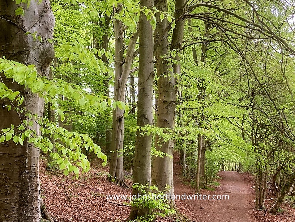
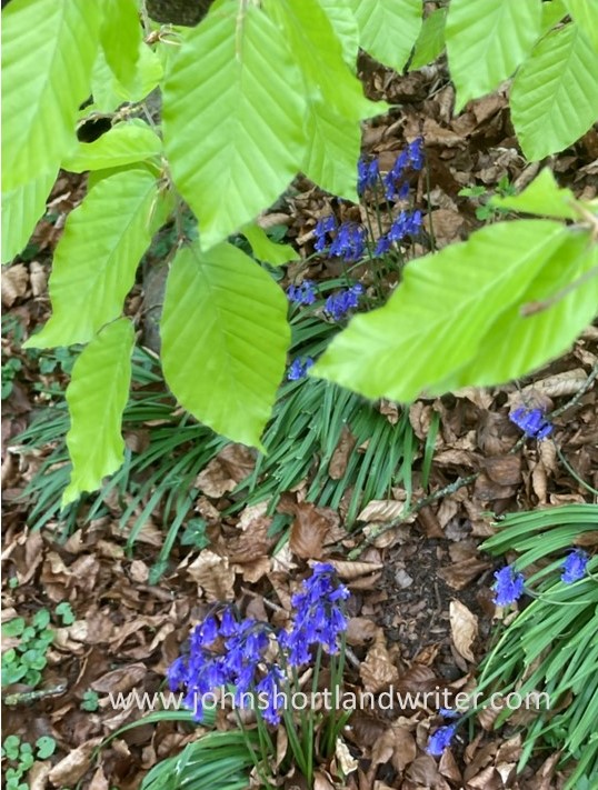
Can there be a more delightful spot to linger than a bluebell wood in spring? The intensity of their colour when seen growing in their tens of thousands would hurt the eyes if not offset by the citrus green of the beech trees they favour growing under. With early morning sunlight filtering through the branches to strike the woodland floor below, both leaves of beech and ‘bell shimmer and sparkle in the clear light. As the forest warms the bluebells release their scent but not the heavy, redolent perfume that one might expect. Instead, a fragrance so soft and gentle that for a moment it seems to come from elsewhere; all too quickly it melts away, dispersed by the increasing heat.

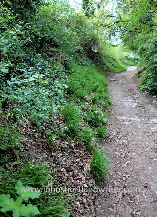
Bluebells are one of the key indicator plants of ancient woodland, a term that refers to woodland that pre-dates AD1600, for their bulbs prefer to remain undisturbed where they can slowly establish huge colonies. Here, in the secret valley where they grow in hedge banks, they can be used to trace the line of an equally ancient drove road for it is thought that the hedgerows and trees that line it are remnants of Wychwood Forest. Over centuries, the boundaries of the Forest have shrunk as fields were created and the trees cleared for arable land or pasture. By leaving the field edges untouched the early farmers saved themselves both time and labour and in doing so preserved the bluebells that give me so much pleasure each spring. The drove road – primarily used for herding livestock long distances to market – passes our little stone-built cottage before diverting across open country. It is still used as a public right of way.

Unsurprisingly for a plant that has been around from time immemorial, the bluebell has numerous regional names – Common Bluebell, English Bluebell, Fairy Bell, Wild Hyacinth to name a few. Perhaps the best has to be Granfer Giggles. In Scotland they are known as harebells although to an Englishman harebell would be a completely different plant that grows later in the summer when the bluebells have long ended. Even the Latin name which is supposed to prevent confusion has changed over time – it is now known as Hyacinthoides non-scripta. I much prefer the earlier name of Endymion non-sciptus, it sounds more attractive as well as having a romantic Greek legend attached to it. Illegal to dig up plants from the wild, bluebells are sometimes offered for sale from cultivated stock under either of these names.

For such a well-loved plant – it has been voted England’s unofficial national flower – bluebells do not seem to feature much in poetry. They are frequently mentioned by name but no-one, as far as I can tell, seems to have written poems specifically about the plant. Perhaps it is because they are such a common sight and have none of the delicacy of the wild rose, the scent of the honeysuckle or the diminuity of wild thyme. Shakespeare, who seems to have written about absolutely everything (including thyme), only mentions it once: “the azur’d harebell” in Cymbeline. The Brontë sisters both wrote of bluebells but I’m not sure they weren’t describing later flowering harebells. Emily’s description “waves in summer air”, and Ann talks of a single flower and of its trembling. Bluebells are quite a stiff flower that don’t wave or tremble that readily whereas Campanula harebells fit the description nicely. I can’t recall even my beloved Richard Jefferies, the Victorian naturalist, waxing lyrical over them as he did over so many other things. I may be wrong about this for I can hardly call myself a Jefferies’ scholar, more an enthusiast. However, Cicely Mary Baker created a delightful illustration of the flower in her set of Flower Fairies published in 1923 where she describes the bluebell as the king of flowers.

It flowers later in the summer and in more open places
It is to the Georgians that I have turned to illustrate our love of bluebells for I have found frequent references to them in old newspapers and periodicals not just in published poetry but also in their fashions. This description of the sumptuous gown worn by the Princess of Wales when attending the King’s Birthday in 1795 is worth reproducing here: “A gown of superb, embroidered crepe imitating the rays of the sun and intertwined with embroidered white lilies. Over which a cape of Venetian net embroidered with laurels and Diana’s (presumably the Goddess) crescent”. Finally, there was another over-cape “embroidered with bluebells (yes!) and held in place by rich cords and tassels”. As if this wasn’t splendid enough there was “a long train of silver gauze bordered in purple and silver”. Having spent twenty years in the world of fashion (before I switched careers to horticulture) this has sent me into overdrive! Sadly, I haven’t found any illustrations for this ensemble but I do have photos of the ‘draft’ for equally exquisite embroidery designed by Norman Hartnell for a robe for Queen Elizabeth II.

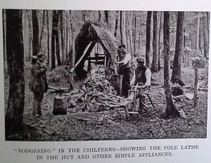
Even earlier, in 1786, Mrs Charlotte Smith was publishing her sonnets. A remarkable woman for the age, she left an unhappy and violent marriage and campaigned for women’s rights and the abolition of slavery. She wrote fiction and poetry to financially support herself and her children. This sonnet reminds me so much of my youth where I roamed the bluebell beechwoods of the Chiltern Hills, for which they are renowned.
“Ah, Hills belov’d! where once a happy child,
Your beechen shades, your turf, your flowers among,
I wove your bluebells into garlands wild,
And woke your echoes with my artless song.
Ah! Hills, belov’d! your turf, your flowers remain;
But can they peace to this fad’ breast restore?
For one poor moment soothe the sense of pain,
And teach a breaking heart to throb no more?
I’m glad to say that my heart is no longer breaking so perhaps the bluebells worked their magic!

.
.
.