Living with Nature

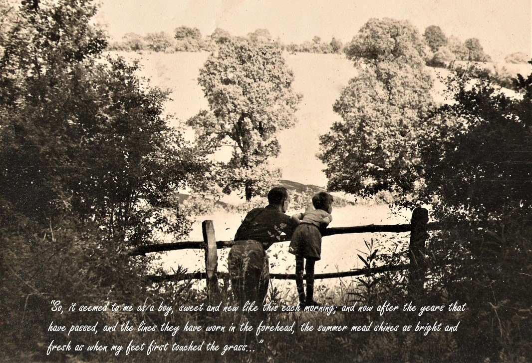
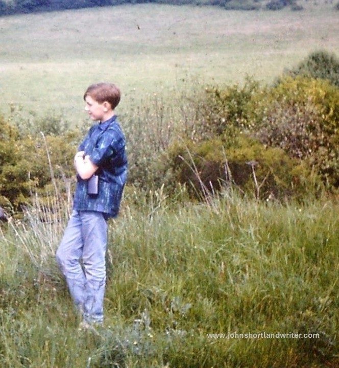
The tag line of my blog and other social media platforms describes me as ‘countryman’ and that’s how I see myself for I have lived in the countryside all my life.  One of my earliest memories is at kindergarten, aged four, and being taken on a nature walk.  There our teacher introduced us to a row of larch, the perfect tree to spark a small child’s imagination.  Soaring into the sky, straight and tall, their drooping branches almost touch the ground – “like gracious ladies curtseying to the mighty oak, the king of trees,” she told us, a description I have never forgotten.  An older cousin introduced me to butterflies and birds, collecting eggs and catching butterflies to mount on a board.  Back in the 1950s there were no concerns about such things, it was only later that the practice became frowned upon.  In my twenties I discovered the writing of Richard Jefferies, the Victorian naturalist; his quote below (and also attached to this favourite photo of myself with my father) sums up so accurately my feelings today.
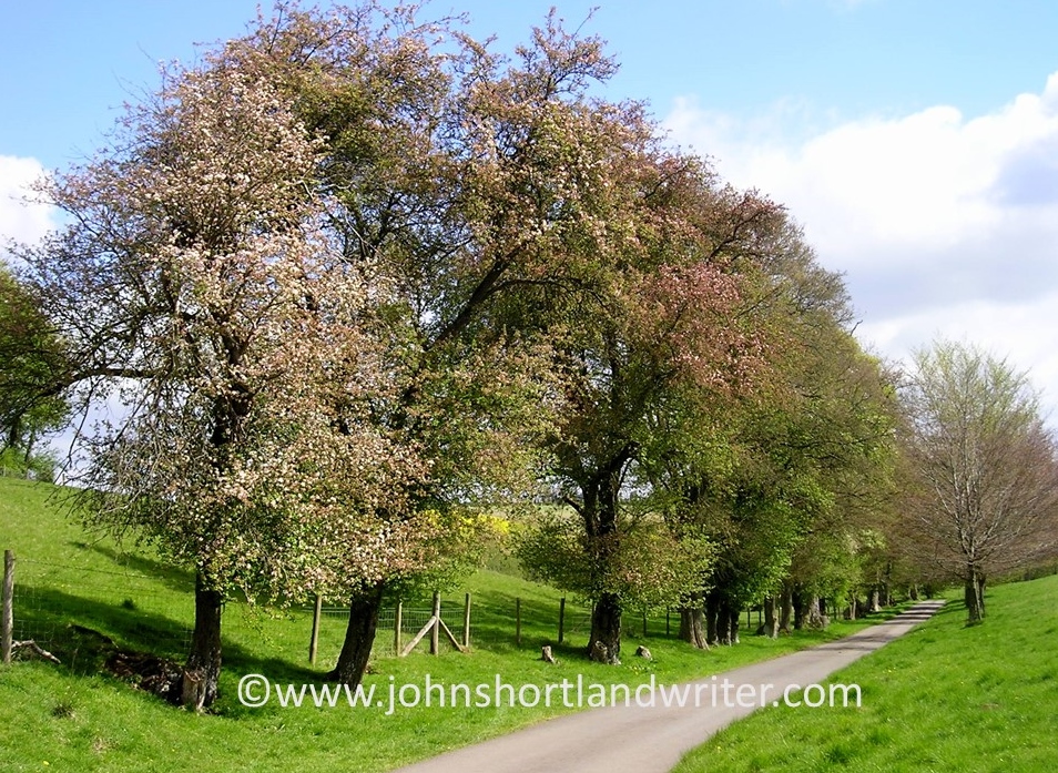
My childhood home backed first onto wheatfields and later onto a cherry orchard under-grazed by a herd of gentle Guernsey cows.  We would walk to the farm to collect pints of their rich, creamy milk and eggs.  The first home of my own looked out towards Watlington Hill, one of the high points of the Chilterns and one which I knew well from long walks and family picnics.  After a few years I moved up the hill to a home fronting a wild bracken-covered common, its scrubby hawthorn trees the home of dormice.  Behind the house were the bluebell beechwoods for which the Chilterns are so famed.  After eighteen years there, I moved fifty miles up the road to the Cotswolds and the secret valley, a very different landscape of which I have so often written and blogged about.
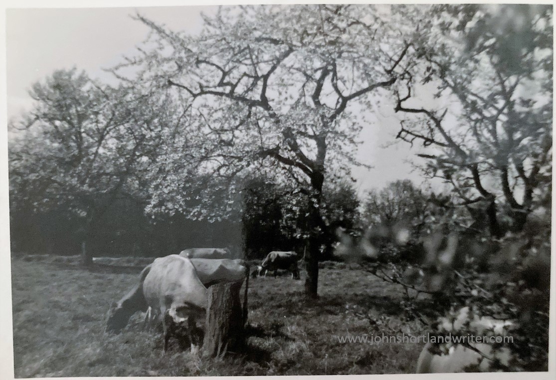
A herd of gentle cows grazed the cherry orchard behind my childhood home
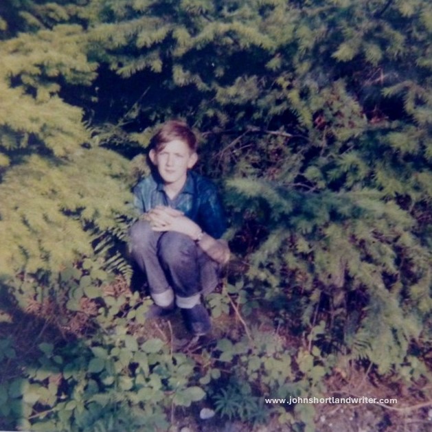
John on Watlington Hill, c1965 – I was rarely without binoculars or camera in my hand
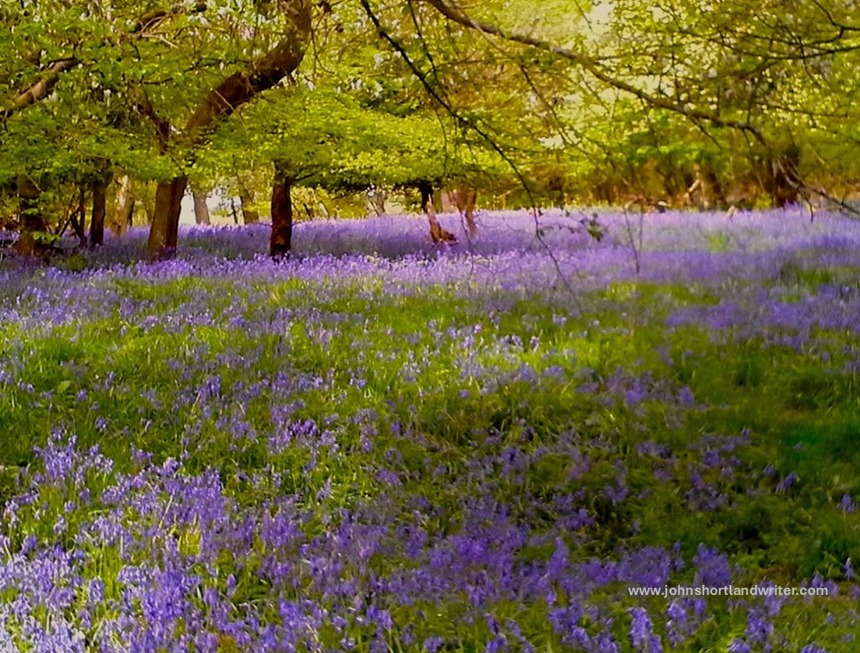
Behind my Chilterns home were bluebell woods, the glory of spring

It was here, in this tiny, hidden Cotswold valley, that my horticultural career developed beyond my wildest expectations, where I finally learned to ride a horse properly (I’d ridden badly from childhood) and where I became involved with both the Blenheim and Burghley International Horse Trials.  It was here where I was instrumental in the founding of both a County Gardens Trust and a Literary Festival, and where I received my commission to write my book, Why Can’t My Garden Look Like That?  It was here where I made new friends and became part of a new family: all of this wouldn’t have been so readily obtained without the constant support and encouragement of my long-suffering partner.  In fact, it was him seeing me writing away in a corner one day and asking what is the point if no-one ever read it, that sparked the idea of blogging regularly.
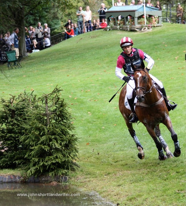

Working behind the scenes at the Burghley Horse Trials gave me a close-up view of the action
Being interviewed at the Chipping Norton Literary Festival

Considering all of the above, along with my passion for the remote and seemingly empty landscape of Exmoor, a National Park in England’s West Country, it comes as a surprise to many others – and perhaps even more to myself – that I/we shall be moving very shortly not just to a built-up area but to the very centre of a town, Cheltenham.  So after twenty-five years in the secret valley I am becoming a ‘townie’. Or, perhaps, a fish out of water?  I doubt it somehow for Cheltenham has some very special and unique qualities which I am looking forward to exploring.  It will be interesting to see how I adapt to town life and I am also looking forward to sharing my discoveries and thoughts through my writing, so watch this space…
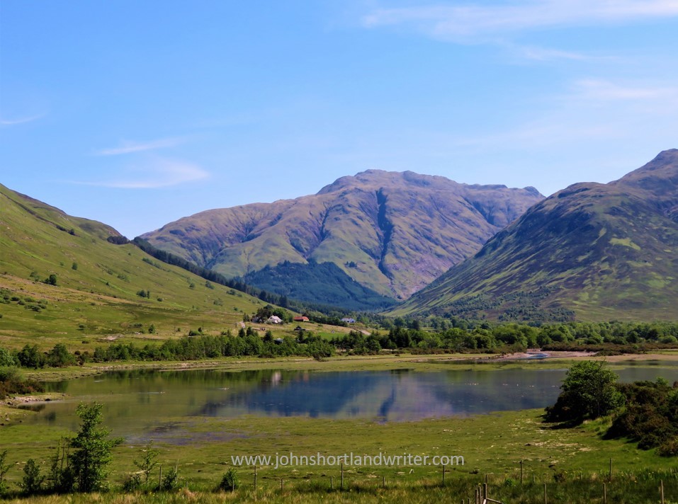
I feel so at home in remote countryside, how will I fare living in a town? This is Scotland, not Exmoor!
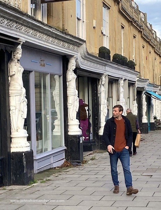
Perhaps the Caryatids – all thirty-two of them – will watch over me when living in Cheltenham

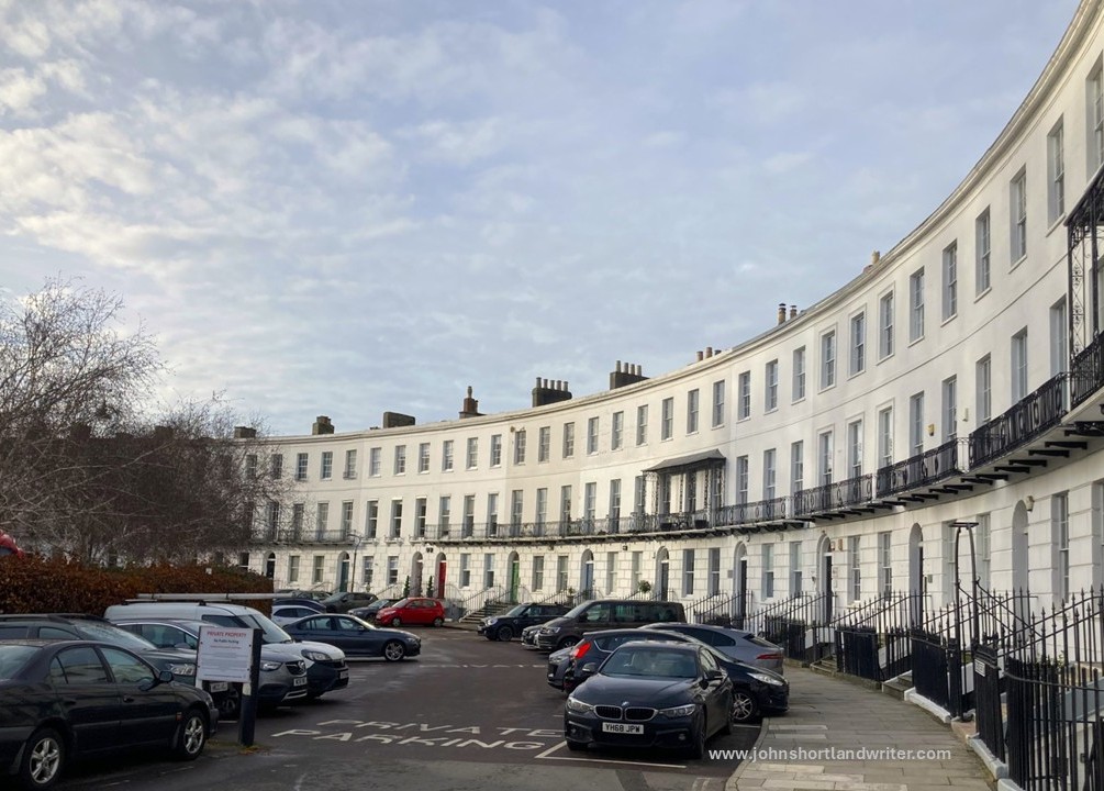
Here are a few facts that I have gleaned during my time visiting Cheltenham.  First and perhaps of the greatest importance to me, it is very leafy for it boasts more trees than people.  It also has numerous green spaces, many award winning and these along with the little river that flows through the town are home to a great array of wildlife: I have been told of brown trout, kingfishers, otters and badgers all living there and, of course, foxes I am sure will pop up everywhere. Peregrine falcons breed on the church towers and, to my surprise, seagulls can be heard with their constant mewing. Another surprise has been the numerous fountains in the town although, perhaps I shouldn’t be, for it was developed in Georgian times for its natural mineral waters, very much like the more famous city of Bath. As a result of this, Cheltenham also boasts some very splendid architecture including its own version of the famous Bath crescent. Finally, Cheltenham is considered one of the Cotswold Gateways for the hills rise steeply from the town’s edge. To the west flows the River Severn, and the Malvern Hills and the Welsh Black Mountains are not far either. There will be so much to explore and write about both of town and of country so Life in the English Cotswolds, after seventeen years, is very much set to continue. I very much hope that you will be joining me on my latest adventure.
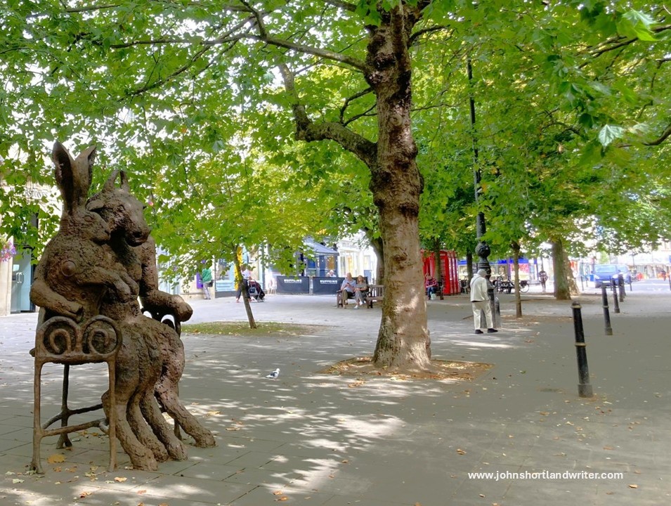
There are more trees than people in Cheltenham. This is one of the main shopping streets, Promenade
The Royal Crescent – splendid Georgian architecture lines the streets of Cheltenham

With so many open, green spaces, walks along the river that made the town so famous (more of that to come in the future), the architecture and fountains, let alone all the festivals and restaurants of which there are many, I think I’ll be fine. In the meantime, I shall remember my two favourite quotes from Richard Jefferies both written in 1885:

i) Those who love nature are the real artists

ii) So it seemed to me as a boy, sweet and new like this each morning; and now after the years that have passed, and the lines they have worn in the forehead, the summer mead shines as bright and fresh as when my foot first touched the grass…

Rights of Passage – England’s Footpath Network

Since the start of writing my Life in the English Cotswolds blog, now over fifteen years ago, overseas readers have repeatedly commented on our network of public footpaths. Mostly it is one of surprise that we can seemingly wander at will over privately owned land and clear any obstruction that may be blocking our way.  In this post I hope to clarify what this civil right, now enshrined in law, is all about.

A footpath crossing privately-owned land in the Cotswolds

Many of our footpaths are ancient in origin dating back 5000 years or more.  Of course, in those days, these paths were the main highways across a wild and untamed land.  Even in the relatively recent past much of the road system was a dusty, uncomfortable route to take in summer and not any better later in the year when winter rain turned them into a muddy quagmire.  Over many centuries the network of paths was created, usually by local people on foot or horseback taking the most direct and dry route to work or market.  This is one of the reasons why paths often pass through farmsteads and gardens.

This public footpath passes close to Lower Dornford Farmhouse

Today, the public footpaths of England and Wales (Scotland has a different system) are much loved and well-used, mostly for recreational purposes.  There are several organisations and charities (see list below) that help to protect the paths and walker’s rights to use them for there are several threats, such as land development for roads and houses, as well as the occasional, unscrupulous landowner.  Landowners seem to fall into two categories: those that maintain the paths to allow ease of access and those that allow the paths to fall into disrepair for it is the landowner that is responsible for the path’s maintenance.  A well-maintained path is clearly defined across the landscape, its gates and stiles giving ease of access whilst remaining stockproof.  By statute, where a path crosses a road, the local council must signpost it.

This farmer has mown a strip through his crop to define the footpath
Where a path meets a road it must be clearly marked

After many years of campaigning, England created its first long-distance path, the Pennine Way, in 1965.  It is 268 miles in length and runs down the spine of northern England passing through spectacular countryside.  Today, there are many of these long-distance paths as well as shorter, circular paths.  However, with a good Ordnance Survey map (paper or app) it is possible to create your own route whether it be for an hour’s stroll or for much longer.  In 2010 the Slow Ways network linking various paths and lanes, villages and towns, across the whole country was created, one of the few benefits to have arisen from the Covid-19 lockdown when walking alone was one of the few permitted activities.  The routes listed are all tried and tested by local people who walk them regularly.

The rugged landscape at Jacob’s Ladder, part of the Pennine Way long-distance path
Ordnance Survey map shows the public rights of way (the solid red line is a main road, the solid yellow line, a country lane [Copyright Ordnance Survey]

In the Ordnance Survey map illustrated above the footpaths are clearly defined using red dashes.  The short dashes show footpaths (walkers only) whereas bridlepaths (walkers, horses and bicycles) have long dashes.  The broken short-long dashes mark those tracks that can be used by horse-drawn vehicles (“restricted byway”).  Some paths have signs along their routes showing not just the route but also the path’s category.

As mentioned, paths frequently cross farmland or other enclosed land. A way through a fenced or walled area must be maintained at all times.  Below are illustrations of some of the different types of barriers you may come across although none must prevent you from continuing along your route.  If it’s a route for horses the rider must be able to open the gate without dismounting.

Wooden gate to pass through easily or wooden stile to scramble over
Not all stone wall are so tricky to get over!

Visitors to England often spend far too much time in the major cities or tourist hot-spots (the Cotswolds have lots of those!) returning home not realising that they have missed the opportunity to see parts of the country that never feature in the travel magazines – the homes and villages, the woodlands and old drover’s tracks that can be found all over the country.  You may choose to walk alone but when you do meet someone, they are often local and happy to exchange greetings and share a few minutes in dialogue.

Bibury – one of the most visited villages in the Cotswolds. To see it like this you need to arrive soon after dawn!
Get away from the crowds by exploring the peace and quiet of the English countryside

Not everyone, of course, feels comfortable walking by themselves, especially in an area unknown to them.  Fortunately, there are a lot of local groups or larger organisations such as the Ramblers Association that will welcome you on a regular or one-off basis.  Occasionally you may even find an individual who’ll be happy to share with a visitor a favourite walk or place – I’ve done it myself and made some good friends along the way.  That is one of the best things about walking, the walks can be short or long, easy or arduous, solitary or in company but it is the interesting conversations you have, the beautiful scenery you pass through, and the wildlife you encounter that make such a memorable experience.  Why not give it a try?

Walk quietly and you’ll be surprised who accompanies you!

Useful Links
click on the organisations below to visit their webpage

Cotswold National Landscape – Guided Walks
National Trust – walks in Gloucestershire and the Cotswolds
Ordnance Survey
Ramblers Association
Slow Ways
The Cotswold Way – a 102 mile trail that takes you through the heart of the Cotswolds to the Roman city of Bath, a UNESCO World Heritage Site.
The Long Distance Walkers Association
Walking in the United Kingdom

A Tour of the Secret Valley

Ask people – both here at home or abroad – how they imagine Great Britain to be, the answer is often the same: an overcrowded island. We do, of course, have our fair share of big cities, motorways and densely populated housing estates but it often comes as a surprise just how much unspoilt, open countryside remains. A few of us are lucky enough to live in it.

m40-stokenchurch-copyright

The M40 motorway where it enters Oxfordshire

rollright-stones-9-copyright

Less than two hours drive from the centre of London, the secret valley, seems more like a million miles away rather than just the eighty odd miles that, in reality, it is. Tucked down an unclassified side road and not shown on a number of maps, only those ‘in the know’ tend to visit it. Time for a quick tour.

secret-valley-3-copyright

The Secret Valley

The approach to the secret valley gives little hint of what’s to come. Lined with crab apple trees, the lane gently descends between a fold in the hills where, on the steepest banks, wild thyme, orchids and other wild flowers grow.

secret-valley-2-copyright

A bend in the road conceals the valley’s crowning glory: the most perfect, easily jumpable river (as can be seen in the header image of this blog page). Twisting and turning as it passes through meadows, in its shallows watercress grows where both trout and crayfish hide. By its banks willow pollards, now elderly and bent, wear garlands of wild roses; they grow from the tree crowns courtesy of seed dropped by birds generations ago.

willow-and-wild-rose-copyright

The lane, crossing the river, passes our tiny stone cottage and climbs towards the village – a cluster of nine houses, a farm and little else. Our home sits alone, down by the river bank, with just one other as companion. Here, the lane – barely wide enough for a combine harvester to pass – once was busy with drovers taking their cattle and sheep to the markets in Oxford.

combine-harvester-copyrightcotswold-traffic-jam-copyright

These days the drove road enters and leaves the secret valley by a different route, only its mid-section by our house is still in use. The ‘old road’, as it is known, can still be walked – its path clearly defined by the wild flowers and hedgerows that line it.

old-road-2-copyright

The river, too, has chosen a different route according to the earliest maps. Downstream from our house, it flows past wooded banks to widen into a small lake before passing through fields, these days marshy where the watermill’s sluice gates have decayed with age.

old-sluice-copyright

Further downstream still, where the sheep cannot graze, swathes of scented, moisture loving plants such as wild valerian – looking very different from the one grown in our gardens – provide nectar for insets and a hiding place for deer.

meadowsweet-valerian-copyright

a forest of Valerian & Meadowsweet

On the higher ground of the secret valley, the fields are cultivated with wheat, barley and oilseed rape. Even here, in the favoured places, wild flowers and birds of many types can be found: the diminutive hay rattle, a relic from the old farming days to ravens, buzzards and red kites, all now common again after centuries of persecution.

yellow-rattle-copyright

red-kite-6-copyright

Red Kite

Sounds idyllic? You’re quite right – it is!

rainbow-2-copyright