Woodstock and Blenheim Palace

Woodstock, a small town in the Oxfordshire Cotswolds, has a long history.  The Domesday Book, a survey of England & Wales completed in 1086, describes it as a Royal Forest – a hunting preserve for nobility.  Fifty years later the area was enclosed by a high wall, a shooting lodge built, and exotic animals, lions and leopards kept within. Just short of a century later, in 1179, King Henry II built Woodstock Palace and granted a Royal Charter that established a market on its boundary.  From thereon, the town developed and prospered.  The palace witnessed several important moments in English history including the imprisonment of the then Princess Elizabeth who became Queen Elizabeth the First, and later, it sheltered King James I who had fled London during a plague.  By 1653 the Palace had been destroyed by the Roundheads (Parliamentarians) during the English Civil War.

The original palace at Woodstock built by Henry II in 1179 [Source:Wikipedia]

The ruins of the palace and its parkland were gifted by the nation to the 1st Duke of Marlborough in recognition of his military triumphs that climaxed with the Battle of Blenheim in 1704.  Blenheim Palace, for which Woodstock is now justly famed and visited annually by thousands from all over the world, was built in its place and, with over 180 rooms, it is one of the largest privately-owned houses in England.  The birthplace (in 1874) and ancestral home of wartime leader, Sir Winston Churchill, the splendour and history of the Palace was recognised as an UNESCO World Heritage Site in 1987.

Blenheim Palace, one of the largest private houses in England

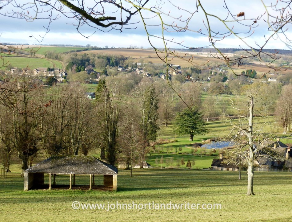
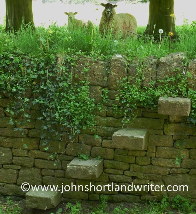
With mixed financial fortunes over the centuries, the Palace has seen many changes both internally and externally.  The parkland was much altered by the eighteenth-century landscape architect, Capability Brown.  The River Glyme that runs through the park was dammed and the Great Lake formed, in the process part-drowning the enormous bridge designed by Vanbrugh.  Incidentally, the river is the same one as the little winding river that flows in ‘our (now not so secret!) secret valley’ and used in the header of this blog.

The dammed tiny River Glyme created the Great Lake at Blenheim Palace…
…in the process, the huge bridge designed by Vanbrugh was partly submerged

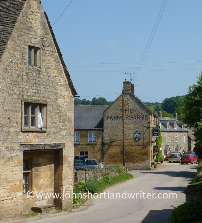
Despite the centuries that have passed, the town still clusters outside the entrance to Blenheim Palace.  Being so small (only 3,500 people live here), it is a great place to explore on foot – something that is missed by most visitors to the Palace who, if they enter the town at all, stay within the two shop-lined streets at its centre.  Behind these lie the church and quaint, timbered houses.

Ancient houses overhang the narrow streets of Woodstock
All the old house and cottages differ from one another in appearance

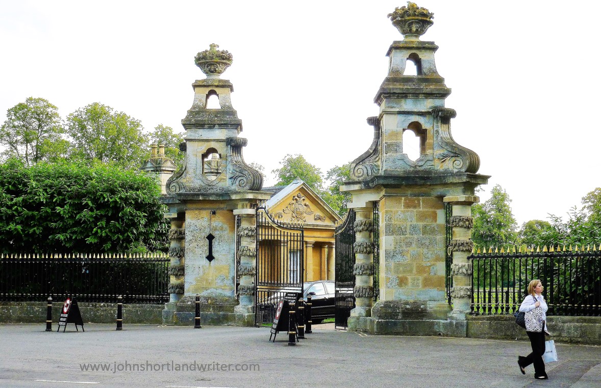
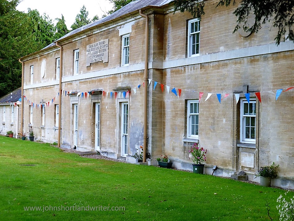
Of course, it is the Palace that dominates Woodstock despite being barely visible from outside the Park.  The entrance that cars and coaches enter by, is splendid enough, but doesn’t match the grandeur of the town gate.  Just past the ‘tourist’ entrance (and so rarely noticed) are the splendid almshouses built in 1798 by Catherine, Duchess of Marlborough.  A visit to the Woodstock Museum should be on everyone’s agenda too; it contains a dinosaur garden to keep the children happy.

The gate by which visitors enter is grand enough but…
…it doesn’t match the splendour of the ‘town’ gate

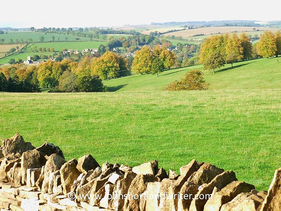
The town has several hotels and makes a good base to explore further afield; Oxford with its universities is only 15 miles away and there are numerous villages and National Trust properties and gardens to visit within the area.  For keen hikers two long-distance trails, the Wychwood Way (36 miles) and Shakespeare’s Way (146 miles) pass through the town and, as in most of England, numerous public footpaths criss-cross the countryside where you can roam freely. Walking is one of the best ways to see the Cotswolds and it is great exercise too. All the footpaths connect with one another so you can easily take shorter walks but, if you have the time, it is possible to walk from one end of England to the other!

The almshouses in Woodstock built in 1798

***********************************
[If you would like specific details of any aspect of staying locally and/or walking routes, places to visit, etc please feel free to contact me and I will do my best to answer your queries]

Sources: 
Wikipedia The Long Distance Walkers Association  Cotswolds.info                                                                                                                      The Making of the English Landscape, W G Hoskins     
                                                                                                                                                                                                                                                      

A Walk by Stonehenge – part 1

It is many years since I last visited Stonehenge, the prehistoric standing stones so closely attuned to the midsummer solstice.  Renowned throughout the world, it has been listed as an UNESCO World Heritage Site since 1986.  With fame comes numerous issues, not least how to cope with the estimated one million visitors that come to see them each year.  To prevent damage to the stones through soil erosion and, surprisingly, physical damage through the chipping off of ‘mementos’, the stones are now cordoned off.  This fencing is removed to allow access at the time of the midsummer solstice, a time when hundreds of people wait through the night for the midsummer sun to rise directly between the stones.  The image below is of a postcard that my great-aunt sent me in 1963 when the stones were much less frequently visited and reminds me of those early years when I used to play amongst them.

Stonehenge was far less visited back in the 1960s!

The Stonehenge World Heritage Site covers an area that includes other Neolithic standing stones close by.  A few miles away, and unlike Stonehenge, a place where you can walk amongst the stones every day of the year, is Avebury.  This circle is huge and considerably older than Stonehenge: flint tools dating back 9000 years show that early man was passing that way 4000 years before Stonehenge was built.  Avebury is the place to visit if you want to get close enough to touch the stones and it is also completely free to visit.  To visit Stonehenge can be quite costly although there is another way you can see the stones (legally) without paying if you’re prepared to walk – see below.

Avebury Stone Circle – part of the Stonehenge World Heritage Site

The third site, and to my mind, the best one for you will almost certainly have the place to yourself, is known as Woodhenge & Durrington Walls.  To be really impressed by this comparatively unknown place you do need to know some background information of its history plus a vivid imagination.  For me, it is such an atmospheric place to visit that the latter has never been an issue!  I recommend starting your walk here and walking inside the circle of Durrington Walls before exploring Woodhenge.  The first thing that is noticeable about Durrington Walls is that there are no walls!  The circular bank and ditch that surrounds the site was enormous and consisted of the bank itself which would have been several metres high.  The ditch originally was over five metres deep and, in places, up to thirty metres wide.  It is estimated that between four and six thousand people would have been needed to build the walls as well as the various houses and large timber circles associated with the site.  A feat quite remarkable nowadays let alone over four thousand years ago using just antler pickaxes!  Although nothing remains above ground now, apart from the bank, I found it very easy to imagine, as I walked alone and in silence, the bustle and noise of these industrious people.

Within Durrington Walls, now a grassy bank, up to 6000 people once lived
Information boards help you to understand the context of what you are not seeing!

Leaving Durrington Walls I made my way to the Cuckoo Stone, my only companions, sheep.  Now fallen, this stone would originally have been placed upright.  Looking at maps, it appears to be more, or less in line with the Great Cursus (more about that below) which in turn leads to Stonehenge.  The Cuckoo Stone, positioned 4000 years ago, continued to be ritually used into Roman times for in 2007, during archaeological excavation, a small building thought to be a shrine from that period was discovered. 

Close to the Cuckoo Stone a Roman shrine once stood

Leaving the Cuckoo Stone, my path led to an old track edged by wildflowers humming with bees and butterflies and bringing me out at the top of the Cursus.  The Cursus is another huge earthwork showing nowadays as a crop mark – two bright green stripes in an otherwise darker landscape.  If you compare my photograph with the one of the information board (below), I was standing at the opposite end.  In my image, the end of the Cursus can just be made out on the far horizon almost two miles distant.  The purpose of the Cursus is unknown but thought to be ceremonial as it is again aligned to the summer solstice.  It is even older than Stonehenge having been constructed several hundred years earlier.

The two-mile long Cursus now only shows as two grassy green stripes
The Cursus is better understood from this aerial photograph

Another good track took me due south before turning west to Old King Barrows and then back south to New King Barrows.  Before leaving the Cursus I stood to watch the visitors to Stonehenge some long way off and thinking how lucky I was to have all of this unseen history of the World Heritage Site to myself with only the song of skylarks as company.  More than five thousand years separated me from the Neolithic people yet surely, they must have stood here too and seen a similar picture as they made their way to join others already arrived, a humbling thought.

A distant Stonehenge can be clearly seen from the Cursus

The Old and New King Barrows consist of two groups, each of seven burial mounds so fourteen in total, separated by Stonehenge Avenue which is only visible as another cropmark.  The Avenue linked Stonehenge to the River Avon almost two miles away and was, perhaps, another route the Ancients would have taken to reach the stones. Despite their name, the Old and New King Barrows date from the same time period, and also around the same as Stonehenge.

One of the prehistoric burial mounds at Old King Barrows

It was by the barrows that I turned back towards Woodhenge, the last part of my relatively short but extraordinarily rich walk, rich both in its views and its wildlife, as well as its history.  As if to bring me almost up-to-date in time, the sound of an old-fashioned binder in an adjoining field was busy bringing in the harvest.  Not quite twenty-first century but a common sight less than a hundred years ago.

Harvesting wheat the old-fashioned way


The final part of my walk to Woodhenge can be found by clicking this link here.

To visit Stonehenge for free involves a walk not dissimilar to this one.  Park in Durrington village and take the public bridleway path (where it meets Fargo Road) directly south to Stonehenge.  The path passes the stones within yards of the public viewing path so you will still be separated from the stones.  Public footpaths continue southwards, criss-crossing an area rich in more barrows and other ancient earthworks.  With the help of an Ordnance Survey map it should be quite possible to make a longer, circular walk.

**Click on any of the images to enlarge**

.

A Sudden Escape

Sometimes it is good to plan and sometimes it is good to be spontaneous. I certainly have proved the latter in the past few days by surprising my family when announcing that I thought I would spend a couple of days away in Sidmouth. “When are you thinking of coming down?” my sister had asked. “Now,” was my response, “can you provide a bed?” I arrived a few hours later.

Sidmouth, a small, Regency resort on the south coast of Devon lies about 170 miles to the south-west of the Cotswolds. Devon, along with Somerset and Cornwall, are three English counties collectively known as “The West Country” and a prime tourist destination. A long peninsula reaching out into the Atlantic Ocean, it has many spectacular cliffs and sandy beaches and these, combined with a benign climate, make it the place where many Brits go for their summer holidays. Inland, it is a country of traditional farming, fast-flowing streams and open moorland and remains one of the few areas where it is possible to roam freely without too many restrictions. It is also home to several National Parks and long-distance footpaths.

Sidmouth (4a) copyright

Sidmouth came to prominence during the 1800s when in 1819 the Duke of Kent came to stay with his young child, Victoria. During this stay he died yet despite this inauspicious start the small fishing village became a fashionable place to visit. Later, after Victoria ascended the throne, she gifted to the church a memorial window which in recent times has been restored, partly funded by a further gift by our present Queen. Much of old Sidmouth is now a conservation area and buildings along the Esplanade, the seafront road, are classic examples of those built during this time.

Sidmouth 15 watermark

The Esplanade

Like many coastal towns, Sidmouth is at the mercy of winter storms and with no natural sheltered harbour to protect it, when the sea batters the town it suffers, although not as badly as might be expected. However, it is the exposed sandstone cliffs that bare the brunt of these storms. Erosion is a real and constant threat and the red cliffs of Salcombe Hill are constantly crumbling. A number of houses are at serious risk of collapse in the forthcoming years. The cliffs form part of the Jurassic Coast, a World Heritage Site, renowned for its rock formations and fossils.

Sidmouth (15) watermark

Not there for much longer…

Sidmouth (9) watermark

Modern fossils!

Away from the crumbling cliff, there are two beaches. The Town Beach is of pebbles, reinstated after a 1990s storm washed it away. It is now protected by manmade rocky outcrops. At the far end of town is Jacob’s Ladder beach, so-named after the series of zig-zag wooden steps that lead down to it from the clifftop. This beach is a combination of sand and shingle. Both beaches are popular in the summer when the water is warmer; now, in February, the sea looks less inviting.

Sidmouth (1) watermark

Jacob’s Ladder Beach in midsummer

Sidmouth - waves (1) watermark

The Town Beach in February

The mild, coastal climate protects many semi-tender plants which further inland would suffer damage from frosts. Connaught Gardens, a public space that date from the 1820s, are a riot of colour during the summer months and each year a number of private gardens also open to the public under the National Gardens Scheme.  Although these can be lovely, for me the jewel in Sidmouth’s crown is the area of natural parkland known as The Byes. A 2km green corridor that follows the course of the Sid river, it has a good path network, some outstanding trees as well as wildflower meadows. It is a good place to spot wild birds such as kingfishers and dippers. Popular with residents, it seems less well-known to visitors.

Sidmouth (12) watermark

The Connaught Gardens in midsummer

Sidmouth (16) watermark

The Byes

During the first week of August, at the height of the tourist season, the Sidmouth Folk Festival takes place. First held in 1955, it attracts some of the top names in the country. Apart from the listed acts, others sit around the seafront playing and busking, greatly adding to the atmosphere. When it all proves too much, there is always the opportunity to sit on a deckchair and take a nap in the summer sun.

Sidmouth Folk Week 2014 (5) copyright

Fiddling on the beach

Sidmouth (6) copyright

Guiting Power, a Cotswold village

The Cotswolds (Cotswold Hills) are fortunate in having very many attractive stone built villages, protected by its AONB (Area of Outstanding Natural Beauty) designation.  One such place, and a little off the beaten track so not as well visited as some of its more famous neighbours, is Guiting Power.

guiting-power-2-copyright

A visit during the week, when most others are working, is like stepping back to a time when life was much slower and with fewer cars and people.  The village has a population of 300 and also lies on the Wardens’ Way, a fourteen mile footpath, but even during the busiest of times it is hardly bustling.  Linking with other public paths it is possible to make a circular walk centred on the village.

guiting-power-3-copyright

As well as for the building of modest cottages, the soft Cotswold stone is used everywhere – to enclose fields, to create stiles, churches, barns, pubs and the grand houses of the wealthy.

guiting-power-stone-stile-copyrightguiting-power-cotswold-barn-copyright

If long country walks aren’t your thing, there’s still plenty of things to do and see.  The church dates from the twelfth century and has the foundations of an earlier one nearby.  Sudeley Castle, near Winchcombe is just a few miles away.  Within the village, The Farmer’s Arms pub offers traditional beers and skittles; just outside the village The Hollow Bottom is a pub popular with the horse racing fraternity.   The Old Post Office, as well as continuing in its traditional role is also now a thriving coffee shop  For almost fifty years the village has hosted an annual music festival.  Adam Henson’s Cotswold Farm Park is also close by.
guiting-power-5-copyrightguiting-power-copyright

Useful links:
How to get there

The Wardens’ Way Footpath

The Hollow Bottom Pub with rooms

The Old Post Office

Guiting Music Festival

Sudeley Castle

Adam Henson’s Cotswold Farm Park