Rights of Passage – England’s Footpath Network

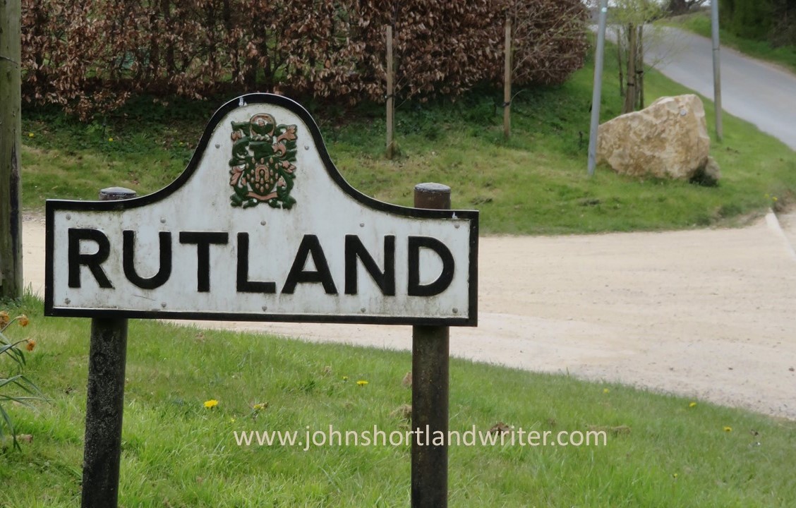
Since the start of writing my Life in the English Cotswolds blog, now over fifteen years ago, overseas readers have repeatedly commented on our network of public footpaths. Mostly it is one of surprise that we can seemingly wander at will over privately owned land and clear any obstruction that may be blocking our way.  In this post I hope to clarify what this civil right, now enshrined in law, is all about.

A footpath crossing privately-owned land in the Cotswolds

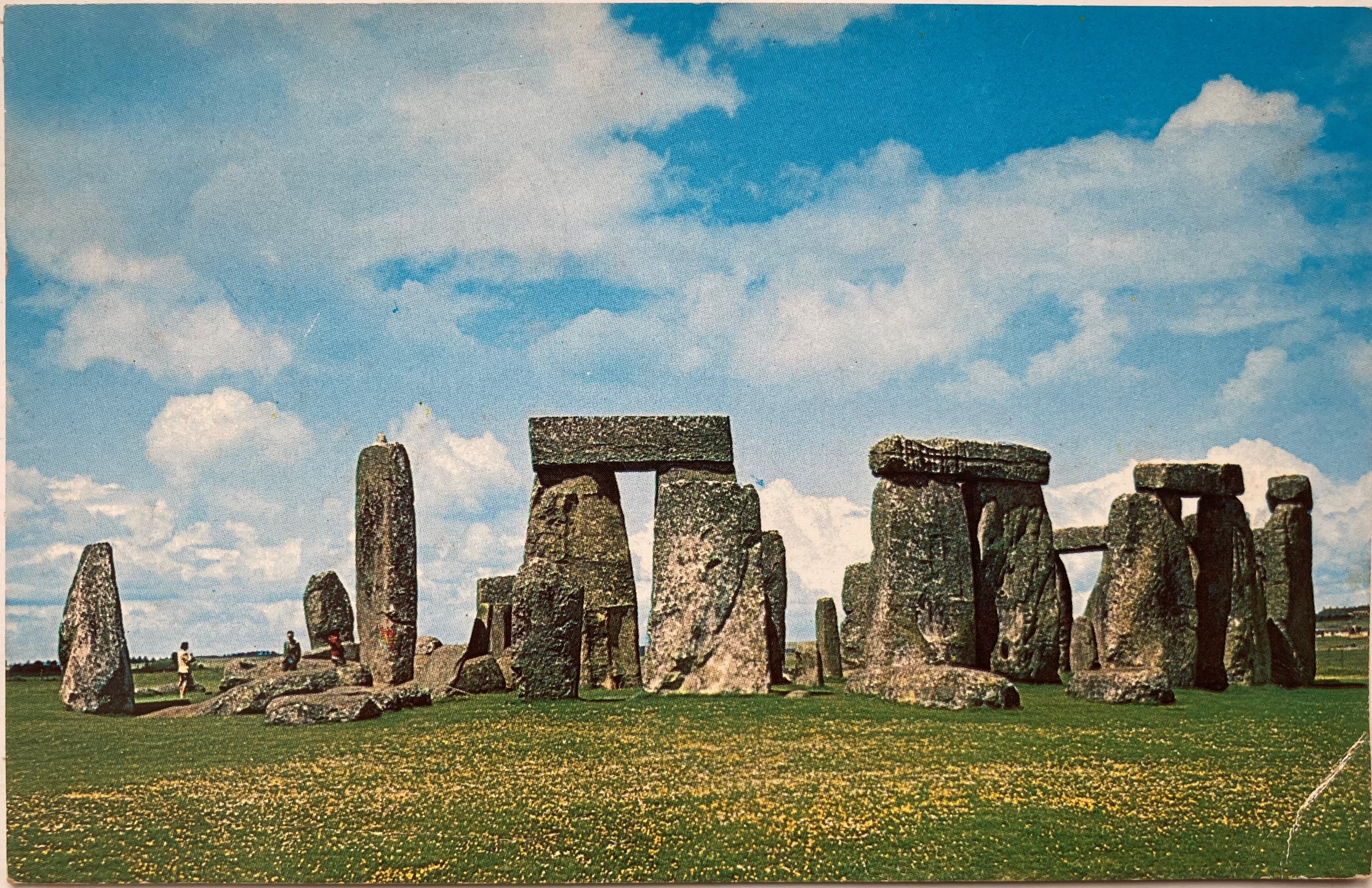
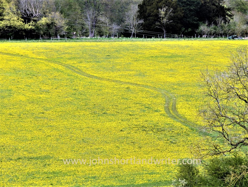
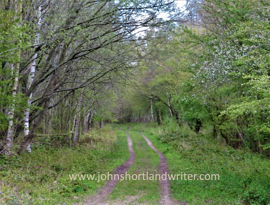
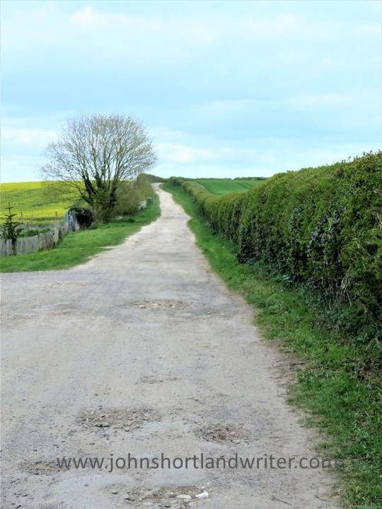
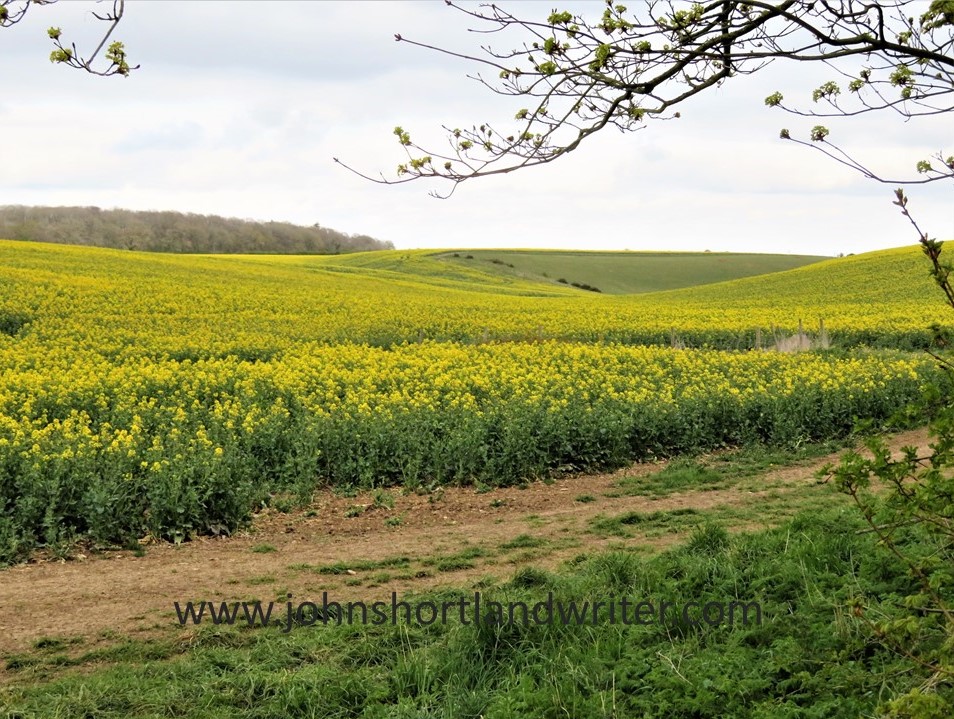
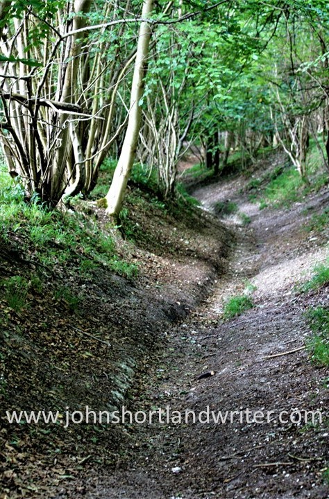
Many of our footpaths are ancient in origin dating back 5000 years or more.  Of course, in those days, these paths were the main highways across a wild and untamed land.  Even in the relatively recent past much of the road system was a dusty, uncomfortable route to take in summer and not any better later in the year when winter rain turned them into a muddy quagmire.  Over many centuries the network of paths was created, usually by local people on foot or horseback taking the most direct and dry route to work or market.  This is one of the reasons why paths often pass through farmsteads and gardens.

This public footpath passes close to Lower Dornford Farmhouse

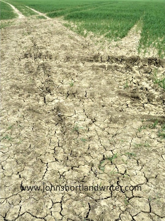
Today, the public footpaths of England and Wales (Scotland has a different system) are much loved and well-used, mostly for recreational purposes.  There are several organisations and charities (see list below) that help to protect the paths and walker’s rights to use them for there are several threats, such as land development for roads and houses, as well as the occasional, unscrupulous landowner.  Landowners seem to fall into two categories: those that maintain the paths to allow ease of access and those that allow the paths to fall into disrepair for it is the landowner that is responsible for the path’s maintenance.  A well-maintained path is clearly defined across the landscape, its gates and stiles giving ease of access whilst remaining stockproof.  By statute, where a path crosses a road, the local council must signpost it.

This farmer has mown a strip through his crop to define the footpath
Where a path meets a road it must be clearly marked

After many years of campaigning, England created its first long-distance path, the Pennine Way, in 1965.  It is 268 miles in length and runs down the spine of northern England passing through spectacular countryside.  Today, there are many of these long-distance paths as well as shorter, circular paths.  However, with a good Ordnance Survey map (paper or app) it is possible to create your own route whether it be for an hour’s stroll or for much longer.  In 2010 the Slow Ways network linking various paths and lanes, villages and towns, across the whole country was created, one of the few benefits to have arisen from the Covid-19 lockdown when walking alone was one of the few permitted activities.  The routes listed are all tried and tested by local people who walk them regularly.

The rugged landscape at Jacob’s Ladder, part of the Pennine Way long-distance path
Ordnance Survey map shows the public rights of way (the solid red line is a main road, the solid yellow line, a country lane [Copyright Ordnance Survey]

In the Ordnance Survey map illustrated above the footpaths are clearly defined using red dashes.  The short dashes show footpaths (walkers only) whereas bridlepaths (walkers, horses and bicycles) have long dashes.  The broken short-long dashes mark those tracks that can be used by horse-drawn vehicles (“restricted byway”).  Some paths have signs along their routes showing not just the route but also the path’s category.

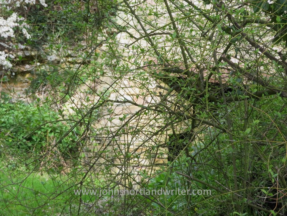
As mentioned, paths frequently cross farmland or other enclosed land. A way through a fenced or walled area must be maintained at all times.  Below are illustrations of some of the different types of barriers you may come across although none must prevent you from continuing along your route.  If it’s a route for horses the rider must be able to open the gate without dismounting.

Wooden gate to pass through easily or wooden stile to scramble over
Not all stone wall are so tricky to get over!

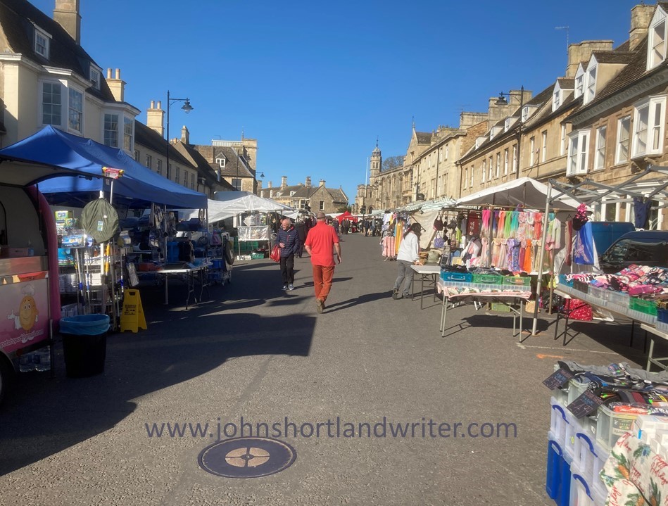
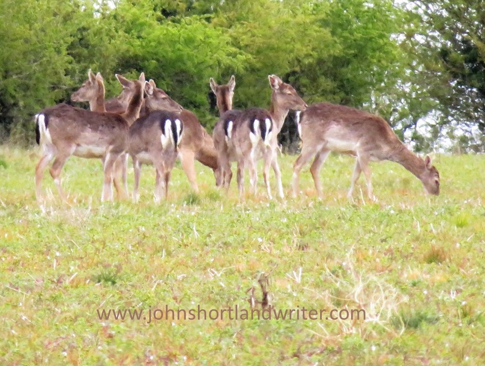
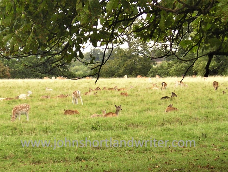
Visitors to England often spend far too much time in the major cities or tourist hot-spots (the Cotswolds have lots of those!) returning home not realising that they have missed the opportunity to see parts of the country that never feature in the travel magazines – the homes and villages, the woodlands and old drover’s tracks that can be found all over the country.  You may choose to walk alone but when you do meet someone, they are often local and happy to exchange greetings and share a few minutes in dialogue.

Bibury – one of the most visited villages in the Cotswolds. To see it like this you need to arrive soon after dawn!
Get away from the crowds by exploring the peace and quiet of the English countryside

Not everyone, of course, feels comfortable walking by themselves, especially in an area unknown to them.  Fortunately, there are a lot of local groups or larger organisations such as the Ramblers Association that will welcome you on a regular or one-off basis.  Occasionally you may even find an individual who’ll be happy to share with a visitor a favourite walk or place – I’ve done it myself and made some good friends along the way.  That is one of the best things about walking, the walks can be short or long, easy or arduous, solitary or in company but it is the interesting conversations you have, the beautiful scenery you pass through, and the wildlife you encounter that make such a memorable experience.  Why not give it a try?

Walk quietly and you’ll be surprised who accompanies you!

Useful Links
click on the organisations below to visit their webpage

Cotswold National Landscape – Guided Walks
National Trust – walks in Gloucestershire and the Cotswolds
Ordnance Survey
Ramblers Association
Slow Ways
The Cotswold Way – a 102 mile trail that takes you through the heart of the Cotswolds to the Roman city of Bath, a UNESCO World Heritage Site.
The Long Distance Walkers Association
Walking in the United Kingdom

A Good Walk Home

Both my partner and I like walking but, more often than not, we walk alone.  Somehow it just works out like that and there is no doubt about it, that when you walk without company you do see and hear so much more.  It isn’t that we chatter away non-stop – we’ve been together for  far too long for that!!  It’s just that with no-one to speak to, or alongside, one becomes far more aware of all that’s around you.  And with only the sound from one pair of walking boots the wild creatures are less aware or concerned of your presence.

Walking quietly it’s possible to get quite close to wildlife

Usually, from necessity, our walks are circular – either back to the car or back to the house if we’ve started from home.  Recently I cadged a lift to Duns Tew, just outside the Cotswolds but still in Oxfordshire and not that far from home and the secret valley.  The village is an interesting mix of houses and makes use of their local ironstone as well as the Cotswold limestone.  I find it fascinating knowing that I live on the edge of two quite different rock formations, 0ne literally as hard as iron and the other, soft and easily worked.  The photo below shows the pretty church built of yellow ironstone and banded with paler limestone – a familiar pattern in the locality.

The thousand year-old Church of St Mary Magdalen, Duns Tew

The houses vary in style and age as well as building materials.  Some have thatched roofs; others slate and some stone tiles.  The traditional village pub has a stone tile roof made from Cotswold stone split into thin tiles.  Just to confuse the unknowing, these tiles are known locally as slates even though they are not made of slate!  The craft of making these roof tiles is centuries old – they have even been found by archaeologists when excavating Roman villas (of which there are quite a few in the Cotswolds) which means the manufacture of them has remained unchanged for the best part of two thousand years.  The pub also has a drystone garden wall, also made from Cotswold stone for which it is so ideal and makes such a memorable feature of the Cotswold Hills.

Village houses: contrasting style and stonework. The thatched house was built in the early 1600s. There are a number of these old signposts still standing locally
The village pub: this dates from the late 1600s. Note the stone ‘slate’ roof

One of the great things about walking in England is that we have a huge network of public footpaths, many of which date back to pre-history.  Now that I realise (thanks to my overseas readers) that being able to walk across privately-owned land by right is almost unique I intend to write specifically about them at a later date.  Suffice to say here, is that it is possible to walk from one end of the country to the other over thousands of miles of paths that must not, by ancient law, be obstructed.  This path is beautifully maintained by the owner. Just outside the village, partly hidden in undergrowth, were the remains of old pony carts.

A well-maintained public right of way that is also a driveway to the owner’s house
Half-hidden at the back of a semi-derelict shed

The path opened onto cornfields, the wheat harvested and the remaining stubble giving a real autumnal look to the countryside.  The hedgerow is also offering its autumnal fruits for the picking – crab apples, elderberries and blackberries; the sloes although looking good won’t be ready to collect until after the first frosts.  The squirrels have taken all the hazelnuts (you have to be quick to get them before they do – but already the embryo catkins, the male flowers, are beginning to appear.  It will be early February before they show the familiar ‘lamb’s tails’ that release clouds of yellow pollen with the slightest breeze.

The path is now gras covered passes ‘twixt hedgerow and cornfield
Crab apples, blackberries, elderberries. Tiny catkins are just forming amongst the blackberries

Although the path, now a wider track, looks obstructed here, the farmer/landowner has to leave the gate unlocked so that people on foot or on horseback can pass.  Crossing the lane it returns to being a path, this time skirting a large wood.  Now hidden by high hedgerows in the spring when the leaves are all bare, the woodland floor is carpeted with bluebells.  In the centre of the field is a stand of mature oaks.  Why were they left there?  For me, they always have a mystical look about them; stepping into their midst the atmosphere changes as if its centuries old story is being told to those that might listen.  Perhaps it’s just my imagination but the fancy is palpable.

As this is a public right of way, one of the gates must be kept unlocked by law
The copse in the middle of the fieldwas it once a sacred site?

Once again the path changes character.  Now a track crossing a small stream, the movement of a young coot searching for food catches my eye and we watch one another for a while before it decides that food is far more important than me.  At such close range I see it snatch a small water beetle before it disappears into the undergrowth.  For a while the path becomes woodland again and then opens up onto a concrete track.  The concrete is all that remains of a WW2 airfield, far inland to be out of the range of German bombers.  I stop to listen and am met with silence.  How different the scene would have been eighty years ago.

The baby coot carried on about its business…
The old wartime concrete paths make easy walking

Finally back home.  Being an Englishman through and through (if you ignore the foreign bits of me!) I sit on the old stone bench in the garden with a refreshing cup of tea and lean back against the walls of our own stone-built house built 170 years ago.  Looking out beyond the garden I can’t help feeling how privileged I am to be seeing the best views of the whole walk!

Not too bad a view from home!

.

.

.

A Walk by Stonehenge – part 1

It is many years since I last visited Stonehenge, the prehistoric standing stones so closely attuned to the midsummer solstice.  Renowned throughout the world, it has been listed as an UNESCO World Heritage Site since 1986.  With fame comes numerous issues, not least how to cope with the estimated one million visitors that come to see them each year.  To prevent damage to the stones through soil erosion and, surprisingly, physical damage through the chipping off of ‘mementos’, the stones are now cordoned off.  This fencing is removed to allow access at the time of the midsummer solstice, a time when hundreds of people wait through the night for the midsummer sun to rise directly between the stones.  The image below is of a postcard that my great-aunt sent me in 1963 when the stones were much less frequently visited and reminds me of those early years when I used to play amongst them.

Stonehenge was far less visited back in the 1960s!

The Stonehenge World Heritage Site covers an area that includes other Neolithic standing stones close by.  A few miles away, and unlike Stonehenge, a place where you can walk amongst the stones every day of the year, is Avebury.  This circle is huge and considerably older than Stonehenge: flint tools dating back 9000 years show that early man was passing that way 4000 years before Stonehenge was built.  Avebury is the place to visit if you want to get close enough to touch the stones and it is also completely free to visit.  To visit Stonehenge can be quite costly although there is another way you can see the stones (legally) without paying if you’re prepared to walk – see below.

Avebury Stone Circle – part of the Stonehenge World Heritage Site

The third site, and to my mind, the best one for you will almost certainly have the place to yourself, is known as Woodhenge & Durrington Walls.  To be really impressed by this comparatively unknown place you do need to know some background information of its history plus a vivid imagination.  For me, it is such an atmospheric place to visit that the latter has never been an issue!  I recommend starting your walk here and walking inside the circle of Durrington Walls before exploring Woodhenge.  The first thing that is noticeable about Durrington Walls is that there are no walls!  The circular bank and ditch that surrounds the site was enormous and consisted of the bank itself which would have been several metres high.  The ditch originally was over five metres deep and, in places, up to thirty metres wide.  It is estimated that between four and six thousand people would have been needed to build the walls as well as the various houses and large timber circles associated with the site.  A feat quite remarkable nowadays let alone over four thousand years ago using just antler pickaxes!  Although nothing remains above ground now, apart from the bank, I found it very easy to imagine, as I walked alone and in silence, the bustle and noise of these industrious people.

Within Durrington Walls, now a grassy bank, up to 6000 people once lived
Information boards help you to understand the context of what you are not seeing!

Leaving Durrington Walls I made my way to the Cuckoo Stone, my only companions, sheep.  Now fallen, this stone would originally have been placed upright.  Looking at maps, it appears to be more, or less in line with the Great Cursus (more about that below) which in turn leads to Stonehenge.  The Cuckoo Stone, positioned 4000 years ago, continued to be ritually used into Roman times for in 2007, during archaeological excavation, a small building thought to be a shrine from that period was discovered. 

Close to the Cuckoo Stone a Roman shrine once stood

Leaving the Cuckoo Stone, my path led to an old track edged by wildflowers humming with bees and butterflies and bringing me out at the top of the Cursus.  The Cursus is another huge earthwork showing nowadays as a crop mark – two bright green stripes in an otherwise darker landscape.  If you compare my photograph with the one of the information board (below), I was standing at the opposite end.  In my image, the end of the Cursus can just be made out on the far horizon almost two miles distant.  The purpose of the Cursus is unknown but thought to be ceremonial as it is again aligned to the summer solstice.  It is even older than Stonehenge having been constructed several hundred years earlier.

The two-mile long Cursus now only shows as two grassy green stripes
The Cursus is better understood from this aerial photograph

Another good track took me due south before turning west to Old King Barrows and then back south to New King Barrows.  Before leaving the Cursus I stood to watch the visitors to Stonehenge some long way off and thinking how lucky I was to have all of this unseen history of the World Heritage Site to myself with only the song of skylarks as company.  More than five thousand years separated me from the Neolithic people yet surely, they must have stood here too and seen a similar picture as they made their way to join others already arrived, a humbling thought.

A distant Stonehenge can be clearly seen from the Cursus

The Old and New King Barrows consist of two groups, each of seven burial mounds so fourteen in total, separated by Stonehenge Avenue which is only visible as another cropmark.  The Avenue linked Stonehenge to the River Avon almost two miles away and was, perhaps, another route the Ancients would have taken to reach the stones. Despite their name, the Old and New King Barrows date from the same time period, and also around the same as Stonehenge.

One of the prehistoric burial mounds at Old King Barrows

It was by the barrows that I turned back towards Woodhenge, the last part of my relatively short but extraordinarily rich walk, rich both in its views and its wildlife, as well as its history.  As if to bring me almost up-to-date in time, the sound of an old-fashioned binder in an adjoining field was busy bringing in the harvest.  Not quite twenty-first century but a common sight less than a hundred years ago.

Harvesting wheat the old-fashioned way


The final part of my walk to Woodhenge can be found by clicking this link here.

To visit Stonehenge for free involves a walk not dissimilar to this one.  Park in Durrington village and take the public bridleway path (where it meets Fargo Road) directly south to Stonehenge.  The path passes the stones within yards of the public viewing path so you will still be separated from the stones.  Public footpaths continue southwards, criss-crossing an area rich in more barrows and other ancient earthworks.  With the help of an Ordnance Survey map it should be quite possible to make a longer, circular walk.

**Click on any of the images to enlarge**

.

In The Footsteps of Clare

The days have been unseasonably dry and the nights exceptionally cold for April but day after day of unbroken sunshine has meant that it has been particularly good to be outdoors.  The warmth tempered by a gentle north-easterly has created perfect walking conditions.    However, as is so often the way, the day I chose to wander along the byways that criss-cross the border of Lincolnshire, one of England’s largest counties, and Rutland, England’s smallest, there was more cloud to be seen than for weeks.

The Ford at Aunby – where the walk begins and ends

My walk began at the ford by the tiny hamlet of Aunby, a few miles north of Stamford.  Stamford has been described as “the most perfect stone town in England” as well as being voted the best place to live.  It certainly is a beautiful place to explore with numerous, fine churches as well as a great Friday market and a wealth of independent shops.  Whereas Stamford has prospered through the centuries, Aunby suffered a dramatic decline: in the fourteenth century there were numerous houses and a church; today, apart from a few cottages, they only show as cropmarks.

A quiet seat in Stanford
Stamford Market before the crowds arrive…

Heading north-west along a grassy bridleway, the path climbs gently until a narrow lane with wide, grassy verges is reached.  One of the many roadside nature reserves in the county, the late spring meant that the only wildflowers to be seen were cowslips which grew in plentiful splendour.  Following this lane uphill  to the elaborate, black and gold entrance gates of Holywell Hall where I turned left, glimpses of the mansion could be seen through the hedgerow that lined the lane. Both the house and grounds are immaculately cared for although I admired most of all the winding path cut through a splendid swathe of dandelions in full bloom.  Considered by many a nuisance ‘weed’ to be sprayed out rather than a wildflower to be kept, dandelions are a great source of early nectar for bees and other insects as well as looking beautiful in their own right.

The entrance to Holywell Hall
Holywell Hall
The dandelion meadow at Holywell Hall

Crossing the county border into Rutland my route immediately turned left onto a forest track to take me up to Holywell Wood and into Pickworth Great Wood.  It was here that I met a local couple exercising their black Labrador dogs, the only people I saw on the whole of my eight-mile walk. They told me that the area was one of the largest woodlands locally as well as being a Site of Special Scientific Interest, designated for its geology as well as its wildlife – a fact confirmed by the NatureSpot website (click here for more information). The woodland path was lined with primroses, the trees just breaking bud and coming into leaf but, sadly, I was too early to hear the nightingales sing. 

Crossing into England’s smallest county
The path through Pickworth Great Wood

Beyond the wood, the path crossed diagonally over unseasonably dry arable land to the village of Pickworth.  It was at this point that I really felt that I was walking in Clare’s footsteps although we can safely assume that he knew most, if not all, of the paths that I would be taking that day.  John Clare, the Peasant Poet, born into poverty and distraught by the destructive changes to the countryside and its people at that time, died in 1864 in the Northampton General Lunatic Asylum.  It was at Pickworth where he laboured in the lime kiln which inspired him to write the poem The Ruins of Pickworth (click link here to read).  The lime kiln still stands although it is barely visible through a thicket of blackthorn.

No muddy boots this unseasonably dry Spring
The barely visible lime kiln where the Peasant Poet, John Clare, toiled

 Pickworth, like Aunby, is another village that has almost disappeared.  Thriving in the 1300s, it now has a population of less than a hundred.  The only sign of the old village is the crumbling stone arch of the church and various grassy mounds and ruts in the surrounding fields. The arch stands on private property but with the help of the camera, details of ornate mouldings and leaves could be seen. It is thought that the Battle of Losecote Field in 1470 fought two miles from the village may have been the cause of its depopulation.

All that remains of the old church at Pickworth is the 13th century arch
Pickworth Old Church – detail

Although the association of Pickworth with Clare is important, to visit the Church of All Saints was the main purpose for my walk.  Built in 1822 at the bequest of Joseph Armitage of Wakefield, Yorkshire, it is a rectangular, stone building of plain beauty and fine proportion.  Set high on a bank and surrounded by trees, the interior is simply lime-washed, the only colour a small amount of stained glass above the altar.

The Church of All Saints, Pickworth
The simple interior of All Saints, Pickworth
The understated beauty of the only stained glass at Pickworth, All Saints

From Pickworth, an old drove road, The Drift, leads back towards Aunby by crossing Ryall Heath.  The road, now another old track, offers pleasing views across arable land, hedgerows filled with wildflowers and the sound of skylarks showering you from high with their song. The Drift ends at the junction with the road that takes you directly back to the start of the walk (turn left here).   Although the B4116 can be quite a busy road at times there are wide grass verges to make walking feel safe.  Finally, you reach the ford at Aunby, where this walk began.  Alternatively, a few yards before the ford you can take the lane that leads to Clematis Cottage, where I stayed for the duration of this oh-so-welcome-after-lockdown short break.

Pickworth Drift, the old drover’s road leads across Ryall Heath
Pickworth Drift, an ancient drover’s road

Clematis Cottages at Lodge Farm, Aunby is a small group of buildings converted into delightful, self-catering holiday accommodation.  Richard and Kaye Griffin, friends as well as the owners, live in the farmhouse where they provide every comfort to make a stay enjoyable.  Set in extensive gardens, their aim is to be self-sufficient in vegetables, eggs and honey.  Throughout the gardens there are paths and seating areas – one of my favourites is the summerhouse overlooking the small lake, a haven for wildlife.  Although set on its own and surrounded by fields, Stamford is only six miles away and the internationally renowned Rutland Water, where you can watch rare ospreys nest and fish, ten miles away.  It’s also the perfect base for the nearby Burghley Horse Trials.  To find out more about staying in one of the cottages and their range of home-produced chutneys, preserves and honey click this link here.

A corner of the pretty gardens at Clematis Cottages, Aunby
A winding woodland path in the gardens of Clematis Cottages, Aunby
Deer are frequently seen in the fields adjacent to Clematis Cottages, Aunby

Notes:  the walk is a relatively easy and gentle route mostly along roads and tracks.  In places the paths can be uneven and/or muddy but neither should deter anyone with average health and mobility.  Although there are some inclines none are prolonged or steep.  However, as always, care should be taken and appropriate clothing and footwear worn.  It is approximately eight miles in length so allow a good three hours to complete.

The Glories of a Beechwood

Buckinghamshire, one of the so-named Shire counties, lies to the north-west of London.  A long, narrow county; the southern part is renowned for its beech woodlands.  Although greatly diminished in size over the centuries, many of them are still there, remnants of the ancient woodlands that once covered much of Britain, although the industries that they supported are long gone.

Nr Fingest 2 watermark

In the Chilterns the beechwoods can almost engulf the lanes

Straddling the Buckinghamshire/Oxfordshire borders the Chiltern Hills extend diagonally northwards into neighbouring Bedfordshire where they change character from dense woodlands to more open downland.  It is within the shadow of the southern woodlands where I was born and where I lived for the greater part of my life before moving to the secret valley in the Cotswolds.  Inspired by Enid Blyton’s The Children of Cherry Tree Farm, my childhood was spent crawling around the fields, woods and hedgerows learning as much as I could about the wild birds and animals that lived within them.john david shortland 1965 watermark

Although nowadays the woods appear mostly deserted, they are still made use of.  The old tracks and paths that were once used by the men and women that worked and lived there are trodden by walkers, and by the wildlife that remains elusive for only those that move quietly have the pleasure of seeing anything other than a glimpse of a fleeing animal.

Woodland Track (2) watermark

This centuries old track leads down into a deep valley

Fallow Deer watermark

Fallow deer can often be seen at rest in clearings if you walk quietly

The making of chair legs to keep the flourishing furniture industry of High Wycombe, the local market town, was carried out within the woodland by men who would set up shelters there.  Known as chair-bodgers, a local dialect word originally confined to this immediate area, they were highly skilled craftsmen who could earn relatively high wages for their work.  The Second World War virtually ended the centuries old tradition, the last being Samuel Rockall who died in the early 1960s.  I had been unaware of Rockall’s life until I researched for this blog post and it seems as if we may have been related for I have Rockalls in my family tree.  In the 1851 census return one of my ancestral cousins is described as a chair turner living in the village where I spent much of my adult life.  More research required!

1851 census - Rockall

Jonathan Rockall, chair turner and ancestral cousin in the 1851 census return.  His wife, Ann, a lace maker,- another local craft

Some of my cousins?! Photo from an old book ‘English Country Life & Work’

It is, perhaps, springtime when the beech woods are most visited for the forest floor is carpeted with bluebells.  The intensity of their colour plus the iridescent green of the tree’s unfurling leaves almost hurt the eyes.  With early morning sunshine the scent is unique and difficult to describe – gentle is the best I can come up with.  As the day progresses the scent is quickly lost.Chilterns Beechwood copyright

During midsummer, the woods become visually silent: the leaves have turned a dark, leathery green and the bluebells gone to lie dormant for the rest of the year.  With autumn, the trees become alive once more with colour, this time as their leaves turn into every shade of copper, gold and brown before they drop to the ground for winter.  It is then that the smooth bark of the trees come to the fore with a silvery sheen that catches the low light of a winter’s day.  Although it may seem as if the woodlands are sleeping, in places the first bluebells are starting to poke their noses through the leaf litter.  Spring is on its way.Autumn colour watermarkIbstone 1984 watermark