Where No Priest Will Go

“Culbone, Oare and Stoke Pero – places where no priest will go-o” says the old Exmoor rhyme about three of the moor’s remotest churches.  That’s not totally surprising for they must be some of the most isolated in England and all involve considerable effort to reach even with today’s modern transport.  Or, perhaps, it was because of their association with witches, bandits and lepers that made them reluctant to go. In his book, Exmoor Memories, A(rthur) G(ranville) Bradley writing of his time spent on Exmoor in the 1860s, tells of how the parson of Simonsbath church wouldn’t stay on the moor during the winter, leaving his parishioners to spiritually fend for themselves.  With no roads at that time crossing the moor, one can hardly blame him.

even today, Exmoor is a wild and rugged place

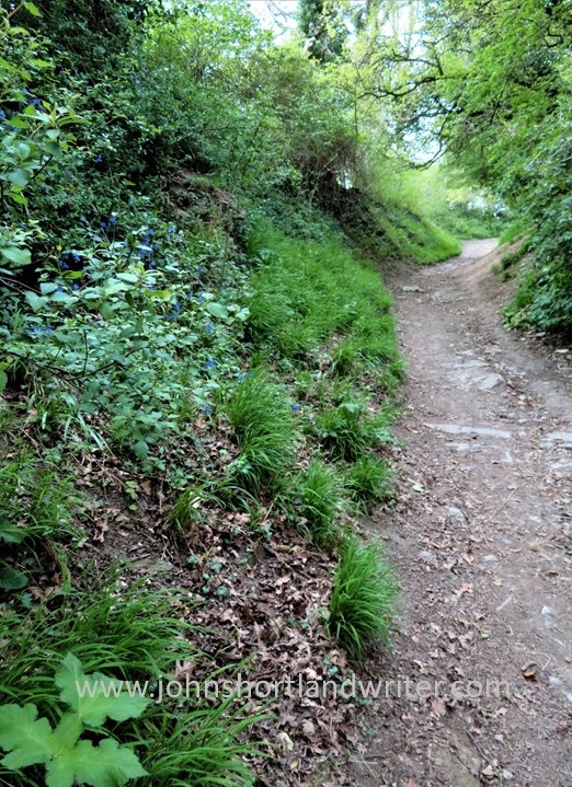
I recently visited Culbone church which can still only be reached on foot.  Whichever of the two routes you take, a very steep climb is involved but the effort is well worthwhile when you finally get there.  The deep wooded combe opens up just enough to allow room for the church and two houses.  It is a very tranquil spot and, resting there in an attempt to recover breath, it did feel very spiritual too – perhaps because records show that it has been a place of worship and meditation for over sixteen hundred years.  The present church was mentioned in the Domesday Book so is just a mere one thousand years old!

Culbone has been a place of worship & silent contemplation for over sixteen hundred years
the private box pews where only the gentry would sit

Claiming to be the smallest parish church in England – it is only 35 foot x 11 foot in size – it can seat about thirty on its hard, wooden pews.  It also has a small box pew where the family of Ashley Combe House once sat.  Like many of the buildings that must have once populated the area, Ashley Combe House has long since disappeared.  Entering the church through its thirteenth-century porch two things are immediately noticeable: first that it is still lit by gas and secondly, the ancient, stone font, now also well over a thousand years old.

the church is still let by gaslamp
the one thousand year old font – how many baptisms has it seen?

Despite the hardship in reaching the church and its very few houses, it is still very much a living church with services held there fortnightly.  However, the priest, perhaps mindful of the old rhyme or the lepers that once roamed the woods lives elsewhere.  To visit Culbone it is possible to park the car by the sea at Porlock Weir and climb 400 feet to reach it or, as we did, park at the top and walk down.  If that sounds the easy option, remember there is still the steep climb back!  Either way you’ll be rewarded with breathtaking sea views and the chance to glimpse a way of life (and worship) now almost totally past.

the church is hidden in a deep, wooded combe
Porlock Weir

Oare church, these days is by far the easiest of the three churches to reach for it is just a short drive down a narrow lane from the A38 Porlock-Lynmouth coastal road.  Famed for its association with Lorna Doone, the novel by R D Blackmore, Lorna was shot at the altar on her wedding day by the wicked outlaw Carver Doone.  A pretty, riverside walk through the stronghold of the Doones, the Doone Valley, is possible from nearby Malmsmead where there is camping as well as an art gallery and coffee shop named the Buttery.  Overlooking the picturesque bridge and ford, it also serves great food and is well worth a visit.

Oare church is easily approached by a narrow lane
the bridge and ford at Malmsmead

Compared with the church at Culbone, Oare is a relative newcomer having been built in the 1400s and then partially rebuilt four hundred years later.  Inside, it is light and airy with memorials to Blackmore and also to the Snow family who feature in the novel.  Blackmore tended to use local family names and traditions in his writing and mixing fact with fiction.  Ridd is another local name; its variation Red is recorded on many of the gravestones at Culbone. For those not too familiar with the tale of Lorna Doone, or to see photos of the Doone Valley take a look at my earlier blogs, The Story of Lorna Doone – just a myth? and A Walk in the Doone Valley.

the interior of Oare church is very light and airy
the window through which Carver Doone shot Lorna on her wedding day as she stood at the altar

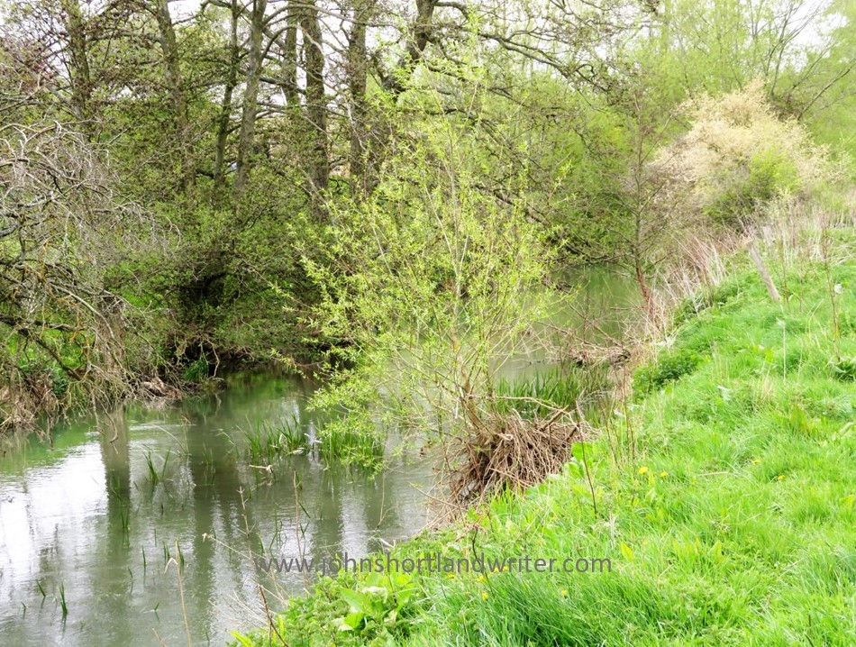
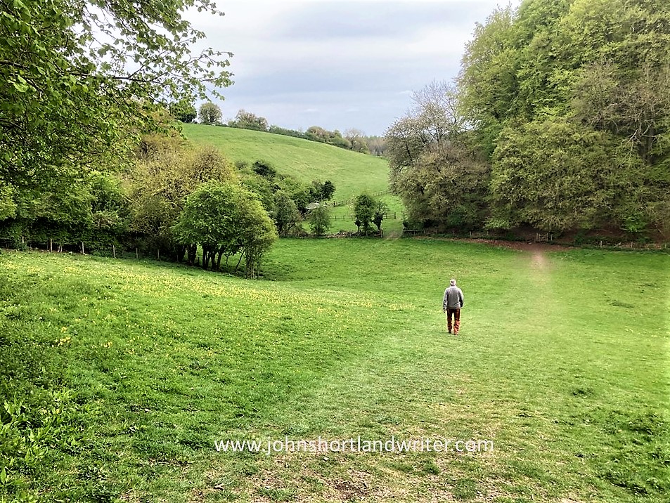
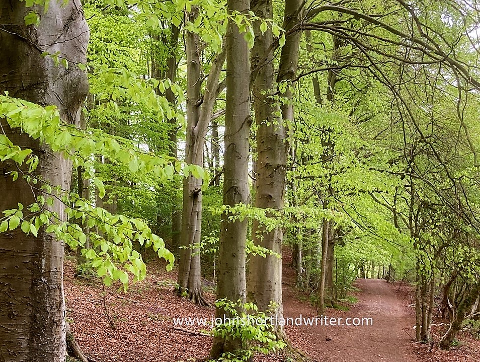
There are wonderful, albeit rather long, walks to Stoke Pero church from Horner Woods (car park at Webber’s Post or in the village of Horner), taking in the ‘four corners of Horner’ and distant views of Dunkery Beacon, the highest point of Exmoor. It is well worth the effort for apart from the views there is a good chance, providing you walk quietly, of spotting red deer, the largest of our wild deer and for which Exmoor is now one of its few remaining strongholds.  There is plentiful wildlife to be seen along the river too – Dippers and Kingfishers and with Buzzards soaring overhead.  You may even be lucky enough to see Red Kites or even White-tailed Sea Eagles which are becoming ever-more frequent visitors to the area.

Dunkery Beacon from Webber’s Post
wild red deer hind with its calf half-hidden in the deep woodland

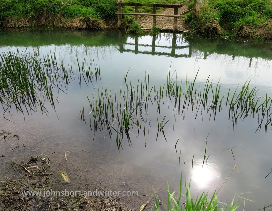
It is possible to drive to Stoke Pero although the lanes are long, winding and narrow.  The road even passes through a working farmyard which confuses many, especially visitors from overseas who find our narrow lanes scary enough at the best of times! If you choose to reach the church this way you will fully understand why a priest might not want to be bothered to travel there. Below is an Ordnance Survey map showing the three churches; I would strongly advise to carry a paper, rather than digital, version of the map for phone signals can be a bit erratic in such remote countryside.

the three churches – a good map and equally good boots are essential if travelling by foot

We’ve had lepers and bandits with our previous two churches which only leaves witches as a possible reason (other than the journey) why Stoke Pero might have been clergy-less.  Look closely at the old oak door and scratched into its surface are a series of lines: witches marks.  ‘Apotropaic’ marks to give them their correct name are symbols carved into buildings to ward off witches and protect people from evil spirits.  They are usually found wherever there is a point of entry such as doors, windows or chimneys and usually date back many centuries when belief of the supernatural was commonplace.  It is not known when the marks at Stoke Pero were made or what they mean but they may well have literally put the fear of God into any visiting priest.

witches marks – apotropaic marks – on the church door at Stoke Pero

The church at Stoke Pero lays claim to being the highest on Exmoor for it stands, isolated at over 1000 feet above sea level.  Although much of the building is only a couple of hundred years old, the church tower dates from the 1200s, as does a list of the rectors which rather belies the story of lack of clergy.  Like Culbone, an earlier church here is mentioned in the Domesday Book and, also like Culbone, services are held here lit by candles or gas lamps.

old sign staking its claim as highest church!
Stoke Pero church sits high on a bank

I blogged about Stoke Pero over fifteen years ago (link here) and mentioned how simple its interior is with its whitewashed walls, the only colour being the splash of red from the altar cloth.  Revisiting recently, unsurprisingly the place hasn’t changed, and the barrel roof is as spectacular as ever.  However, this time I noticed other things too such as the delicate ferns growing inside the window of the ancient bell tower and the contrast between the rough-hewn stone windows and the smooth white plasterwork.

the magnificent barrel roof of Stoke Pero church
ferns grow in the cool shade found inside the ancient bell tower

If you have the opportunity to visit Exmoor, now protected by its National Park status, there is much to see – but only if your pleasure comes from the joy of being in wild, open places for it remains remarkably uncommercialised.  It has much to offer apart from the moorland (spectacular at this time of years smothered in purple heather) for it has the sea, rugged cliffs, fast-running boulder-strewn rivers and the unspoilt little towns of Porlock, Lynton and Lynmouth. It is a walker and nature lovers paradise.

the heather moorland tumbles away to the sea
Lynmouth

Regular readers of my blog will know of my love of Exmoor which I discovered now nearly sixty years ago.  They may even recall how through a chance meeting it changed the direction of my life, giving me an outdoor career as well as many Exmoor friends.  More remarkably, I have found numerous family references to the moor, unknown at the time, for A G Bradley was my grandmother’s cousin and other family members lived and are buried at Luccombe, a village not too far from Stoke Pero.  An uncle was involved with the rebuilding of Lynmouth after the devastating floods and loss of life in 1952 and a few years prior to that my parents honeymooned on the moor.  A small world indeed and one in a small way I have been privileged to be part of.

my first night spent on Exmoor – many, many years ago!
old postcard of the cottage in Luccombe where my ancestors lived in the early 1900s

Rights of Passage – England’s Footpath Network

Since the start of writing my Life in the English Cotswolds blog, now over fifteen years ago, overseas readers have repeatedly commented on our network of public footpaths. Mostly it is one of surprise that we can seemingly wander at will over privately owned land and clear any obstruction that may be blocking our way.  In this post I hope to clarify what this civil right, now enshrined in law, is all about.

A footpath crossing privately-owned land in the Cotswolds

Many of our footpaths are ancient in origin dating back 5000 years or more.  Of course, in those days, these paths were the main highways across a wild and untamed land.  Even in the relatively recent past much of the road system was a dusty, uncomfortable route to take in summer and not any better later in the year when winter rain turned them into a muddy quagmire.  Over many centuries the network of paths was created, usually by local people on foot or horseback taking the most direct and dry route to work or market.  This is one of the reasons why paths often pass through farmsteads and gardens.

This public footpath passes close to Lower Dornford Farmhouse

Today, the public footpaths of England and Wales (Scotland has a different system) are much loved and well-used, mostly for recreational purposes.  There are several organisations and charities (see list below) that help to protect the paths and walker’s rights to use them for there are several threats, such as land development for roads and houses, as well as the occasional, unscrupulous landowner.  Landowners seem to fall into two categories: those that maintain the paths to allow ease of access and those that allow the paths to fall into disrepair for it is the landowner that is responsible for the path’s maintenance.  A well-maintained path is clearly defined across the landscape, its gates and stiles giving ease of access whilst remaining stockproof.  By statute, where a path crosses a road, the local council must signpost it.

This farmer has mown a strip through his crop to define the footpath
Where a path meets a road it must be clearly marked

After many years of campaigning, England created its first long-distance path, the Pennine Way, in 1965.  It is 268 miles in length and runs down the spine of northern England passing through spectacular countryside.  Today, there are many of these long-distance paths as well as shorter, circular paths.  However, with a good Ordnance Survey map (paper or app) it is possible to create your own route whether it be for an hour’s stroll or for much longer.  In 2010 the Slow Ways network linking various paths and lanes, villages and towns, across the whole country was created, one of the few benefits to have arisen from the Covid-19 lockdown when walking alone was one of the few permitted activities.  The routes listed are all tried and tested by local people who walk them regularly.

The rugged landscape at Jacob’s Ladder, part of the Pennine Way long-distance path
Ordnance Survey map shows the public rights of way (the solid red line is a main road, the solid yellow line, a country lane [Copyright Ordnance Survey]

In the Ordnance Survey map illustrated above the footpaths are clearly defined using red dashes.  The short dashes show footpaths (walkers only) whereas bridlepaths (walkers, horses and bicycles) have long dashes.  The broken short-long dashes mark those tracks that can be used by horse-drawn vehicles (“restricted byway”).  Some paths have signs along their routes showing not just the route but also the path’s category.

As mentioned, paths frequently cross farmland or other enclosed land. A way through a fenced or walled area must be maintained at all times.  Below are illustrations of some of the different types of barriers you may come across although none must prevent you from continuing along your route.  If it’s a route for horses the rider must be able to open the gate without dismounting.

Wooden gate to pass through easily or wooden stile to scramble over
Not all stone wall are so tricky to get over!

Visitors to England often spend far too much time in the major cities or tourist hot-spots (the Cotswolds have lots of those!) returning home not realising that they have missed the opportunity to see parts of the country that never feature in the travel magazines – the homes and villages, the woodlands and old drover’s tracks that can be found all over the country.  You may choose to walk alone but when you do meet someone, they are often local and happy to exchange greetings and share a few minutes in dialogue.

Bibury – one of the most visited villages in the Cotswolds. To see it like this you need to arrive soon after dawn!
Get away from the crowds by exploring the peace and quiet of the English countryside

Not everyone, of course, feels comfortable walking by themselves, especially in an area unknown to them.  Fortunately, there are a lot of local groups or larger organisations such as the Ramblers Association that will welcome you on a regular or one-off basis.  Occasionally you may even find an individual who’ll be happy to share with a visitor a favourite walk or place – I’ve done it myself and made some good friends along the way.  That is one of the best things about walking, the walks can be short or long, easy or arduous, solitary or in company but it is the interesting conversations you have, the beautiful scenery you pass through, and the wildlife you encounter that make such a memorable experience.  Why not give it a try?

Walk quietly and you’ll be surprised who accompanies you!

Useful Links
click on the organisations below to visit their webpage

Cotswold National Landscape – Guided Walks
National Trust – walks in Gloucestershire and the Cotswolds
Ordnance Survey
Ramblers Association
Slow Ways
The Cotswold Way – a 102 mile trail that takes you through the heart of the Cotswolds to the Roman city of Bath, a UNESCO World Heritage Site.
The Long Distance Walkers Association
Walking in the United Kingdom

A Walk by Stonehenge – part 2 – Woodhenge

The prehistoric monument of Stonehenge was built in alignment with the sunrise of both the summer and winter solstices. For many, it is a sacred time and a moment to connect with our ancestors of 5000 years ago. With the Summer Solstice just days away it seems appropriate to write the conclusion of a relatively gentle walk that incorporates not just Stonehenge but also the nearby and lesser-known Woodhenge. Part 1 of the walk, along with photos, can be found by clicking on the link here.

The lesser-known circle of Woodhenge

Access to the stones of Stonehenge is usually restricted by a fence to prevent the one million visitors that view them every year from damaging the stones by touch, or by eroding the ground the stones stand on. For the solstice the fence is removed so that it is possible to walk amongst the stones and to witness the sun as it rises behind the Heel Stone. Thousands of people will attend the solstice but I prefer solitude for my walks whenever possible. I would choose to stand at the Cursus and to look down on the stones (and the crowds) or even to sit silently at Woodhenge.

A distant Stonehenge can be clearly seen from the Cursus

So what is Woodhenge? The official description is “a timber monument comprising of six oval rings of posts”. Not the most inspiring but the more you explore Woodhenge the more fascinating it becomes. Of course, the timber posts have long since rotted, and now their positions are marked by low pillars of differing diameters. As you walk amongst them and begin to picture the timber posts, the tallest of which reached 9 metres (30 foot) in height and weighed five tons, you realise just how awe-inspiring it must have been, especially if they were coloured or carved in some way.

Woodhenge as it may have looked 5000 years ago

Woodhenge was built at the same time as Stonehenge and on the same summer/winter solstice alignment. The two henges, two miles apart, were possibly connected by paths, one showing as banks and ditches is marked on maps as Stonehenge Avenue. The Cursus also is in direct alignment with Woodhenge and in those pre-history days the two monuments probably could be seen from these points.

Excavation of the site took place in 1926 but it is only now that more detailed studies are taking place. The initial dig discovered the body of a child at the centre of the circle and it was thought to have been sacrificed there. The remains were taken to London for later examination but were destroyed by bombing during WW2 before this took place. The grave is now marked by a small stone cairn. Other remains found within the circle were numerous pieces of pottery, butchered pig bones and, just outside the entrance, the body of a teenager. These finds indicate that activity at the site continued for many hundreds of years, long after the posts had rotted.

The site of the grave of the child is now marked by a cairn

Although the purpose of Woodhenge can only be surmised, the recent interest in it and its relationship to Stonehenge, Durrington Walls and other sites within the Stonehenge World Heritage Site, slowly reveal more connections between them. One such thought is that it may have held a spiritual connection with Stonehenge: the stones of Stonehenge being the enduring place of the spiritual world, whereas Woodhenge, with its feasting and slowly decaying timbers, the transformation of life towards death. Interestingly, similarities with ancient sites in Madagascar, although 4000 years later than those in England, can be found.

When I first visited Stonehenge as a child in the early 1960s there were far fewer people about!

To visit Stonehenge for free involves a walk not dissimilar to this one.  Park in Durrington village and take the public bridleway path (where it meets Fargo Road) directly south to Stonehenge.  The path passes the stones within yards of the public viewing path so you will still be separated from the stones.  Public footpaths continue southwards, criss-crossing an area rich in more barrows and other ancient earthworks.  With the help of an Ordnance Survey map it should be quite possible to make a longer, circular walk.

**Click on any of the images to enlarge**

Sources:
English Heritage Wikipedia

A Walk by Stonehenge – part 1

It is many years since I last visited Stonehenge, the prehistoric standing stones so closely attuned to the midsummer solstice.  Renowned throughout the world, it has been listed as an UNESCO World Heritage Site since 1986.  With fame comes numerous issues, not least how to cope with the estimated one million visitors that come to see them each year.  To prevent damage to the stones through soil erosion and, surprisingly, physical damage through the chipping off of ‘mementos’, the stones are now cordoned off.  This fencing is removed to allow access at the time of the midsummer solstice, a time when hundreds of people wait through the night for the midsummer sun to rise directly between the stones.  The image below is of a postcard that my great-aunt sent me in 1963 when the stones were much less frequently visited and reminds me of those early years when I used to play amongst them.

Stonehenge was far less visited back in the 1960s!

The Stonehenge World Heritage Site covers an area that includes other Neolithic standing stones close by.  A few miles away, and unlike Stonehenge, a place where you can walk amongst the stones every day of the year, is Avebury.  This circle is huge and considerably older than Stonehenge: flint tools dating back 9000 years show that early man was passing that way 4000 years before Stonehenge was built.  Avebury is the place to visit if you want to get close enough to touch the stones and it is also completely free to visit.  To visit Stonehenge can be quite costly although there is another way you can see the stones (legally) without paying if you’re prepared to walk – see below.

Avebury Stone Circle – part of the Stonehenge World Heritage Site

The third site, and to my mind, the best one for you will almost certainly have the place to yourself, is known as Woodhenge & Durrington Walls.  To be really impressed by this comparatively unknown place you do need to know some background information of its history plus a vivid imagination.  For me, it is such an atmospheric place to visit that the latter has never been an issue!  I recommend starting your walk here and walking inside the circle of Durrington Walls before exploring Woodhenge.  The first thing that is noticeable about Durrington Walls is that there are no walls!  The circular bank and ditch that surrounds the site was enormous and consisted of the bank itself which would have been several metres high.  The ditch originally was over five metres deep and, in places, up to thirty metres wide.  It is estimated that between four and six thousand people would have been needed to build the walls as well as the various houses and large timber circles associated with the site.  A feat quite remarkable nowadays let alone over four thousand years ago using just antler pickaxes!  Although nothing remains above ground now, apart from the bank, I found it very easy to imagine, as I walked alone and in silence, the bustle and noise of these industrious people.

Within Durrington Walls, now a grassy bank, up to 6000 people once lived
Information boards help you to understand the context of what you are not seeing!

Leaving Durrington Walls I made my way to the Cuckoo Stone, my only companions, sheep.  Now fallen, this stone would originally have been placed upright.  Looking at maps, it appears to be more, or less in line with the Great Cursus (more about that below) which in turn leads to Stonehenge.  The Cuckoo Stone, positioned 4000 years ago, continued to be ritually used into Roman times for in 2007, during archaeological excavation, a small building thought to be a shrine from that period was discovered. 

Close to the Cuckoo Stone a Roman shrine once stood

Leaving the Cuckoo Stone, my path led to an old track edged by wildflowers humming with bees and butterflies and bringing me out at the top of the Cursus.  The Cursus is another huge earthwork showing nowadays as a crop mark – two bright green stripes in an otherwise darker landscape.  If you compare my photograph with the one of the information board (below), I was standing at the opposite end.  In my image, the end of the Cursus can just be made out on the far horizon almost two miles distant.  The purpose of the Cursus is unknown but thought to be ceremonial as it is again aligned to the summer solstice.  It is even older than Stonehenge having been constructed several hundred years earlier.

The two-mile long Cursus now only shows as two grassy green stripes
The Cursus is better understood from this aerial photograph

Another good track took me due south before turning west to Old King Barrows and then back south to New King Barrows.  Before leaving the Cursus I stood to watch the visitors to Stonehenge some long way off and thinking how lucky I was to have all of this unseen history of the World Heritage Site to myself with only the song of skylarks as company.  More than five thousand years separated me from the Neolithic people yet surely, they must have stood here too and seen a similar picture as they made their way to join others already arrived, a humbling thought.

A distant Stonehenge can be clearly seen from the Cursus

The Old and New King Barrows consist of two groups, each of seven burial mounds so fourteen in total, separated by Stonehenge Avenue which is only visible as another cropmark.  The Avenue linked Stonehenge to the River Avon almost two miles away and was, perhaps, another route the Ancients would have taken to reach the stones. Despite their name, the Old and New King Barrows date from the same time period, and also around the same as Stonehenge.

One of the prehistoric burial mounds at Old King Barrows

It was by the barrows that I turned back towards Woodhenge, the last part of my relatively short but extraordinarily rich walk, rich both in its views and its wildlife, as well as its history.  As if to bring me almost up-to-date in time, the sound of an old-fashioned binder in an adjoining field was busy bringing in the harvest.  Not quite twenty-first century but a common sight less than a hundred years ago.

Harvesting wheat the old-fashioned way


The final part of my walk to Woodhenge can be found by clicking this link here.

To visit Stonehenge for free involves a walk not dissimilar to this one.  Park in Durrington village and take the public bridleway path (where it meets Fargo Road) directly south to Stonehenge.  The path passes the stones within yards of the public viewing path so you will still be separated from the stones.  Public footpaths continue southwards, criss-crossing an area rich in more barrows and other ancient earthworks.  With the help of an Ordnance Survey map it should be quite possible to make a longer, circular walk.

**Click on any of the images to enlarge**

.

A Walk With Dinosaurs and Romans

One of the perks of getting older is retirement or, in my case, semi-retirement.  Suddenly, I no longer need to keep checking my watch to see if I have enough time to do things without racing onto something or somewhere else.  It has given me time to re-visit some of the pleasures that I enjoyed in the past. One of these is walking.  When I was much younger I used to walk the long-distance footpaths and trails that were then just beginning to be created.  Now there are literally dozens of them to be enjoyed varying in length from a few dozen miles to several hundred.  I’m not up to the lengthy walks of my youth yet – the longest took a fortnight to complete.  At present, I’m content to be out for a few hours and, hopefully, the mileage will increase over time. 

England is criss-crossed by public footpaths and longer trails

The other day my partner and I decided to visit the Roman villa at North Leigh not far from the small, Cotswold town of Woodstock.  Unlike the Roman villa where you rarely see anyone, Woodstock is visited by thousands of international visitors every year, for it is where Blenheim Palace, a World Heritage Site, is located.  The two houses, six miles apart in distance but fifteen hundred years apart in their building, are very different.  Whereas the Palace is full of priceless treasures, all that is left of the villa are the foundations and a single mosaic floor.  At its peak in 300AD, the villa was one of the largest in Britain with suites of rooms, many mosaics and several baths.  Now it is quiet, wildflowers scramble over the walls and it is set in glorious countryside close to the River Evenlode.  With parking close-by, this was the starting point for the walk.

The Roman Villa, once busy – now a haven of peace and quiet
Wildflowers scramble over the ruins of the Roman villa

The path to the villa and those leading away from it are well maintained and marked, making the trail easy to follow.  Most of the route we took was on the network of public footpaths that criss-cross England, most of them dating from the time when all travel was either on foot or horse.  At one point, the paths joined the Oxfordshire Way, a path of 66 miles in length.  This in turn links to other long-distance paths so how long you walk for is entirely up to you!  After ten minutes or so, the Evenlode was reached and crossed.  Originally known as the Blade, its present name is relatively modern, first being recorded in use in the 1880s.  It meanders through the Cotswolds for nearly fifty miles before entering the River Thames. Crossing the river, the path turns to the west and the country changes in character with steep grassy banks rich in wildflowers rising high to our right, the river to our left.  Here we’re walking along Akeman Street, an ancient Roman road, once busy but now a quiet, grassy track.

The paths cross meadows until the river is reached

“The tender Evenlode that makes her meadows hush to hear the sound of water…”

Before long, the character of the path changes once more.  The Evenlode changes in character too for there is a wide ford – perfect for wild swimming.  Various paths meet here but we walked the steep path towards the village of Stonesfield, known locally for its history of making the stone rooftiles that are a feature of old Cotswold properties.  In pre-history, the Cotswold Hills were submerged by a warm sea and now fossils can be found quite easily; they can even be seen occasionally in the stones that have been used to build the houses.  It was in the Stonesfield loose and flaky rock that the very first dinosaur fossil to be found anywhere in the world was discovered.  Close to where it was found, a steel bench inscribed with the words of the French poet Hilaire Belloc has recently been placed – welcome indeed, after clambering up the steep path that leads from the ford to the village.

The view of the river from the ford
The rocks around the village of Stonesfield yielded the world’s first dinosaur fossil
The steel bench engraved with the words of Hilaire Belloc

After a short walk along the edge of the village, our path left the Oxfordshire Way to descend steeply through meadows before reaching a strip of woodland, Stockey Plantation.  Although there are firs planted there, there are also many native beech trees which are, arguably, at there most glorious at this time of year.  The newly unfurled leaves are of the most intense green which, along with the deep blue of bluebells and the yellows of other spring flowers are almost too bright for the eyes to bear.

The descent to the woods becomes more gentle as it crosses the meadow
The path through the beechwood
The intense colours of the beech leaves and bluebells almost hurt the eyes

Leaving the woodland we reach the Evenlode ford once more but this time cross it – there is a footbridge, so no need to get wet – before striking off across the fields again to return by an alternative route to the Roman villa and the car beyond.  The walk probably took no more than a couple of hours and is relatively easy.  The weather, this April has been very dry.  At other times, the paths can be muddy and so sensible, walking shoes or boots are recommended.  The route we chose does have some steep hills to climb but these can be avoided for there are many paths that keep to the level ground.  An Ordnance Survey map of the area is handy to work out routes – I used the app on my phone but paper maps covering all parts of the UK are readily available. 

The sun seemed to shine brighter in the water than overhead
In the damper woodlands Ramsons, the wild garlic, carpeted the floor

To see more photos of the Roman villa and read of its history take a look at one of my earlier posts by clicking on the link here.

To read the full text of Hilaire Beloc’s poem of the Evenlode river click here