2024: A Year in Review – part 2

In Part 1 of my review I began by saying words to the effect of life is for living – and when you become older there’s even less time to waste! The result of following my own advice is that part 2 of the review is a couple of weeks late in being published. than I would have liked

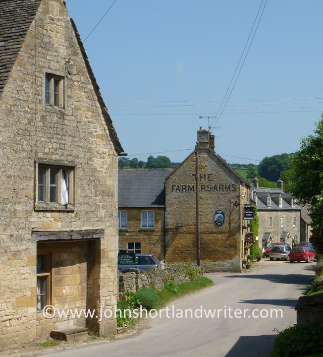
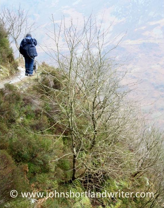
Keeping active was also part of the theme of a couple of my blog posts last year, specifically about England’s network of public footpaths. Although we Brits just accept them as part of our historic right to walk across privately-owned land, it seems that for a great part of the world, this would not be an option. My American friends and readers in particular find it hard to comprehend that we can walk across someone else’s property at will (assuming a public footpath crosses it) without confrontation. Many of our footpaths link villages and farms and so, on occasion, you may find yourself walking through someone’s garden or farmyard. The history behind the right to walk and what you can and can’t do was discussed in November’s post which can be found by clicking the link here.

Walking on designated footpaths across privately-owned land is a basic right in England and Wales

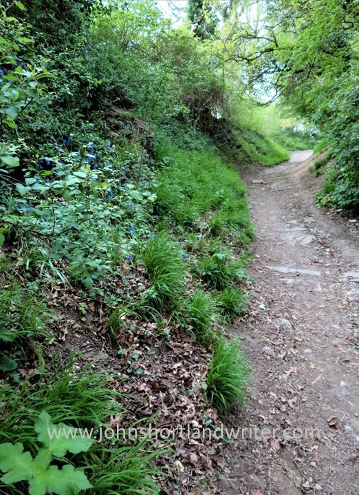
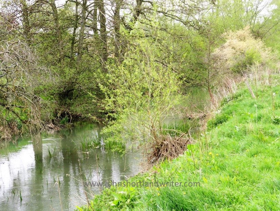
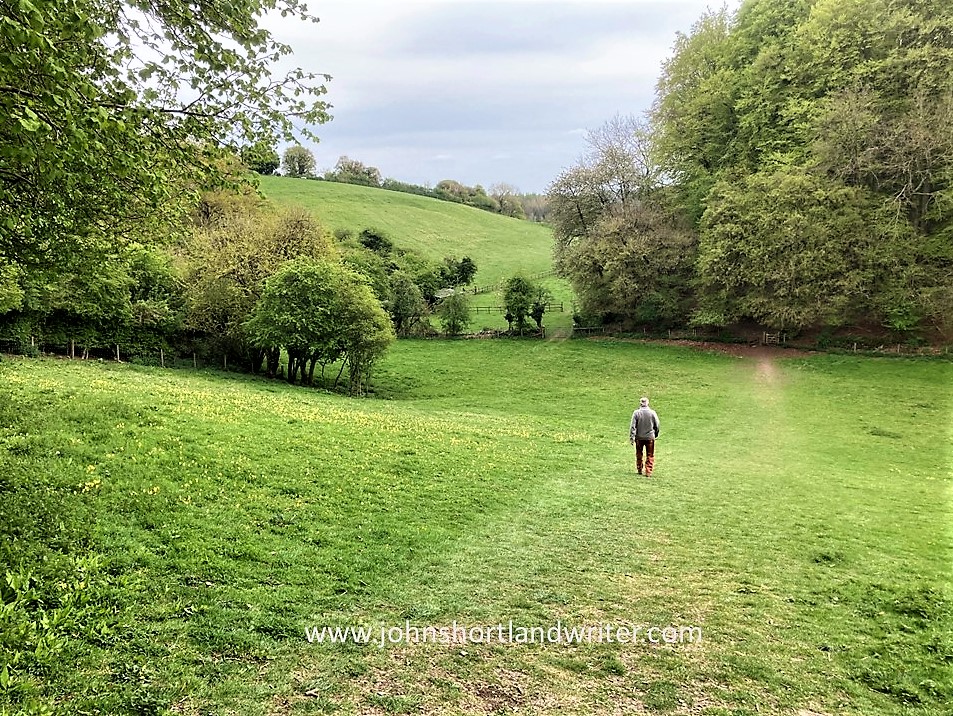
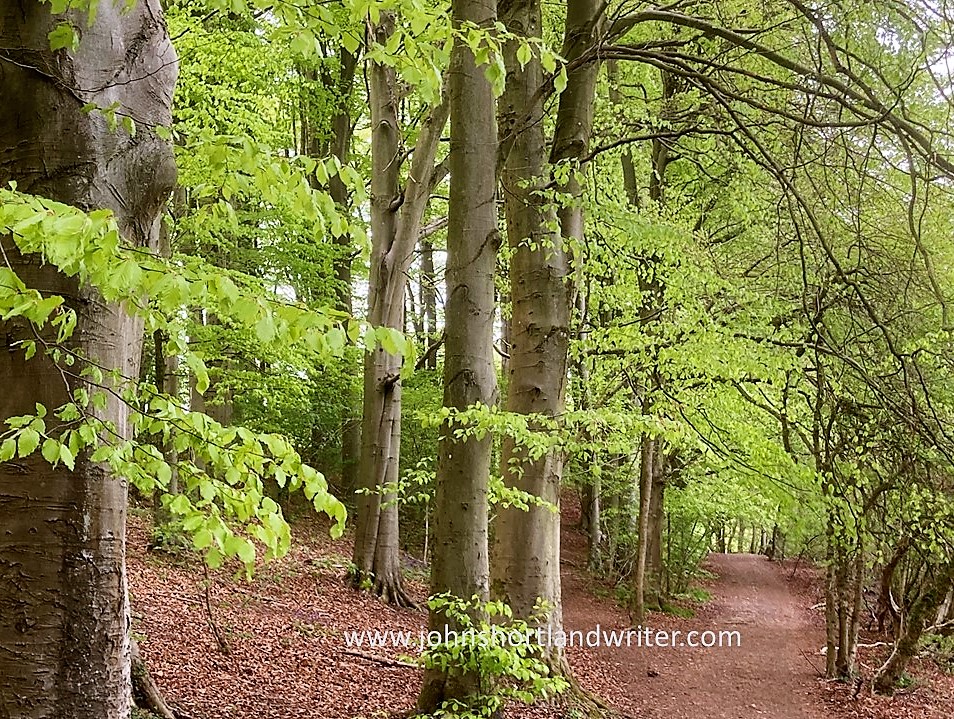
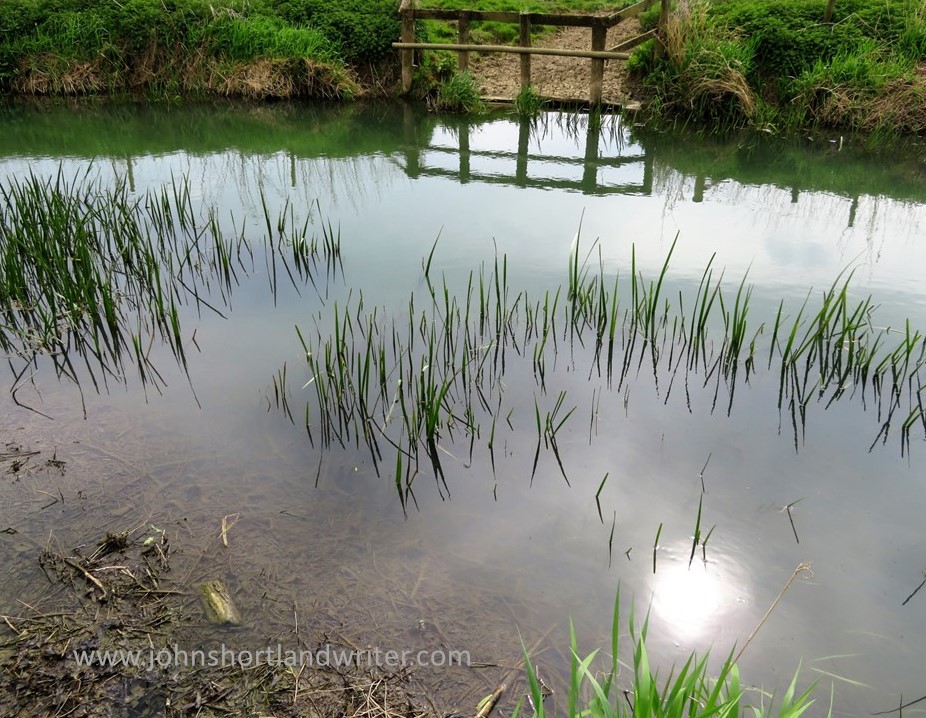
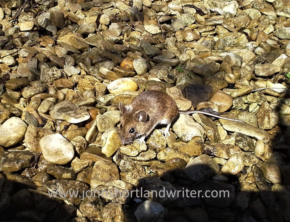
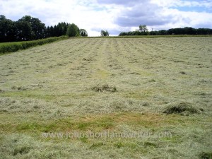
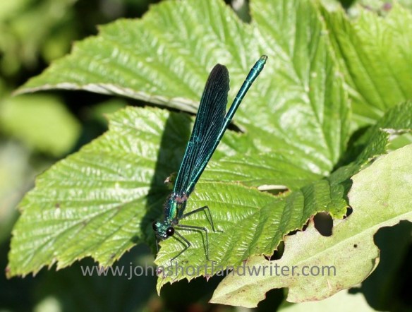
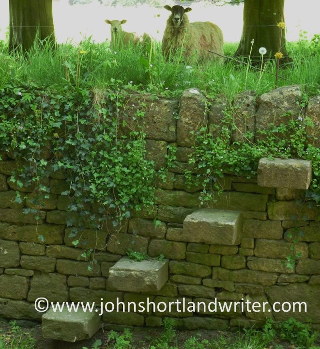
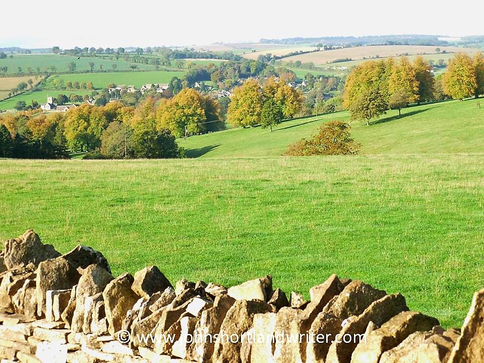
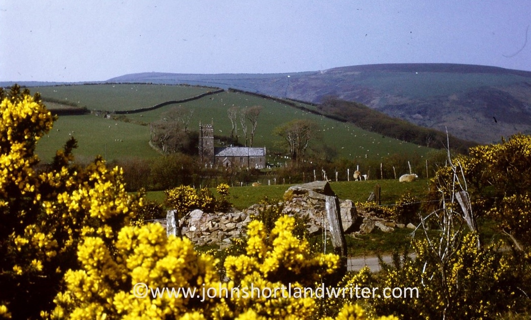
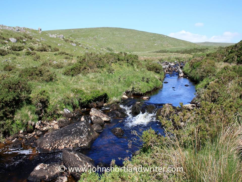
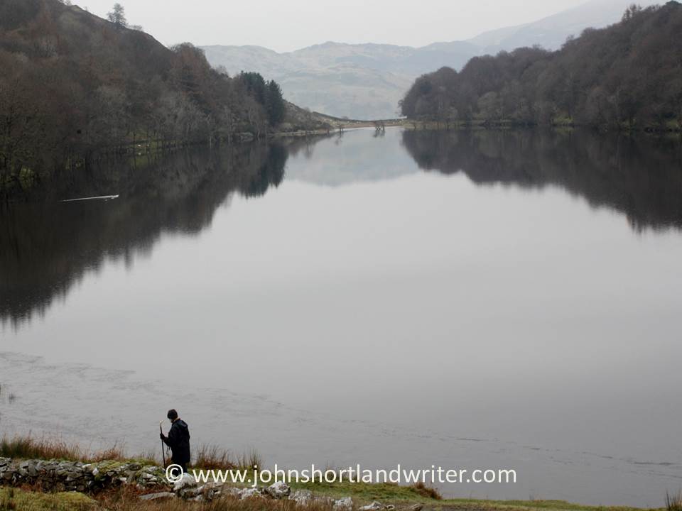
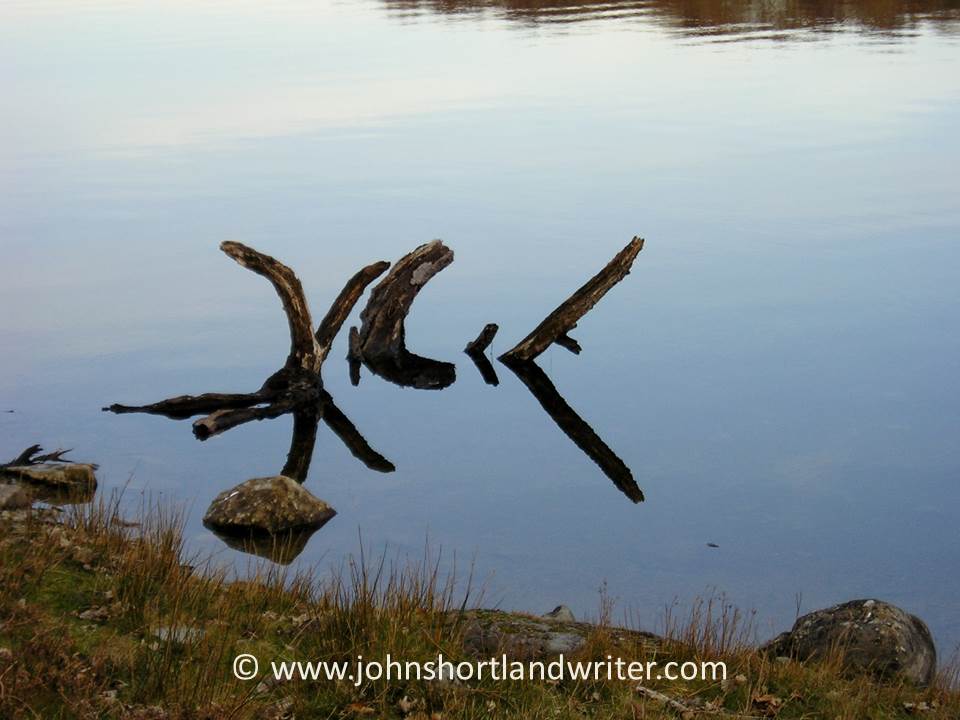
A few month’s earlier in August, I wrote of a walk that I had taken across fields, through woods and down country lanes back to my home in the secret valley. It was a lovely walk with the first signs of autumn colouring the trees and hedgerows which were laden with wild fruits and berries. After the noise and bustle of harvest, the fields were quiet and I met no-one for much of the walk. I prefer it that way for it is then, walking in silence, that you are likely to come across the wild birds and animals that also share this space, To follow the route that I took and to see the beautiful creatures I encountered click here.

When walking quietly you come across the wild creatures that live there

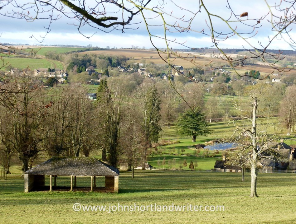
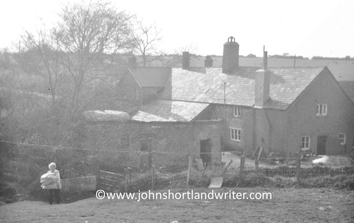
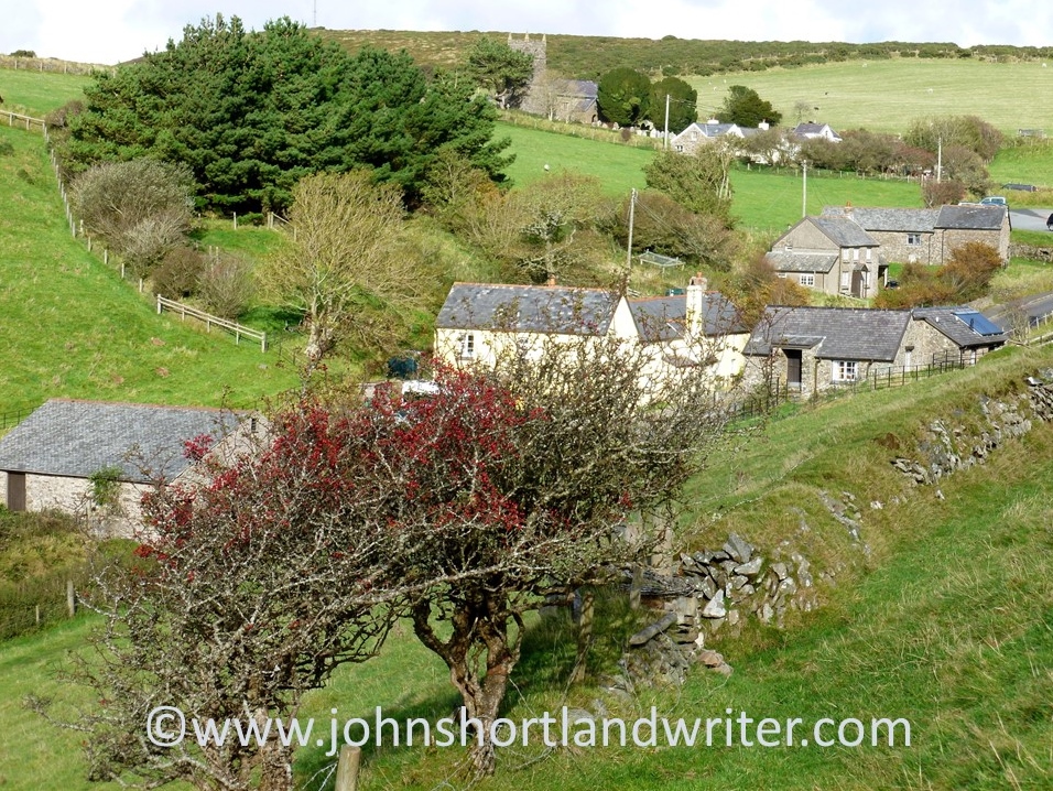
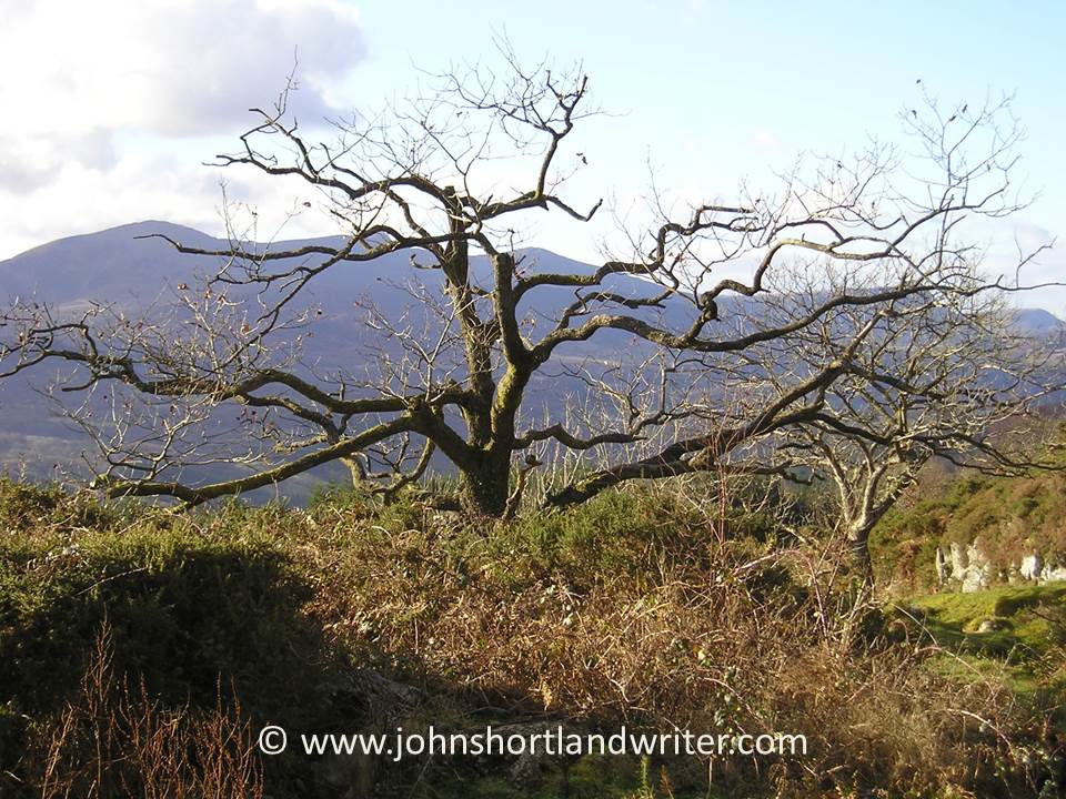
I have lived in the country all my life and my father was very much the epitome of the ‘English country gent’. My mother remained a ‘townie’ all her life (she had been brought up in the West End of London) and we both teased her mercilessly about her lack of knowledge of country ways. When she met and married my father it must have come as quite a culture shock to find herself living in a small, close-knit community where everyone knew one another and one another’s business. Neither of my parents were walkers but as a child they would drive my sister and I out to Turville Heath. Over time the heath became my place of refuge whenever I was in need of comfort or in need of re-charging the batteries. It would also be the place for summer walks, playing cricket and picnics. Of equal importance as the heath itself was the car journey out to it – past miniature farm and other magic moments that we children couldn’t get enough of. Click October’s link here to find out more.

My father, very much the country gent despite not liking guns!

Looking back even further in time, I explored the lives of ancestral aunts, uncles and cousins. They had been born, married and died in a village very close to the where I had been raised for our family have lived in the area for at least five hundred years. Discovering their stories had been quite a revelation – for my 3rd great-grandaunt had been about to marry in the local church when she gave birth to a child. The repercussion of this – for the child was obviously not that of the grooms – was far-reaching. Devastated Thomas cancelled the wedding and did something rather surprising shortly afterward, as told in September’s blog post. What happened to disgraced Ann? And what happened to poor Henry, the baby boy, who lived with the stigma of his birth? Was it this that took him down the path of self-destruction and a young death many thousands of miles from home in ….. – well, you’ll need to click on the link to find out what, when and where!

The village church where Thomas & Ann were to wed in 1809


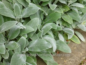
So, what will 2025 bring, I wonder? World politics seems to be on the news with constant and often seemingly bizarre twists and turns unsettling many of us. I’m quite good at not getting too worked up about things that I have no control over. Fortunately, I live and work in stunningly beautiful countryside and my interest in family history has taught me that life carries on regardless of turmoil all around us. I shall continue to write about my adventures (if that isn’t too strong a word to describe them). I also have a couple of writing projects to see to, and of course, there are my garden projects too. In dues course, they may appear on these pages. As with all my blogs, there are lots of photos to view so why not take a look and please do comment as appropriate.

Rights of Passage – England’s Footpath Network

Since the start of writing my Life in the English Cotswolds blog, now over fifteen years ago, overseas readers have repeatedly commented on our network of public footpaths. Mostly it is one of surprise that we can seemingly wander at will over privately owned land and clear any obstruction that may be blocking our way.  In this post I hope to clarify what this civil right, now enshrined in law, is all about.

A footpath crossing privately-owned land in the Cotswolds

Many of our footpaths are ancient in origin dating back 5000 years or more.  Of course, in those days, these paths were the main highways across a wild and untamed land.  Even in the relatively recent past much of the road system was a dusty, uncomfortable route to take in summer and not any better later in the year when winter rain turned them into a muddy quagmire.  Over many centuries the network of paths was created, usually by local people on foot or horseback taking the most direct and dry route to work or market.  This is one of the reasons why paths often pass through farmsteads and gardens.

This public footpath passes close to Lower Dornford Farmhouse

Today, the public footpaths of England and Wales (Scotland has a different system) are much loved and well-used, mostly for recreational purposes.  There are several organisations and charities (see list below) that help to protect the paths and walker’s rights to use them for there are several threats, such as land development for roads and houses, as well as the occasional, unscrupulous landowner.  Landowners seem to fall into two categories: those that maintain the paths to allow ease of access and those that allow the paths to fall into disrepair for it is the landowner that is responsible for the path’s maintenance.  A well-maintained path is clearly defined across the landscape, its gates and stiles giving ease of access whilst remaining stockproof.  By statute, where a path crosses a road, the local council must signpost it.

This farmer has mown a strip through his crop to define the footpath
Where a path meets a road it must be clearly marked

After many years of campaigning, England created its first long-distance path, the Pennine Way, in 1965.  It is 268 miles in length and runs down the spine of northern England passing through spectacular countryside.  Today, there are many of these long-distance paths as well as shorter, circular paths.  However, with a good Ordnance Survey map (paper or app) it is possible to create your own route whether it be for an hour’s stroll or for much longer.  In 2010 the Slow Ways network linking various paths and lanes, villages and towns, across the whole country was created, one of the few benefits to have arisen from the Covid-19 lockdown when walking alone was one of the few permitted activities.  The routes listed are all tried and tested by local people who walk them regularly.

The rugged landscape at Jacob’s Ladder, part of the Pennine Way long-distance path
Ordnance Survey map shows the public rights of way (the solid red line is a main road, the solid yellow line, a country lane [Copyright Ordnance Survey]

In the Ordnance Survey map illustrated above the footpaths are clearly defined using red dashes.  The short dashes show footpaths (walkers only) whereas bridlepaths (walkers, horses and bicycles) have long dashes.  The broken short-long dashes mark those tracks that can be used by horse-drawn vehicles (“restricted byway”).  Some paths have signs along their routes showing not just the route but also the path’s category.

As mentioned, paths frequently cross farmland or other enclosed land. A way through a fenced or walled area must be maintained at all times.  Below are illustrations of some of the different types of barriers you may come across although none must prevent you from continuing along your route.  If it’s a route for horses the rider must be able to open the gate without dismounting.

Wooden gate to pass through easily or wooden stile to scramble over
Not all stone wall are so tricky to get over!

Visitors to England often spend far too much time in the major cities or tourist hot-spots (the Cotswolds have lots of those!) returning home not realising that they have missed the opportunity to see parts of the country that never feature in the travel magazines – the homes and villages, the woodlands and old drover’s tracks that can be found all over the country.  You may choose to walk alone but when you do meet someone, they are often local and happy to exchange greetings and share a few minutes in dialogue.

Bibury – one of the most visited villages in the Cotswolds. To see it like this you need to arrive soon after dawn!
Get away from the crowds by exploring the peace and quiet of the English countryside

Not everyone, of course, feels comfortable walking by themselves, especially in an area unknown to them.  Fortunately, there are a lot of local groups or larger organisations such as the Ramblers Association that will welcome you on a regular or one-off basis.  Occasionally you may even find an individual who’ll be happy to share with a visitor a favourite walk or place – I’ve done it myself and made some good friends along the way.  That is one of the best things about walking, the walks can be short or long, easy or arduous, solitary or in company but it is the interesting conversations you have, the beautiful scenery you pass through, and the wildlife you encounter that make such a memorable experience.  Why not give it a try?

Walk quietly and you’ll be surprised who accompanies you!

Useful Links
click on the organisations below to visit their webpage

Cotswold National Landscape – Guided Walks
National Trust – walks in Gloucestershire and the Cotswolds
Ordnance Survey
Ramblers Association
Slow Ways
The Cotswold Way – a 102 mile trail that takes you through the heart of the Cotswolds to the Roman city of Bath, a UNESCO World Heritage Site.
The Long Distance Walkers Association
Walking in the United Kingdom

A Walk by Stonehenge – part 2 – Woodhenge

The prehistoric monument of Stonehenge was built in alignment with the sunrise of both the summer and winter solstices. For many, it is a sacred time and a moment to connect with our ancestors of 5000 years ago. With the Summer Solstice just days away it seems appropriate to write the conclusion of a relatively gentle walk that incorporates not just Stonehenge but also the nearby and lesser-known Woodhenge. Part 1 of the walk, along with photos, can be found by clicking on the link here.

The lesser-known circle of Woodhenge

Access to the stones of Stonehenge is usually restricted by a fence to prevent the one million visitors that view them every year from damaging the stones by touch, or by eroding the ground the stones stand on. For the solstice the fence is removed so that it is possible to walk amongst the stones and to witness the sun as it rises behind the Heel Stone. Thousands of people will attend the solstice but I prefer solitude for my walks whenever possible. I would choose to stand at the Cursus and to look down on the stones (and the crowds) or even to sit silently at Woodhenge.

A distant Stonehenge can be clearly seen from the Cursus

So what is Woodhenge? The official description is “a timber monument comprising of six oval rings of posts”. Not the most inspiring but the more you explore Woodhenge the more fascinating it becomes. Of course, the timber posts have long since rotted, and now their positions are marked by low pillars of differing diameters. As you walk amongst them and begin to picture the timber posts, the tallest of which reached 9 metres (30 foot) in height and weighed five tons, you realise just how awe-inspiring it must have been, especially if they were coloured or carved in some way.

Woodhenge as it may have looked 5000 years ago

Woodhenge was built at the same time as Stonehenge and on the same summer/winter solstice alignment. The two henges, two miles apart, were possibly connected by paths, one showing as banks and ditches is marked on maps as Stonehenge Avenue. The Cursus also is in direct alignment with Woodhenge and in those pre-history days the two monuments probably could be seen from these points.

Excavation of the site took place in 1926 but it is only now that more detailed studies are taking place. The initial dig discovered the body of a child at the centre of the circle and it was thought to have been sacrificed there. The remains were taken to London for later examination but were destroyed by bombing during WW2 before this took place. The grave is now marked by a small stone cairn. Other remains found within the circle were numerous pieces of pottery, butchered pig bones and, just outside the entrance, the body of a teenager. These finds indicate that activity at the site continued for many hundreds of years, long after the posts had rotted.

The site of the grave of the child is now marked by a cairn

Although the purpose of Woodhenge can only be surmised, the recent interest in it and its relationship to Stonehenge, Durrington Walls and other sites within the Stonehenge World Heritage Site, slowly reveal more connections between them. One such thought is that it may have held a spiritual connection with Stonehenge: the stones of Stonehenge being the enduring place of the spiritual world, whereas Woodhenge, with its feasting and slowly decaying timbers, the transformation of life towards death. Interestingly, similarities with ancient sites in Madagascar, although 4000 years later than those in England, can be found.

When I first visited Stonehenge as a child in the early 1960s there were far fewer people about!

To visit Stonehenge for free involves a walk not dissimilar to this one.  Park in Durrington village and take the public bridleway path (where it meets Fargo Road) directly south to Stonehenge.  The path passes the stones within yards of the public viewing path so you will still be separated from the stones.  Public footpaths continue southwards, criss-crossing an area rich in more barrows and other ancient earthworks.  With the help of an Ordnance Survey map it should be quite possible to make a longer, circular walk.

**Click on any of the images to enlarge**

Sources:
English Heritage Wikipedia

A Walk With Dinosaurs and Romans

One of the perks of getting older is retirement or, in my case, semi-retirement.  Suddenly, I no longer need to keep checking my watch to see if I have enough time to do things without racing onto something or somewhere else.  It has given me time to re-visit some of the pleasures that I enjoyed in the past. One of these is walking.  When I was much younger I used to walk the long-distance footpaths and trails that were then just beginning to be created.  Now there are literally dozens of them to be enjoyed varying in length from a few dozen miles to several hundred.  I’m not up to the lengthy walks of my youth yet – the longest took a fortnight to complete.  At present, I’m content to be out for a few hours and, hopefully, the mileage will increase over time. 

England is criss-crossed by public footpaths and longer trails

The other day my partner and I decided to visit the Roman villa at North Leigh not far from the small, Cotswold town of Woodstock.  Unlike the Roman villa where you rarely see anyone, Woodstock is visited by thousands of international visitors every year, for it is where Blenheim Palace, a World Heritage Site, is located.  The two houses, six miles apart in distance but fifteen hundred years apart in their building, are very different.  Whereas the Palace is full of priceless treasures, all that is left of the villa are the foundations and a single mosaic floor.  At its peak in 300AD, the villa was one of the largest in Britain with suites of rooms, many mosaics and several baths.  Now it is quiet, wildflowers scramble over the walls and it is set in glorious countryside close to the River Evenlode.  With parking close-by, this was the starting point for the walk.

The Roman Villa, once busy – now a haven of peace and quiet
Wildflowers scramble over the ruins of the Roman villa

The path to the villa and those leading away from it are well maintained and marked, making the trail easy to follow.  Most of the route we took was on the network of public footpaths that criss-cross England, most of them dating from the time when all travel was either on foot or horse.  At one point, the paths joined the Oxfordshire Way, a path of 66 miles in length.  This in turn links to other long-distance paths so how long you walk for is entirely up to you!  After ten minutes or so, the Evenlode was reached and crossed.  Originally known as the Blade, its present name is relatively modern, first being recorded in use in the 1880s.  It meanders through the Cotswolds for nearly fifty miles before entering the River Thames. Crossing the river, the path turns to the west and the country changes in character with steep grassy banks rich in wildflowers rising high to our right, the river to our left.  Here we’re walking along Akeman Street, an ancient Roman road, once busy but now a quiet, grassy track.

The paths cross meadows until the river is reached

“The tender Evenlode that makes her meadows hush to hear the sound of water…”

Before long, the character of the path changes once more.  The Evenlode changes in character too for there is a wide ford – perfect for wild swimming.  Various paths meet here but we walked the steep path towards the village of Stonesfield, known locally for its history of making the stone rooftiles that are a feature of old Cotswold properties.  In pre-history, the Cotswold Hills were submerged by a warm sea and now fossils can be found quite easily; they can even be seen occasionally in the stones that have been used to build the houses.  It was in the Stonesfield loose and flaky rock that the very first dinosaur fossil to be found anywhere in the world was discovered.  Close to where it was found, a steel bench inscribed with the words of the French poet Hilaire Belloc has recently been placed – welcome indeed, after clambering up the steep path that leads from the ford to the village.

The view of the river from the ford
The rocks around the village of Stonesfield yielded the world’s first dinosaur fossil
The steel bench engraved with the words of Hilaire Belloc

After a short walk along the edge of the village, our path left the Oxfordshire Way to descend steeply through meadows before reaching a strip of woodland, Stockey Plantation.  Although there are firs planted there, there are also many native beech trees which are, arguably, at there most glorious at this time of year.  The newly unfurled leaves are of the most intense green which, along with the deep blue of bluebells and the yellows of other spring flowers are almost too bright for the eyes to bear.

The descent to the woods becomes more gentle as it crosses the meadow
The path through the beechwood
The intense colours of the beech leaves and bluebells almost hurt the eyes

Leaving the woodland we reach the Evenlode ford once more but this time cross it – there is a footbridge, so no need to get wet – before striking off across the fields again to return by an alternative route to the Roman villa and the car beyond.  The walk probably took no more than a couple of hours and is relatively easy.  The weather, this April has been very dry.  At other times, the paths can be muddy and so sensible, walking shoes or boots are recommended.  The route we chose does have some steep hills to climb but these can be avoided for there are many paths that keep to the level ground.  An Ordnance Survey map of the area is handy to work out routes – I used the app on my phone but paper maps covering all parts of the UK are readily available. 

The sun seemed to shine brighter in the water than overhead
In the damper woodlands Ramsons, the wild garlic, carpeted the floor

To see more photos of the Roman villa and read of its history take a look at one of my earlier posts by clicking on the link here.

To read the full text of Hilaire Beloc’s poem of the Evenlode river click here

Discovering the Five Senses in Lockdown

It sometimes takes a crisis to make us re-evaluate what is of importance in our lives and the present one of Coronavirus/Corvid-19 surely has to be the greatest that we will collectively face. Now, several weeks into lockdown we have all been developing new patterns to our daily regime, one of which may well be taking more exercise. Never before have we placed so much value on fresh air and being able to walk freely whether it be in our parks, gardens or open countryside.

Marlow watermark

                           Riverside path, Higginson Park, Marlow (before social distancing).                                 The river is the River Thames in Buckinghamshire

Living where I do in the Cotswolds surrounded by fields and with woodlands and the river close by it is relatively easy for me to enjoy the open space. For others able to take advantage of their enforced free time, it may involve a longer walk and I have certainly noticed an increase in the numbers of walkers and cyclists here in the valley. I have also noticed that for many of them one aspect of their lives hasn’t changed: as they walk their eyes are glued to the screen of their mobiles and headphones are clamped to their ears, seemingly unaware of their surroundings. It has made me think all the more of our five senses and how we use (or should use) each one of them when out exercising.

Nr Fingest copyright

Cycling in the Chiltern Hills

SIGHT For those of us blessed with the gift of vision, perhaps sight is the most important sense we use and perhaps the one we most take for granted.  Without it, it is still possible to enjoy one’s surroundings for the other senses become heightened but I doubt if anyone would deny the pleasure of seeing the beauty that surrounds us on our daily walks. Even within cities there is much nature to be enjoyed although I admit that sometimes it has to be sought with more vigour and awareness.

Viola watermark

Look everywhere – self-sown violas peep out from overhead guttering!

At this time of year, more than any other season, there is much to see. Tight leaf buds unfurl into an explosion of vivid green foliage, iridescent wherever sunlight filters through; young ducklings tumbling into the park pond to take their first swim. But it isn’t just the natural world to be seen anew, there are other things too. Although it had been there for more than a hundred and forty years (and I’d walked past it very day for twenty) the date scratched into the stone on this wall had gone unnoticed.

Date stone watermark

Who scratched this date into the old stone wall and why?

HEARING Along with sight the second most important sense we use on our daily amble. Apart from the glory of birdsong there are other sounds that bombard us when out walking. The wind flurry that makes the catkins tremble and shed their pollen, the stronger breeze that make the twigs and branches clatter gently against one another. Then there’s the rustle in the undergrowth. Stop and wait silently and with patience you may be rewarded by the sight of a little field mouse going about its daily chores or a rabbit venturing out to feed.

Field Mouse watermark

patience was rewarded when this little field mouse ventured into the open

Altamont Gardens (8) watermark

… and also this rabbit

The sound of the river alters constantly. The smooth, barely audible glide of the water changes to a tinkling of soft musical sounds, its flow interrupted by a fallen branch. A few yards further downstream they rise to a crescendo as they crash and tumble over the old millrace before returning to silence as the flow stills in the calm of the millpond.

Radford Mill (1) watermark

The old millrace 

Radford Mill watermark

the calm of the millpond

TOUCH   In the present crisis we are sensibly being discouraged from touching things unnecessarily. Out on walks perhaps care may be advisable when opening gates or climbing stiles but, if you do, take a moment to think about what you feel. Heed the cold steel of the metal five-bar gate and the way it slowly warms beneath your hand; feel the rough timbers of a stile worn smooth from much use over the years. Of less concern health-wise – and all the more pleasurable for that – become aware of the softness of new horse chestnut leaves; later in the year they will become as harsh as sandpaper. Run your fingers across the twisted, grooved bark of the sweet chestnut tree and stroke the furry softness of the aptly named ‘Lamb’s Ears’, the favourite garden herbaceous plant Stachys byzantina.

Sweet Chestnut 4 watermark

The deeply grooved bark of the Sweet Chestnut tree

Stachys byzantina  Lamb’s Ears

SMELL   The scent of spring is everywhere at the moment and to be delighted in. However, the sense of smell is also a powerful trigger of long-forgotten memories. In a few weeks’ time the sweet scent of drying hay in the meadows may recall childhood farm holidays but for now there is the unique smell of new-mown lawns. Both start off as freshly cut grass yet their scent is so surprisingly different. Likewise, compare the subtly differing fragrance of apple and cherry blossom, both in their full-blown glory right now.

Drying hay before baling

The smell of freshly-mown grass…

Without even leaving home, squeeze the leaves of the herbs on the kitchen sill and notice their variation in scent, their colours and textures too. Early morn in the woodland, especially after warm rain, the delicate perfume of bluebells quickly disappears as the sun becomes stronger. Half-close your eyes and glory in their colour, in the silence and in their perfume and leave all cares behind you – if only for a while.

discover the different textures & scents of herbs

The vivid greens & blues of an English beechwood in spring

In town, the scents are also there just waiting to be noticed. Rain falling on roads and pavements or scorched by hot sun both produce delightfully tarry smells, one mild, the other strong. In the formal beds of the local park flowering bulbs stand in regimental rows; each have a unique scent which rises in the air to mingle with the vanilla fragrance of wallflowers. The wallflowers, their dull green foliage barely noticeable throughout the winter, now shout out the arrival of spring through the colours of their flowers of brick red, orange and yellow.

Tulips & wallflowers – a favourite park bedding combination

TASTE   In shaded places where the soil stays moist you may be greeted – even before you arrive – by the pungent scent of wild garlic. A prolific carpeter of the woodland floor its leaves and flowers make a useful ingredient to spring salads. Wild garlic or Ramsons to give it it’s country name, is fickle where it will grow. In some places that would seem suitable, not a single plant can be found. A less common member of the onion family to be found in the wild are the chives of our gardens, they grow along road edges and field boundaries locally. It is thought that they were spread by the old drovers of centuries ago so that they could harvest them along the way to liven up a bland meal. There is no doubting its identification, disturb the tubular green leaves and the familiar scent is immediately released.

Ramsons grow in damp, shaded places

It is not only the onion family that can be nibbled en route. Richard Mabey in his book Food for Free, published many years before foraging became a ‘craze’, suggests nibbling on the half-open buds of hawthorn. Many a country child has done so over countless generations and perhaps that is how they got their old name of Bread and Cheese. To me, they only have a slightly nutty taste and texture.

Hawthorn leaf buds are not really worth eating!

As a boy, brought up close to the River Thames, the hollow stems of the common reed were a regular source of pleasure for the soft pithy centre could be drawn out by pulling the stems through clenched teeth. Close to my present home there is also a small reedbed. These tall reeds have something to offer every one of the other senses too: sight – the pleasure of watching petrol-blue damsel-flies sunbathing on the stems; hearing – as they sway and rustle with the slightest breeze; touch – the coarseness of the leaves, a contrast to their smooth stems; smell – those of the river as it seeps around the roots, a heady mix of wet mud and wet greenery.

Only the male of the Beautiful Demoiselle damsel-fly has petrol-blue wings & body

So, within the bounds and restraints of the Covid-19 advice when out on your daily exercise, remove the earphones, place the phone in your pocket and use, really use, every one of your senses. Not only will you notice more, you will wonder how you never managed to notice them before. Stay safe, stay alert and take this unique opportunity to discover a new world on your doorstep.

Finally, one word of warning. Only try tasting wild plants if you are confident they have been identified correctly. If you decide to forage, do so responsibly and only pick a few leaves at a time. Make sure that all plants for consumption are free of pesticides and other contaminants, especially those growing in or near water.


Guiting Power, a Cotswold village

The Cotswolds (Cotswold Hills) are fortunate in having very many attractive stone built villages, protected by its AONB (Area of Outstanding Natural Beauty) designation.  One such place, and a little off the beaten track so not as well visited as some of its more famous neighbours, is Guiting Power.

guiting-power-2-copyright

A visit during the week, when most others are working, is like stepping back to a time when life was much slower and with fewer cars and people.  The village has a population of 300 and also lies on the Wardens’ Way, a fourteen mile footpath, but even during the busiest of times it is hardly bustling.  Linking with other public paths it is possible to make a circular walk centred on the village.

guiting-power-3-copyright

As well as for the building of modest cottages, the soft Cotswold stone is used everywhere – to enclose fields, to create stiles, churches, barns, pubs and the grand houses of the wealthy.

guiting-power-stone-stile-copyrightguiting-power-cotswold-barn-copyright

If long country walks aren’t your thing, there’s still plenty of things to do and see.  The church dates from the twelfth century and has the foundations of an earlier one nearby.  Sudeley Castle, near Winchcombe is just a few miles away.  Within the village, The Farmer’s Arms pub offers traditional beers and skittles; just outside the village The Hollow Bottom is a pub popular with the horse racing fraternity.   The Old Post Office, as well as continuing in its traditional role is also now a thriving coffee shop  For almost fifty years the village has hosted an annual music festival.  Adam Henson’s Cotswold Farm Park is also close by.
guiting-power-5-copyrightguiting-power-copyright

Useful links:
How to get there

The Wardens’ Way Footpath

The Hollow Bottom Pub with rooms

The Old Post Office

Guiting Music Festival

Sudeley Castle

Adam Henson’s Cotswold Farm Park

A Hidden Exmoor Walk

I have misgivings about sharing this walk for it is a favourite of mine: in the 48 years that I have known it I have rarely met anyone other than those that work the land here. Do I want to encourage others to discover its beauty? I’m not sure.

This circular walk begins with the open expanses of Brendon Common but follows more sheltered winding lanes before descending through beech woodland to Rockford and the East Lyn River. A steep climb past Brendon church returns you to the moor. How long does it take? There’s no easy answer to this – allow two hours although experience tells me there are so many distractions along the way, including the Rockford Inn, that it can take much, much longer. Whether you want a quick sprint or a leisurely amble good supportive footwear is essential as is the ability to climb hefty hills.

Brendon Common (14)   copyright

Brendon Common


There is plentiful parking at Scobhill Gate, the cattle grid on the B3223 that denotes the westernmost boundary of Brendon Common. From here walks radiate across the 2000 acres of heather moorland but our route takes us over the cattle grid into farmed country and turns right by the hairpin bends at Brendon Manor Stables.

Scob Hill Gate   copyright.jpg

Scobhill Gate


After a few hundred yards the road, which is flanked by hedges of hazel, ash, furze, bramble and bilberry (known locally as wurts), meets Gratton Lane. This is very much ‘home’ territory for me, for it is here at Brendon Barton that I arrived as a lad to work and play in 1968. Opposite the farm there are fine views of Brendon church and in the far distance Countisbury Common and the sea.

Lil @ Brendon Barton 1968   copyright

Brendon Barton 1968

Brendon Church 1968 (2)   copyright.jpg


Walking along Gratton Lane is lovely at any time of the year but is at its best in spring when the beech hedges are bursting into leaf and primroses and bluebells nestle at their feet. These banks are an ancient method of providing shelter, as well as a barrier to livestock, from the fierce gales and snowstorms that sweep in from the Atlantic. The banks stand about five feet in height, lined with stone with the beech planted above.

Above Brendon Barton (2)   copyright.jpg

Gratton Lane


Just as the lane starts to descend it enters woodland and it is here – just past the warning sign denoting the ford that crosses the road – that a footpath is taken to the left. The path follows a pretty stream as it tumbles over rocks down to join the East Lyn River. It is here that the unwary walker can also take a tumble as the path crosses outcrops of rock that become quite slippery when damp. This stream has everything a larger one would have – cascades, waterslides, ferns growing from niches – but all in miniature. Despite its diminutive size it once powered a sawmill.Waterfalls (2)   copyright.jpg

The mill has long been a ruin and is now fenced for safety but the rusting ironwork is still visible. Just beyond the old building the path joins the road. Turn left and follow the lane to the hamlet of Rockford. You are now walking in the Brendon valley with its beechwoods clinging to the steep hills high above, home to a number of rare rowan trees (Sorbus) unique to the area.  The East Lyn River is a major river; when water levels are low it is difficult to imagine its ferocity when in spate. In 1952 it destroyed bridges, houses and lives as it passed through the valley culminating in the flood disaster at Lynmouth where thirty-four people lost their lives and over one hundred houses were destroyed. The Rockford Inn is a good place to stop for a beer; they also serve cream teas. Just make sure that you put the cream on the scone before the jam in the Exmoor tradition! It is possible to extend the walk to Watersmeet (where there is a National Trust tearoom) by crossing the river.

ROCKFORD MILL   copyright.jpg

The Old Mill nr Rockford


East Lyn River (2)  copyright.jpg

East Lyn River


Once past Rockford the road starts to climb until it reaches Brendon church. The hill is a killer – it’s not called Church Steep for nothing! The church which nestles into the hill and looks out across the combes looks as if it has been there for centuries. In reality, it was moved stone by stone from nearby Cheriton in 1738. It is simply decorated inside but has some attractive stained glass. Brendon Barton, passed earlier, can be seen from the steps of the church. Follow the lane back to the farm; from there retrace the original route back to Scobhill Gate.

Brendon Church (5)   copyright.jpg

Brendon Barton (2)   copyright.jpg

Brendon Barton, view from the church


Happy walking!


Exmoor is a National Park in the southwest of England and straddles the counties of Devon and Somerset. Apart from miles of wonderful moorland walks, it also has the highest sea cliffs in England, pretty villages and spectacular wildlife including the majestic Red Deer. Native Exmoor ponies roam the open moor. Now a rare breed they remain virtually unchanged from pre-history.


In the Footsteps of the Danes

In 858AD Hubba the Dane invaded England to be defeated by the Saxons at the Battle of Arx Cynuit. Recorded in the Anglo-Saxon Chronicles by Asser, biographer of King Alfred the Great, the site of the battle it is thought took place at Countisbury, a tiny clifftop community on Exmoor. Whether true or fanciful, a walk to Wind Hill hillfort* is well worth the effort. It is a place where it is possible to experience all the elements that Exmoor offers in one glorious 360 degree panoramic view.

Countisbury copyright

All the best English country walks should start and end at a pub and there are plenty of options to choose on this one. Mine started from the Blue Ball Inn at Countisbury which is as welcoming now as it was when I first crossed its threshold fifty years earlier.

Blue Ball (2) copyright

Turning left from the pub, walk down the road for a few yards before entering a gate to National Trust land, also on the left and the starting point of several extensive walks. Our destination is a short walk and is the high point close to the road. The path to the fort is well defined and grass covered; it merges with a field access track that leads gently uphill to its entrance. The second photograph below is taken from the fort: the pub is the white building.Wind Hill (9) copyrightWind Hill (5) copyright

The fort is a rare example of a promontory fort where the natural landscape has been adapted to create the defences. The coastal cliffs which form its northern defence are the highest in England rising to over 300 metres, to the west and south the East Lyn River has cut a deep gorge. Where necessary double ramparts were built to defend the weaker areas: at the entrance they still rise, after two thousand years or more, to an impressive thirteen metres.

Wind Hill (10) copyrightWind Hill (2) copyright

Although it is possible to make Wind Hill part of a longer walk I prefer not to do this. It is rare to meet anyone else here and to be able to explore the 85 acre site in splendid isolation gives a real feel of the place. Just spend time enjoying the silence,  lying down with your back propped against the ramparts listening to the wind and sheep calling.  As mentioned earlier, the views from the fort are magnificent: heather moorland, ancient woodland, hills, villages, sea, cliffs, the distant coast of Wales as well as wild creatures, ranging from the iconic red deer to seabirds and butterflies.

Wind Hill (8) copyright


* also known as Countisbury Castle


Links:

Historic England

The Megalithic Portal

Exmoor National Park

The Blue Ball Inn

A Walk Over Dartmoor – part 1

All the best walks start and end at a pub and a popular place to aim for is the Warren House Inn.  Located in the heart of Dartmoor, a national park in the county of Devon in England’s West Country, it has been a stopping point for thirsty travellers since the mid eighteenth century.  The fire, according to tradition, has never been allowed to go out – probably out of necessity for the inn is isolated and exposed on a high windswept plateau.

Warren House Inn copyright

Two miles to the south-west of the inn is the village of Postbridge, famed for its ancient clapper bridge, first mentioned in 1380 and reached by a track opposite the pub.  It passes the remains of habitation for Dartmoor once had a tin mining community and these are just some of the signs of this now vanished industry throughout the moor.  The mining is thought to have predated the Romans, flourished during medieval times and also the nineteenth century before finally ending in the mid-1900s.

IMG_1121 copyrIMG_1124  copyri

Spring comes late to this harsh environment: the few trees grow slowly and stunted.  When the moor flowers many different species of butterflies can be seen.

Stunted and sheep grazed hawthorn

Stunted and sheep grazed hawthorn

Small Pearl-Bordered FritillaryButterfly

Small Pearl-Bordered Fritillary Butterfly

As with many parts of Britain where rock lies close to the surface, drystone walls are a feature.  Unlike the soft limestone walls of the Cotswolds which use small pieces of thin, flat stone, Dartmoor’s are granite and some of the stones massive.  It is hard to conceive how they were built but the huge slabs foreshadow those that are to be found at Postbridge.

Drystone Wall   copyright

Crossing the East Dart River, the clapper bridge at Postbridge is perhaps the best known of all of these bridges in England although there are more than two hundred on Dartmoor alone.  Thought to have been built to allow carts to carry tin off the moor, the bridge is over four metres long and two metres wide.  Some of the stones weigh more than eight tons.  The village consists of a few houses, a pub and a post office and is a favouriteplace to stop  for a traditional Devon cream tea.

The clapper bridge with the 'new' bridge behind built in 1780

The clapper bridge with the ‘new’ bridge behind built in 1780

Postbridge 2   copyrightPostbridge 3   copyright

A riverside path heading north from the village leads into the heart of the moor towards the next stopping point, the prehistoric Grey Wethers stone circle, featured in part two of this blog.

East Dart River   copyright

On the Edge of the Precipice

Snowdonia, the third of Britain’s national parks to be designated (and the first in Wales) is a popular holiday destination despite it being the wettest place in the UK.  Mt. Snowdon, Wales’ highest peak after which the park is named, is challenging to climb although thousands ascend by the easy route – using the narrow guage railway.

Far to the south and away from the crowds the scenery is still dramatic giving great opportunities for hill walking.  It is possible to walk all day with only ravens, buzzards and red kites for company.

WALES FEB 2006 006   copyright

The Precipice Path near the small town of Dolgellau is a relatively short and easy circular walk that offers spectacular views in all directions.  It is a good introduction to walking in the hills for it is well signposted and, more often than not, there are other walkers nearby.  If, like me, you prefer to walk in splendid isolation then that is still possible by starting early or late in the day and avoiding weekends.

Precipice Walk   copyright

The path leading up to the precipice winds its way gently alongside woodland before climbing more steeply for a few hundred yards.  It is rocky and uneven and, as with any hill walking, strong shoes or boots should always be worn.  During the winter, this part of the path is often icy.

Precipice Walk (3)   copyright

As the path turns towards the west spectacular views of the river, the Afon Mawddach appear, set in a deep glacial valley that leads out to sea.  The path now narrows and with a sharp drop to one side – although it is quite safe small children need to be supervised and those that suffer from a fear of heights will find this stretch challenging.

Precipice Walk (5)   copyright

Precipice Walk (8)   copyright

For those not worried by height the bird’s eye view of Dol-y-clochydd is fascinating especially if you are lucky enough to see the sheep being herded by the farmer and his dogs.

Precipice Walk (7)   copyright

At the halfway point, a bench marks the end of the precipice and from here there are vews of the village of Llanelltyd and of the river flowing into the sea.Precipice Walk (10)   copyright

The path now turns back on itself in a wide arc before descending to the edge of Llyn Cynwch, a small reservoir with views of the mountains and crystal clear water giving superb reflections.  The path follows the edge of the lake until it returns to the starting point of the walk.  Novice walkers should allow at least two hours for completion.

Precipice Walk (12)   copyright

The Precipice Path lies within the nine hundred year old Nannau Estate and, although not a public right of way, the estate has opened it to the public since 1890.  It is a working estate and there may be sheep or other livestock roaming freely so it is necessary to keep dogs strictly under control. Precipice Walk (18)   copyright